


Get to know Jinghong
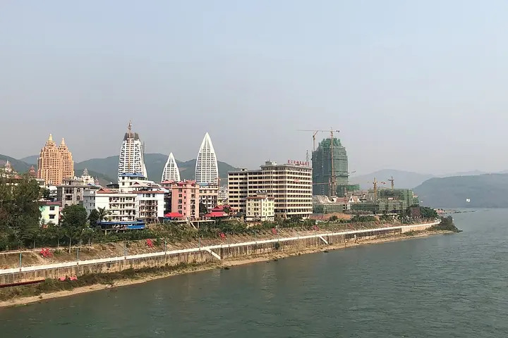
Photo adjustments
Full frame retained; proportionally resized and converted to WebP. No retouching or changes to the photographed subject. Card displays may crop the view.
- Administrative area
- County-level city · 县级市
- Part of
- Xishuangbanna Dai Autonomous Prefecture
- Chinese name
- 景洪市
- Local areas
- County-level city guide
Area & population
- Area in the source
- 7,133.00 km²
- Population · 2020 census
- 642,737
Source: cited geographic source, as of the dates shown.
Setting and landscape
The city stands where the Liusha River (流沙河) joins the Lancang, 560 kilometres from Kunming (昆明). The Lancang flows for 158 kilometres inside the city's boundaries. Land rises to 2,196.6 metres at Nanlejiaomei (南勒角梅), the main peak of the Lunan Mountains (路南山) in the west, and falls to 485 metres in the southeast, where the Nan'a River (南阿河) meets the Lancang. The city government describes the climate as tropical humid monsoon and gives forest cover as 78.48 percent. Jinghong Port (景洪港) is a first-class state port of entry, and Chinese, Lao, Burmese and Thai merchant ships began sailing the Lancang together in June 2001. The China-Laos Railway (中老铁路) stops at Wild Elephant Valley (野象谷), Xishuangbanna and Ganlanba (橄榄坝) stations within the city.
History
Old names include Jingyong (景咏), Jinglong (景陇) and Cheli (车里). Under the Southern Song, the Dai leader Pa Zhen (叭真) broke from the Dali Kingdom (大理国) and made this his capital of the Jinglong kingdom (景陇金殿国). The Yuan set up the Cheli (彻里) command here, and in 1384 the Ming turned it into the Cheli Pacification Commission (车里军民宣慰使司). Xishuangbanna became an autonomous area in 1953, Jinghong County was formed in 1958 and the city in 1993.
What to see
Menghan (勐罕), 27 kilometres southeast of the city seat on the Lancang, holds the 4A-rated Dai Garden (傣族园) and the 3A-rated village of Manyuan (曼远); the town lists zhangha singing (章哈), Dai brocade (傣锦) and Dai boxing as national intangible heritage. Jinuo Mountain (基诺山) township is the homeland of the Jino (基诺族), recognised by the State Council in 1979 as China's 56th ethnic group, and is one of the six ancient tea mountains of Pu'er tea (普洱茶). The Temaoke festival (特懋克) and the Jino big-drum dance are national intangible heritage, and rainforest trekking is the township's main draw. Wikipedia also lists Manting Park (曼听公园), the Manfeilong Pagoda (曼飞龙塔) and the tropical flower garden among the city's sights; Laos keeps a consular office in the Gaozhuang Xishuangjing (告庄西双景) complex.
Food and local products
The Jino have had their own tea culture since the Ming and drink cold-dressed tea (凉拌茶) and fire-pot tea (火罐茶), also cooking with tea. Jinuo Mountain also produces amomum (砂仁), a medicinal herb first planted there in the 1960s, red rice (红米) and a small, fine-fleshed winter melon (冬瓜) that the local county annals trace to the Ming.
Highlights
- Dai Garden 傣族园: 4A scenic area in Menghan on the Lancang, 27 km from the city seat.
- Jinuo Mountain 基诺山: Homeland of the Jino people and one of the six ancient Pu'er tea mountains.
- Manting Park 曼听公园: Listed by Wikipedia among the city's sights.
- Jinghong Port 景洪港: First-class port on the Lancang; four-nation shipping began in 2001.
Sources for this guide
2025年景洪市基本概况 · Jinghong Municipal People's Government
景洪市 - 维基百科,自由的百科全书 · Wikipedia (Chinese) · CC BY-SA 4.0
勐罕镇概况 · Jinghong Municipal People's Government
基诺山基诺族乡基本概况 · Jinghong Municipal People's Government
Original English written from the listed sources and checked sentence by sentence against quoted extracts by a separate reviewer. Updated 2026-09-25.
Explore Jinghong
Core places to explore, with English and Chinese names.
Places to explore around Jinghong
 A white Dai-style stupa of five spires — a tall central one ringed by four smaller ones on tiered white bases with gilt ornament — against a deep blue sky, with a fan palm and dark foliage at the lower left.
Manting Park and Zongfo Temple曼听公园与总佛寺
Manting Park and the Zongfo Temple are two sites in Jinghong, Yunnan: a former Dai royal garden and Xishuangbanna's senior Theravada Buddhist temple.
Read the place guide →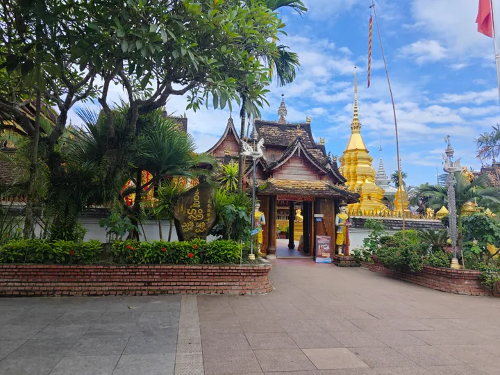 A temple gateway and golden stupa inside the Xishuangbanna Dai Ethnic Garden, Jinghong · 西双版纳傣族园内的寺庙山门与金塔,景洪市 Source-recorded photograph date: 2025-08-09 09:48:01.
Dai Ethnic Garden傣族园
The Dai Ethnic Garden (傣族园) is a scenic area in Ganlanba, Jinghong, Yunnan, comprising five traditional Dai villages.
Read the place guide →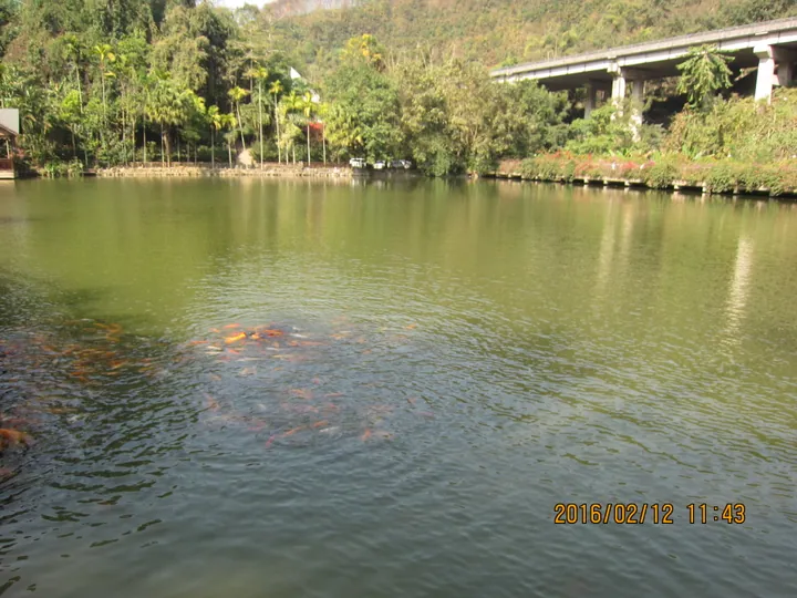 A forest lake inside the Xishuangbanna Primeval Forest Park near Jinghong · 景洪市西双版纳原始森林公园内的森林湖泊 Source-recorded photograph date: 2016-02-12 11:43:47.
Xishuangbanna Primeval Forest Park原始森林公园
The Xishuangbanna Primeval Forest Park is a rainforest reserve within the Caiyanghe protection area east of Jinghong, Yunnan.
Read the place guide →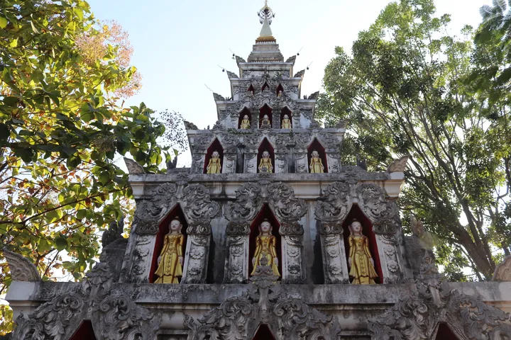 A Theravada Buddhist pagoda within the Gaozhuang Xishuangjing complex, Jinghong, Xishuangbanna · 西双版纳傣族自治州景洪市告庄西双景内南传佛教塔寺 Source-recorded photograph date: 2025-01-12 17:27:06.
Gaozhuang Xishuangjing District告庄西双景
Gaozhuang Xishuangjing is a riverside culture-and-leisure district in Jinghong, Yunnan, centred on its Star Light Night Market.
Read the place guide → AI illustration · AI 示意图(仅供参考,非该地点实拍)
Jinuo Mountain Village基诺山寨
Jinuo Shanzhai is a Jinuo ethnic-culture scenic area in Jinuo Mountain Jinuo Ethnic Township, Jinghong, Yunnan.
Read the place guide →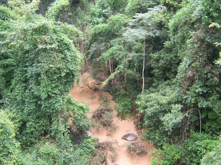 An elevated view down into dense tropical forest: a silt-brown stream winding between steep banks of tangled green canopy, bamboo and broadleaf trees, with boulders and fallen branches in the water and no sky visible.
Wild Elephant Valley野象谷
Wild Elephant Valley occupies the Sanchahe forest area north of Jinghong. Elevated viewing walkways provide a way to observe the valley without entering elephant habitat, while the Asian Elephant Museum explains the animals’…
Read the place guide →Plan your visit
Getting there
Jinghong covers the centre of Xishuangbanna Dai Autonomous Prefecture. Search for 景洪市 in a map app to find stations and your accommodation.
Where to stay →Build your route
Manting Park and Zongfo Temple and Dai Ethnic Garden are both listed here. The linked place guides have entrance and visit details.
Continue with Xishuangbanna Dai Autonomous Prefecture →More in Xishuangbanna Dai Autonomous Prefecture
Sources & geographic information
Administrative names and parent areas: Official geographic directory · Reference date 2026-09-06.
Some facts checked against 景洪市 — Wikipedia contributors, CC BY-SA 4.0.
Photo: Manting Park and Zongfo Temple · Liuxingy · CC BY-SA 4.0. Full frame retained; proportionally resized and converted to WebP. No retouching or changes to the photographed subject. Card displays may crop the view.

Photo: Dai Ethnic Garden · Zhangzhugang · CC BY-SA 4.0. Full frame retained; proportionally resized and converted to WebP. No retouching or changes to the photographed subject. Card displays may crop the view.

Photo: Xishuangbanna Primeval Forest Park · Liuxingy · CC BY-SA 4.0. Full frame retained; proportionally resized and converted to WebP. No retouching or changes to the photographed subject. Card displays may crop the view.

Photo: Gaozhuang Xishuangjing District · Liuxingy · CC BY-SA 4.0. Full frame retained; proportionally resized and converted to WebP. No retouching or changes to the photographed subject. Card displays may crop the view.

Photo: Wild Elephant Valley · zhanyoun · CC BY-SA 3.0. Full frame retained; proportionally resized and converted to WebP. No retouching or changes to the photographed subject. Card displays may crop the view.

Map data © OpenStreetMap contributors. Pins mark approximate centres, not entrances or boundaries.