


Get to know Xishuangbanna Dai Autonomous Prefecture
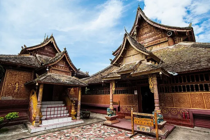
Photo adjustments
Full frame retained; proportionally resized and converted to WebP. No retouching or changes to the photographed subject. Card displays may crop the view.
- Administrative area
- Autonomous prefecture · 自治州
- Part of
- Yunnan
- Chinese name
- 西双版纳傣族自治州
- Local areas
- 3 local areas
Area & population
- Population · 2010
- 1,133,515
- Administrative seat
- Jinghong
Source: cited geographic source, as of the dates shown.
This region of China is noted for the distinct culture of its ethnic groups, which is very different from that of the Han Chinese. The people, architecture, language and culture more closely resemble those of the Shan, Dai and Tai peoples, which includes the Thai and Lao.
Culture
The six famous tea mountains region located in the prefecture produces some of the most highly regarded Pu-erh tea in the 20th century.
Xishuangbanna is rich in nature, historical and cultural resources, noted for its folklore, rain forests, rare plants, and wildlife. Its major tourist attractions include Menglun Tropical Botanical Garden, Manfeilong Pagodas (Tanuozhuanglong), Jingzhen Pavilion, Wild Elephant Gully, Dai people's village at Ganlanba. The Manchunman Buddhist Temple, which has a history of more than 1400 years, is also a very popular tourist attraction. The complex is made up of four parts, the main hall, the sutra collection pavilion, the gold pagoda, and the drum tower. The temple is well known within the Southeast Asian region and each year attracts Buddhist monks and visitors from Sri Lanka, Thailand, Myanmar and Laos.
Transport
Since the opening of the Xishuangbanna Gasa International Airport (formerly Jinghong International Airport) in 1990, traveling to Xishuangbanna by air has become more popular and convenient and there are daily flights connecting Xishuangbanna with Kunming City. The area also has air connections with Dali, Chengdu and Bangkok. The Xishuangbanna Airport is 6 km south of Jinghong City.
There are also bus routes to places all over Yunnan and neighboring provinces. It is 590 km from Kunming to Jinghong. Long-distances buses depart from Kunming South Station and arrive at Jinghong Bus Station, costing CNY 210–250, which is about 8–10 hours duration.
Explore Xishuangbanna Dai Autonomous Prefecture
Core places to explore, with English and Chinese names.
Jingzhen Octagonal Pavilion 景真八角亭
Mengjinglai Dai Village 勐景来
Nannuo Mountain Ancient Tea Gardens 南糯山古茶园
Xishuangbanna Tropical Botanical Garden 中国科学院西双版纳热带植物园
Yiwu Ancient Town 易武古镇
Wangtianshu Rainforest Scenic Area 望天树
Mengyuan Fairyland 勐远仙境
Manting Park and Zongfo Temple 曼听公园与总佛寺
Dai Ethnic Garden 傣族园
Xishuangbanna Primeval Forest Park 原始森林公园
Gaozhuang Xishuangjing District 告庄西双景
Jinuo Mountain Village 基诺山寨
Wild Elephant Valley 野象谷
Jinghong 景洪市
Menghai County 勐海县
Mengla County 勐腊县
Places to explore around Xishuangbanna Dai Autonomous Prefecture
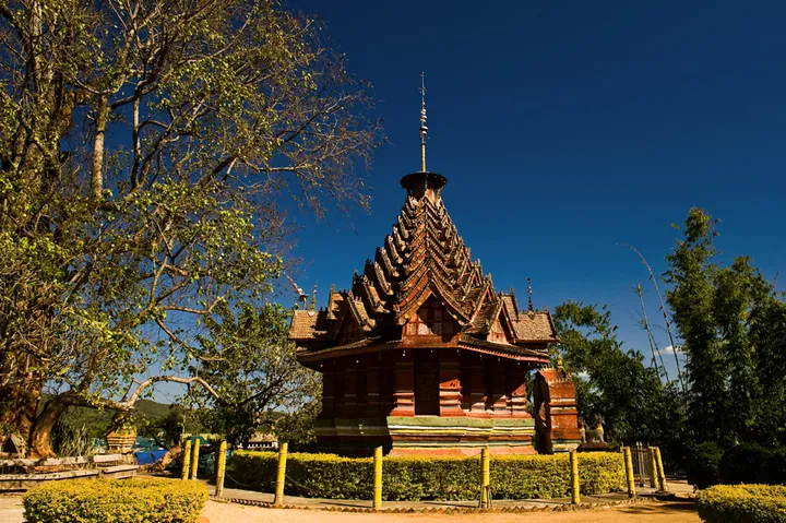 Jingzhen Octagonal Pavilion (Jingzhen Octagonal Pavilion) in Menghai County, Xishuangbanna · 西双版纳勐海县景真八角亭 Source-recorded photograph date: 2015-04-01 20:41:59.
Jingzhen Octagonal Pavilion景真八角亭
Octagonal ordination hall of Jingzhen Temple in Menghai, Xishuangbanna, built in 1701 with an eleven-tier roof; a national heritage site since 1988.
Read the place guide →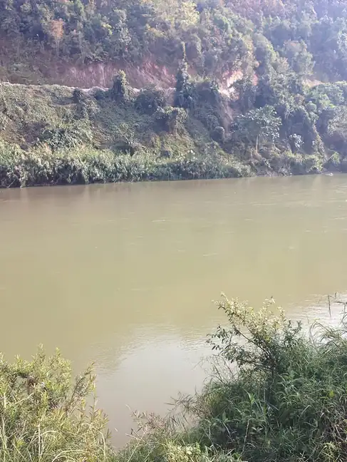 Mengjinglai Dai Village · 勐景来
Mengjinglai Dai Village勐景来
Mengjinglai (勐景来) is a Dai village and scenic area on the China-Myanmar border in Menghai County, Yunnan, developed around a traditional Dai settlement in Daluo township.
Read the place guide → AI illustration · AI 示意图(仅供参考,非该地点实拍)
Nannuo Mountain Ancient Tea Gardens南糯山古茶园
Nannuo Mountain (南糯山) is an old tea-growing area in Geladehe Hani Township, Menghai County, Yunnan, home to more than 20 Hani villages.
Read the place guide → Xishuangbanna Tropical Botanical Garden (中国科学院西双版纳热带植物园), Mengla County. Photograph: "Tropical Botanical Garden, Xishuangbanna - panoramio - Colin W (1)".
Xishuangbanna Tropical Botanical Garden中国科学院西双版纳热带植物园
Chinese Academy of Sciences garden on Hulu Island in Menglun, founded by Cai Xitao in 1959, with over 14,000 plant taxa and 250 ha of rainforest.
Read the place guide →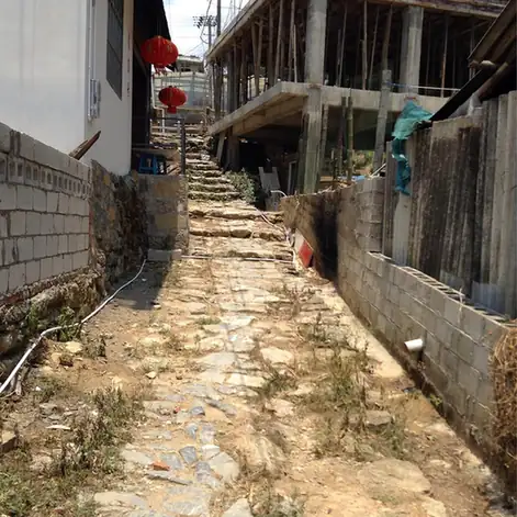 Yiwu Ancient Town · 易武古镇
Yiwu Ancient Town易武古镇
Yiwu (易武) is an old tea-trading town in Mengla County, Yunnan, built around a legacy of Puer tribute-tea production.
Read the place guide →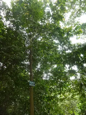 Wangtianshu Rainforest Scenic Area · 望天树
Wangtianshu Rainforest Scenic Area望天树
Wangtianshu Rainforest Scenic Area scenic area is a tropical-rainforest reserve in Mengla County, Yunnan, named for its emergent canopy tree species.
Read the place guide →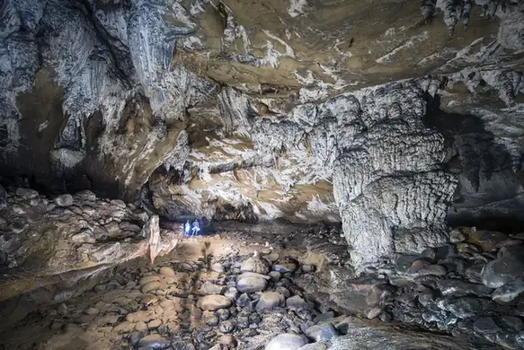 Mengyuan Fairyland · 勐远仙境
Mengyuan Fairyland勐远仙境
Mengyuan Fairyland (勐远仙境) is a rainforest and cave scenic area in Guanlei township, Mengla County, Yunnan, within the experimental zone of the Xishuangbanna National Nature Reserve.
Read the place guide → A white Dai-style stupa of five spires — a tall central one ringed by four smaller ones on tiered white bases with gilt ornament — against a deep blue sky, with a fan palm and dark foliage at the lower left.
Manting Park and Zongfo Temple曼听公园与总佛寺
Manting Park and the Zongfo Temple are two sites in Jinghong, Yunnan: a former Dai royal garden and Xishuangbanna's senior Theravada Buddhist temple.
Read the place guide →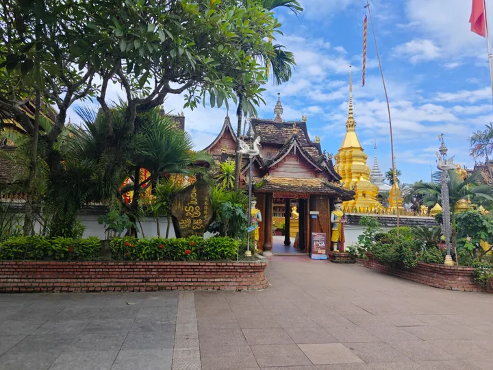 A temple gateway and golden stupa inside the Xishuangbanna Dai Ethnic Garden, Jinghong · 西双版纳傣族园内的寺庙山门与金塔,景洪市 Source-recorded photograph date: 2025-08-09 09:48:01.
Dai Ethnic Garden傣族园
The Dai Ethnic Garden (傣族园) is a scenic area in Ganlanba, Jinghong, Yunnan, comprising five traditional Dai villages.
Read the place guide →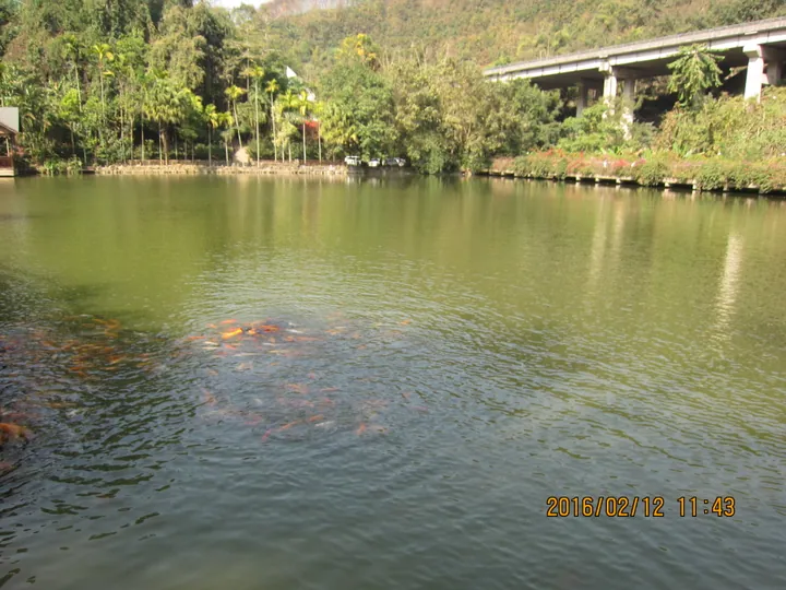 A forest lake inside the Xishuangbanna Primeval Forest Park near Jinghong · 景洪市西双版纳原始森林公园内的森林湖泊 Source-recorded photograph date: 2016-02-12 11:43:47.
Xishuangbanna Primeval Forest Park原始森林公园
The Xishuangbanna Primeval Forest Park is a rainforest reserve within the Caiyanghe protection area east of Jinghong, Yunnan.
Read the place guide →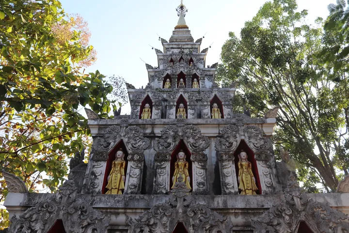 A Theravada Buddhist pagoda within the Gaozhuang Xishuangjing complex, Jinghong, Xishuangbanna · 西双版纳傣族自治州景洪市告庄西双景内南传佛教塔寺 Source-recorded photograph date: 2025-01-12 17:27:06.
Gaozhuang Xishuangjing District告庄西双景
Gaozhuang Xishuangjing is a riverside culture-and-leisure district in Jinghong, Yunnan, centred on its Star Light Night Market.
Read the place guide → AI illustration · AI 示意图(仅供参考,非该地点实拍)
Jinuo Mountain Village基诺山寨
Jinuo Shanzhai is a Jinuo ethnic-culture scenic area in Jinuo Mountain Jinuo Ethnic Township, Jinghong, Yunnan.
Read the place guide →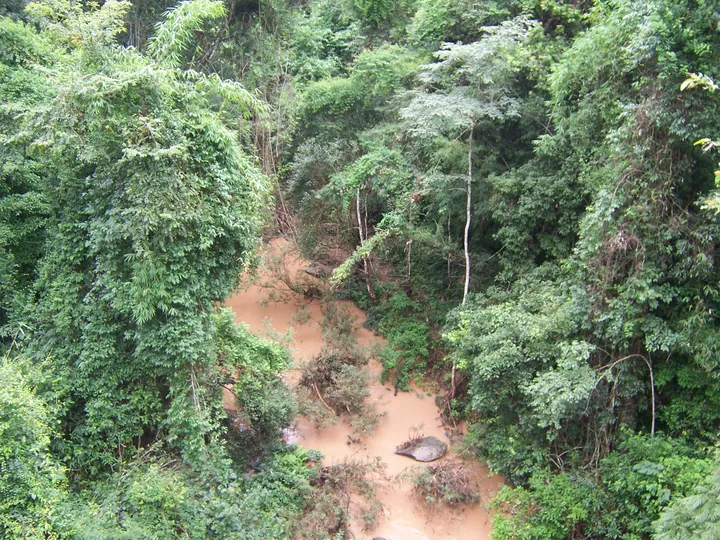 An elevated view down into dense tropical forest: a silt-brown stream winding between steep banks of tangled green canopy, bamboo and broadleaf trees, with boulders and fallen branches in the water and no sky visible.
Wild Elephant Valley野象谷
Wild Elephant Valley occupies the Sanchahe forest area north of Jinghong. Elevated viewing walkways provide a way to observe the valley without entering elephant habitat, while the Asian Elephant Museum explains the animals’…
Read the place guide →Local life & food
Xishuangbanna Dai Autonomous Prefecture local specialties
西双版纳傣族自治州特色美食 · 14 specialties to discover
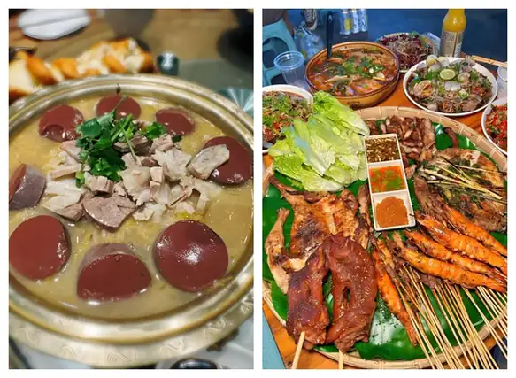 Dai-Style Barbecue 傣味烧烤
Dai-Style Barbecue (傣味烧烤) is the grilled food of Xishuangbanna (西双版纳), Yunnan, sold after dark from barbecue stalls and shops of every size.
Read the dish guide →Photo adjustments
EXIF orientation normalized; resized without changing aspect ratio; converted to WebP. No subject edits.
 Dai lemongrass grilled fish 香茅草烤鱼AI illustration · AI 示意图
The surface develops browned spots while the interior stays moist, with a citrus-herbal fragrance from the lemongrass.
Source ↗Read the dish guide → Purple Rice Steamed in Pineapple 菠萝紫米饭AI illustration · AI 示意图(仅供参考,非实拍)
Purple Rice Steamed in Pineapple (菠萝紫米饭) is a sweet dish of the Dai (傣族) people in which purple glutinous rice is steamed inside a hollowed-out pineapple.
Read the dish guide → Pounded Chicken Feet 舂鸡脚AI illustration · AI 示意图(仅供参考,非实拍)
Pounded Chicken Feet (舂鸡脚) is a Dai (傣族) cold dish from Xishuangbanna (西双版纳), Yunnan, in which cooked chicken feet are pounded with lemon, tomato and chilli until soft and sour-hot.
Read the dish guide →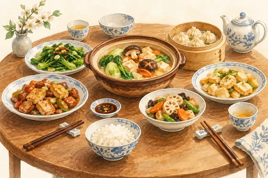 Leaf-Wrapped Grilled Dishes 包烧AI illustration · AI 示意图(仅供参考,非实拍)
Leaf-Wrapped Grilled Dishes (包烧) describes a Dai (傣族) cooking method in Xishuangbanna (西双版纳), Yunnan (云南), in which fresh leaves enclose food while it cooks over the charcoal of a fire pit.
Read the dish guide →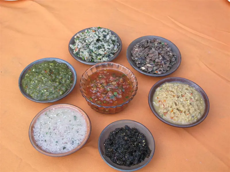 Nanmi Dipping Sauce 喃咪
Nanmi Dipping Sauce (喃咪) is a family of Dai sauces from Xishuangbanna (西双版纳), Yunnan. "Nanmi" is a Dai word that can be rendered as sauce or condiment, and the sauces are eaten with fruit, vegetables and sticky rice.
Read the dish guide →Photo adjustments
EXIF orientation normalized; resized without changing aspect ratio; converted to WebP. No subject edits.
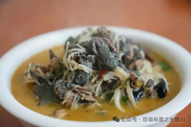 Chicken Boiled with Sour Bamboo Shoots 酸笋煮鸡
Chicken Boiled with Sour Bamboo Shoots (酸笋煮鸡) is listed among the local specialties of Xishuangbanna Dai Autonomous Prefecture, Yunnan. The name includes 鸡 (chicken), 笋 (bamboo shoots).
Read the dish guide →Photo adjustments
EXIF orientation normalized; resized without changing aspect ratio; converted to WebP. No subject edits.
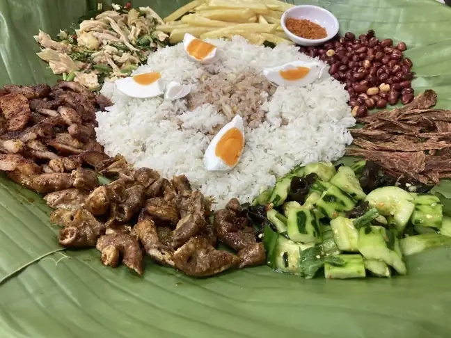 Dai-Style Rice Eaten by Hand 傣味手抓饭
Dai-Style Rice Eaten by Hand (傣味手抓饭) is listed among the local specialties of Xishuangbanna Dai Autonomous Prefecture, Yunnan. It is grouped here with rice & congee; retain the complete Chinese name when comparing local menus.
Read the dish guide →Photo adjustments
EXIF orientation normalized; resized without changing aspect ratio; converted to WebP. No subject edits.
All dish names · 全部菜名 (14)
- Dai-Style Barbecue · 傣味烧烤
- Dai lemongrass grilled fish · 香茅草烤鱼
- Purple Rice Steamed in Pineapple · 菠萝紫米饭
- Pounded Chicken Feet · 舂鸡脚
- Leaf-Wrapped Grilled Dishes · 包烧
- Nanmi Dipping Sauce · 喃咪
- Chicken Boiled with Sour Bamboo Shoots · 酸笋煮鸡
- Dai-Style Rice Eaten by Hand · 傣味手抓饭
- Bamboo Tube Rice · 竹筒饭
- Grilled Chicken · 烤鸡
- Deep-Fried Bamboo Worms · 油炸竹虫
- Sapie Cold Dish · 撒撇
- Lemon Sa Cold Dish · 柠檬撒
- Paluda Iced Dessert Drink · 帕露达
More dishes from across Yunnan are in the Yunnan food guide.
Counties & districts in Xishuangbanna Dai Autonomous Prefecture
3 areas belong directly to Xishuangbanna Dai Autonomous Prefecture.
3 areas
Jinghong 景洪市
Jinghong is a city in and the seat of Xishuangbanna Dai Autonomous Prefecture, in the far south of China's Yunnan province, and the historic capital of the former Tai kingdom of Sipsongpanna.
Explore the area →CountyMenghai County 勐海县
Menghai County is a county under the jurisdiction of Xishuangbanna Dai Autonomous Prefecture, in the far south of Yunnan, China, bordering Burma's Shan State to the south and west.
Explore the area →CountyMengla County 勐腊县
Mengla County (simplified Chinese: 勐腊县; traditional Chinese: 勐臘縣; pinyin: Měnglà Xiàn; Tai Lue: ᦵᦙᦲᧂ ᦟᦱᧉ ᦶᦉᧃᧈ, Mueang La; Burmese: မိုးလား, Lao: ເມືອງລ້າ; Thai: เมืองล้า) is a county under the jurisdiction of…
Explore the area →No areas match this name.
Plan your visit
Getting there
Search for 西双版纳傣族自治州 in a map app to find stations and your accommodation.
Where to stay →Build your route
Jingzhen Octagonal Pavilion and Mengjinglai Dai Village are both listed here. The linked place guides have entrance and visit details.
Continue with Yunnan →More in Yunnan
Sources & geographic information
Administrative names and parent areas: Official geographic directory · Reference date 2026-09-06.
Background text adapted from Xishuangbanna Dai Autonomous Prefecture — Wikipedia contributors, under CC BY-SA 4.0. Text has been shortened and reorganized; source revision 1370826353.
Photo: Jingzhen Octagonal Pavilion · 爵士鼓手 · CC BY 3.0. Full frame retained; proportionally resized and converted to WebP. No retouching or changes to the photographed subject. Card displays may crop the view.

Photo: Mengjinglai Dai Village · Liuxingy · CC BY-SA 4.0. EXIF orientation normalized; resized without changing aspect ratio; converted to WebP. No subject edits.

Photo: Xishuangbanna Tropical Botanical Garden · Colin W · CC BY-SA 3.0. Full frame retained; EXIF orientation normalized, proportionally resized to at most 800 pixels and converted to WebP. No generated pixels or subject changes. Cards may crop the display.

Photo: Yiwu Ancient Town · Source photographer · License not provided. EXIF orientation normalized; resized without changing aspect ratio; converted to WebP. No subject edits.
Photo: Wangtianshu Rainforest Scenic Area · Hungda · CC BY-SA 3.0. EXIF orientation normalized; resized without changing aspect ratio; converted to WebP. No subject edits.

Photo: Mengyuan Fairyland · Source photographer · License not provided. EXIF orientation normalized; resized without changing aspect ratio; converted to WebP. No subject edits.
Photo: Manting Park and Zongfo Temple · Liuxingy · CC BY-SA 4.0. Full frame retained; proportionally resized and converted to WebP. No retouching or changes to the photographed subject. Card displays may crop the view.

Photo: Dai Ethnic Garden · Zhangzhugang · CC BY-SA 4.0. Full frame retained; proportionally resized and converted to WebP. No retouching or changes to the photographed subject. Card displays may crop the view.

Photo: Xishuangbanna Primeval Forest Park · Liuxingy · CC BY-SA 4.0. Full frame retained; proportionally resized and converted to WebP. No retouching or changes to the photographed subject. Card displays may crop the view.

Photo: Gaozhuang Xishuangjing District · Liuxingy · CC BY-SA 4.0. Full frame retained; proportionally resized and converted to WebP. No retouching or changes to the photographed subject. Card displays may crop the view.

Photo: Wild Elephant Valley · zhanyoun · CC BY-SA 3.0. Full frame retained; proportionally resized and converted to WebP. No retouching or changes to the photographed subject. Card displays may crop the view.

Map data © OpenStreetMap contributors. Pins mark approximate centres, not entrances or boundaries.