

Explore the region
Tap any red Chinese text to hear it in Mandarin.
About First Bend of the Yellow River
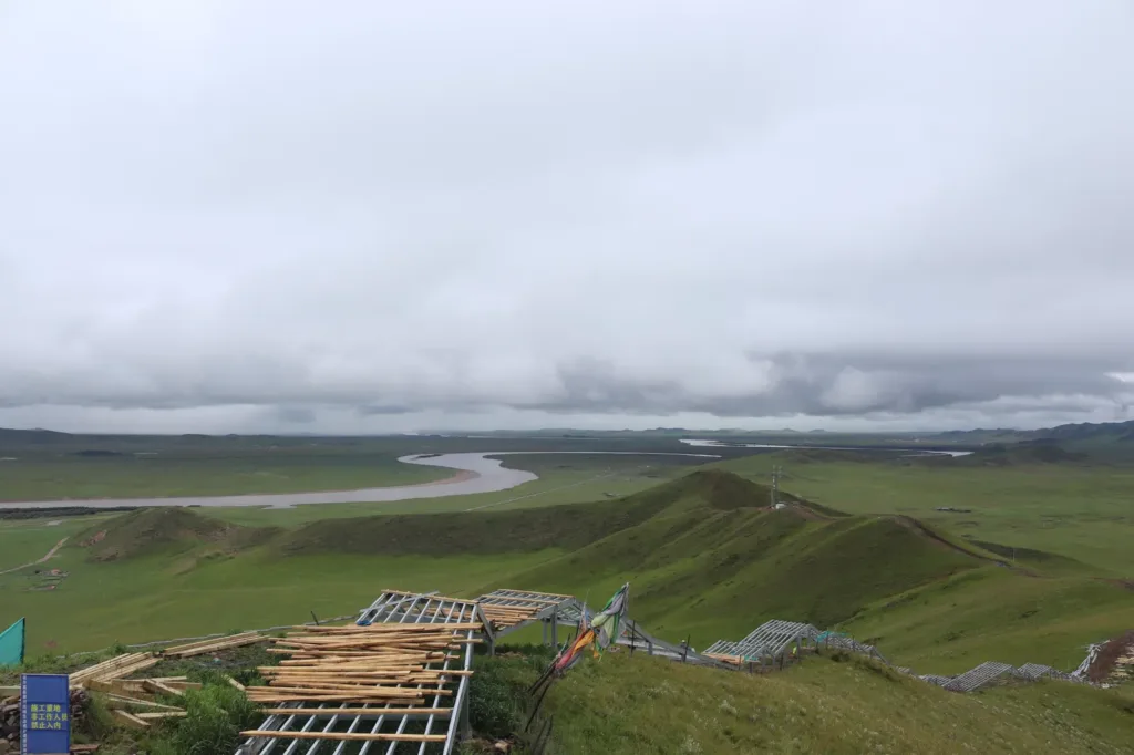
This is not a waterfall or a single riverbank photo stop. It is a wide grassland and wetland landscape in which the Yellow River enters Ruo’ergai from the Bayan Har mountain region, makes a roughly 180-degree turn at Luohua Bay near the Tangke–Xiaman boundary, and then runs back toward the northwest. The river meets the White River near Suoge Zang Temple in Tangke Town.
From ground level the water can look surprisingly calm and flat. The distinctive view appears when the river is read together with the grassland, wetland and low hills. A viewing platform on the hill behind the temple gives the useful change of scale: the bend stops looking like an isolated curve and becomes part of a much larger highland basin. The wider Ruo’ergai wetland supports waterbirds and is part of the area’s conservation story.
What to look for
Start by identifying the Yellow River’s long sweep rather than trying to find one dramatic foreground bend. From the designated viewing platform, look for the river’s return direction and the point where the White River joins it below the temple. On a clear day, the contrast between the blue water, open grassland and rounded ochre hills is more revealing than a close-up view from the road. The temple, river and wetland should be treated as one setting, not as interchangeable attractions.
The visitor route can be walked uphill or taken by sightseeing escalator according to the current attraction listing. A 2025 visitor account describes a connected 14-escalator system, but the exact operating section and availability are not established by a current official operating notice, so confirm them before paying. Tangke is above 3,400 metres, and the climb can feel much harder than its distance suggests. Walk slowly, pause before the next rise, and do not turn an altitude-sensitive visit into a race.
Keep to signed paths and viewing areas. Do not descend into wetland or river-edge areas that are not open to visitors, feed wildlife, or treat the temple grounds as a photo set. If you enter Suoge Zang Temple, follow local instructions, keep voices low and avoid photographing worshippers without permission.
Getting there and back
The current attraction listing gives the address as 唐克镇唐热路, Ruoergai County, Aba Tibetan and Qiang Autonomous Prefecture and displays the ticket enquiry number +86 837 2291558. Use the Chinese name 黄河九曲第一湾 Huáng Hé Jiǔqū Dìyī Wān in Amap or Apple Maps and confirm the signed visitor entrance on 唐热路 before setting out; the exact gate and parking arrangement were not independently confirmed in a current official notice.
For a practical international-visitor plan, arrange a private car or local driver from Ruoergai county town and agree the return or an overnight stay in Tangke before leaving. A government transport table published in 2013 records the 若尔盖汽车客运中心站 Ruò’ěrgài Qìchē Kèyùn Zhōngxīn Zhàn in 达扎寺镇 and a 14:30 service toward 辖曼乡 via 唐克乡, with an estimated three-hour journey, but that table is too old to treat as a current timetable. Do not assume that a bus reaching Tangke will continue to the scenic entrance or that a same-day return is available.
Ticket prices, opening hours, passport booking or inspection arrangements, the exact entrance, and the current escalator schedule should be confirmed for your date through the venue or local transport staff. The prefecture’s 2026 plan calls for further infrastructure improvement at the scenic area, another reason not to carry forward an old price, gate or facility assumption. If you plan to stay for late light, check the closing time and secure the return ride first.
Find First Bend of the Yellow River
黄河九曲第一湾 · 若尔盖县
The pin marks the area, not the entrance.
Sources & visit information
Sources checked on 24 October 2026. Hours, tickets, reservations and transport can change; confirm with the operator before you go.
Image credits & notes (1)
- The Yellow River’s broad bends and wetland basin seen from the hillside viewpoint at the First Bend of the Yellow River, Ruoergai County. Photo: Liuxingy (Wikimedia Commons username)Photo: CC BY-SA 4.0