


Get to know Ngawa Tibetan and Qiang Autonomous Prefecture
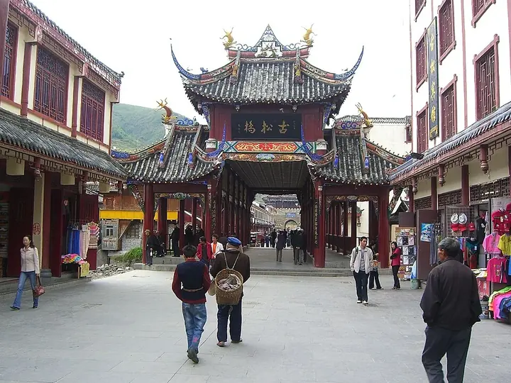
Photo adjustments
Full frame retained; proportionally resized and converted to WebP. No retouching or changes to the photographed subject. Card displays may crop the view.
- Administrative area
- Autonomous prefecture · 自治州
- Part of
- Sichuan
- Chinese name
- 阿坝藏族羌族自治州
- Local areas
- 13 local areas
Area & population
- Area in the source
- 83,201.00 km²
- Population · 2022
- 895,200
- Administrative seat
- Barkam (Barkam Town)
Source: cited geographic source, as of the dates shown.
The county of Wenchuan in Ngawa is the site of the epicenter of the 2008 Sichuan earthquake, in which over 20,000 of its residents died and 40,000 were injured.
Tourism
There are many places of interest in the prefecture, including
Wolong National Nature Reserve in Wenchuan County, a well-known giant panda reserve where the China Conservation and Research Center for the Giant Panda was established in 1980 Kirti Gompa, a 15th-century Tibetan Buddhism monastery Nangzhik Gompa monastery, founded in the 12th century Huanglong Scenic and Historic Interest Area in Songpan County Jiuzhaigou, Jiuzhaigou County, a nature reserve known for its many multi-level waterfalls and colorful lakes, declared a UNESCO World Heritage Site in 1992 Mount Siguniang (四姑娘山 སྐུ་བླ "Sku Mountain"; formerly 四姑山, a transcription), the highest point of the Qionglai Mountains, on the border between Xiaojin County (小金县; Tibetan: བཙན་ལྷ) and Wenchuan County.
Explore Ngawa Tibetan and Qiang Autonomous Prefecture
Core places to explore, with English and Chinese names.
Wenchuan Special Tourism Area 汶川特别旅游区
Jiuzhaigou Valley 九寨沟
Mount Siguniang 四姑娘山
Mounigou Valley 牟尼沟
Huanglong Scenic and Historic Interest Area 黄龙风景名胜区
Songpan Ancient City 松潘古城
Wolong Shenshuping Giant Panda Base 卧龙中华大熊猫苑神树坪基地
Yingxiu Earthquake Ruins and Memorial Hall 映秀地震遗址与纪念馆
Shuimo Ancient Town 水磨古镇
Taoping Qiang Village 桃坪羌寨
Bipenggou 毕棚沟
Ganbao Tibetan Village 甘堡藏寨
Miyaluo Autumn Foliage 米亚罗彩林
Emetang Flower Sea 俄么塘花海
Hongyuan Moon Bay 红原月亮湾
Ruo'ergai Flower Lake 若尔盖花湖
Langmusi Kirti Monastery Sichuan Side 郎木寺四川侧格尔底寺
First Bend of the Yellow River 黄河九曲第一湾
Diexi Songpinggou Valley 叠溪松坪沟
China Ancient Qiang City 中国古羌城
Jinchuan Pear Blossom Valley 金川梨花河谷
Guanyinqiao Scenic Area 观音桥
Lianbao Yeze Scenic Area 莲宝叶则
Kirti Monastery 格尔登寺
Zhuokeji Chieftain's Residence 卓克基土司官寨
Xisuo Tibetan Village 西索民居
Naizigou Autumn Foliage 奶子沟彩林
Dagu Glacier 达古冰川
Ma'erkang 马尔康市
Wenchuan County 汶川县
Lixian 理县
Maoxian 茂县
Songpan County 松潘县
Jiuzhaigou County 九寨沟县
Jinchuan County 金川县
Xiaojin County 小金县
Heishui County 黑水县
Rangtang County 壤塘县
Aba County 阿坝县
Ruo'ergai 若尔盖县
Hongyuan County 红原县
Places to explore around Ngawa Tibetan and Qiang Autonomous Prefecture
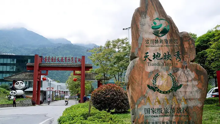 Wenchuan Special Tourism Area · 汶川特别旅游区
Wenchuan Special Tourism Area汶川特别旅游区
Wenchuan Special Tourism Area groups Yingxiu, Shuimo and Sanjiang, with themes of remembrance, reconstruction and mountain-town life.
Read the place guide →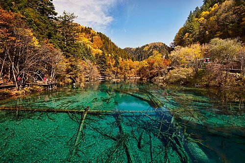 Jiuzhaigou Natural Reserve · 九寨沟
Jiuzhaigou Valley九寨沟
Jiuzhaigou is a protected mountain-valley landscape in northern Sichuan where clear lakes, waterfalls and limestone formations sit below forested slopes. Its appeal comes from the relationship between water, minerals, vegetation…
Read the place guide → Snow-covered peaks of Mount Siguniang. Photograph date recorded by the source: 29 March 2019 (according to Exif data).
Mount Siguniang四姑娘山
Mount Siguniang is a group of high peaks above three distinct visitor valleys: Shuangqiao, Changping and Haizi. Shuangqiao has a road and sightseeing-bus system with boardwalk sections, while the other valleys offer different…
Read the place guide →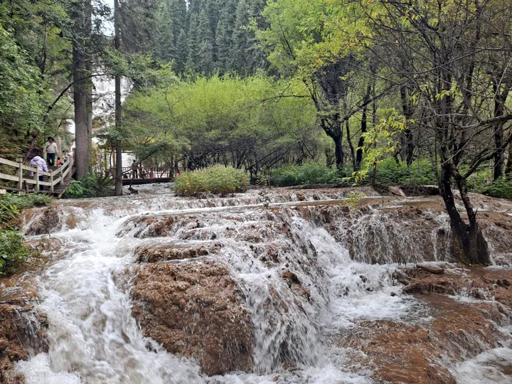 A travertine cascade waterfall along the forested boardwalk trail in Mouni Valley, Songpan County · 四川松潘县牟尼沟钙化瀑布 Source-recorded photograph date: 2023-09-11.
Mounigou Valley牟尼沟
Travertine valley in Songpan, Sichuan, with the tall Zhaga Waterfall and the forest lakes and hot springs of Erdaohai.
Read the place guide →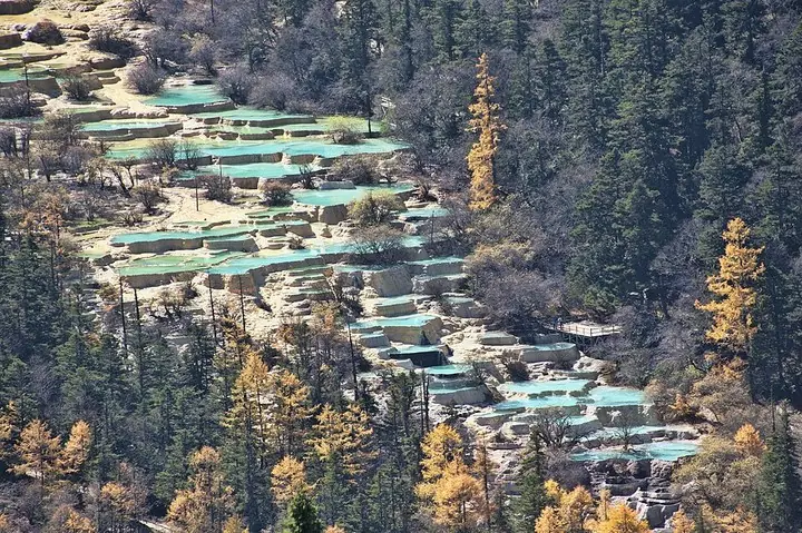 Travertine pools at Huanglong, Sichuan · 四川黄龙钙华彩池 Photograph date recorded by the source: 24 October 2011.
Huanglong Scenic and Historic Interest Area黄龙风景名胜区
Huanglong is a mountain valley distinguished by a sequence of travertine pools, mineral formations and waterfalls. The pale terraces and colored water are part of a natural system, set among forests and high peaks rather than…
Read the place guide → Songpan Ancient City wall and gate from above · 松潘古城城墙与城门俯瞰 Photograph date recorded by the source: 17 October 2023, 05:31:38.
Songpan Ancient City松潘古城
Songpan’s old city is shaped by its fortified gates and the Min River running through the built-up area. Gusong Bridge gives a close view of the water and the houses along its banks, while the surrounding streets retain a busy…
Read the place guide → Wolong Shenshuping Giant Panda Base · 卧龙中华大熊猫苑神树坪基地
Wolong Shenshuping Giant Panda Base卧龙中华大熊猫苑神树坪基地
Wolong Zhonghua Daxiongmao Yuan Shenshuping Jidi is the Shenshuping base of the China Conservation and Research Center for the Giant Panda, at Gengda town in the Wolong section of Giant Panda National Park, Wenchuan County, Aba prefecture, Sichuan, built with Hong Kong government reconstruction funding after the 2008 earthquake and opened in 2016.
Read the place guide → Yingxiu Earthquake Ruins and Memorial Hall · 映秀地震遗址与纪念馆
Yingxiu Earthquake Ruins and Memorial Hall映秀地震遗址与纪念馆
Yingxiu Dizhen Yizhi Yu Jinianguan covers two linked sites in Yingxiu town, Wenchuan County, Aba prefecture, Sichuan, at the epicentre of the 2008 Wenchuan earthquake: the ruins of Xuankou Middle School, left largely as the earthquake left them, and the separate '5.12' Wenchuan Earthquake Epicentre Memorial Hall built nearby with Dongguan, Guangdong reconstruction funding.
Read the place guide →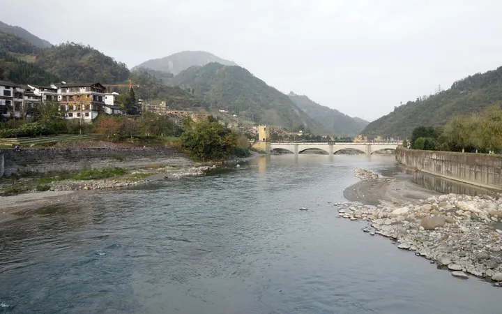 Shuimo Ancient Town on the banks of the Shouxi River, Wenchuan County · 汶川县水磨古镇,寿溪河畔景观 Source-recorded photograph date: 2016-11-20 16:55:09.
Shuimo Ancient Town水磨古镇
Shuimo Ancient Town is Shuimo town, on the Shouxi River in the south of Wenchuan County, Aba prefecture, Sichuan, rebuilt with paired reconstruction assistance from Foshan, Guangdong after the 2008 Wenchuan earthquake into a town themed on Qiang culture.
Read the place guide →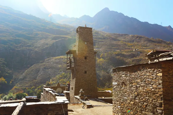 A stone watchtower and dwellings of Taoping Qiang Village, Li County, Sichuan, with the surrounding mountains behind · 四川理县桃坪羌寨石碉楼及民居,背靠群山 Source-recorded photograph date: 2015-11-14 13:56:59.
Taoping Qiang Village桃坪羌寨
Taoping’s older Qiang village is built from stone and timber, with covered passages linking houses beneath tall defensive towers. Water channels run below the buildings, making infrastructure as interesting as the skyline. A…
Read the place guide → Autumn stream and mountain scenery in Bipenggou · 毕棚沟秋林、溪流与雪山 Photograph date recorded by the source: 13 October 2013, 10:38:18.
Bipenggou毕棚沟
Bipenggou is a developed mountain valley in Li County, where lakes, forest and high rocky peaks make a varied alpine excursion. Panyang Lake is a natural focus for reflections and a gentler walk, while the route toward Yanziyan…
Read the place guide →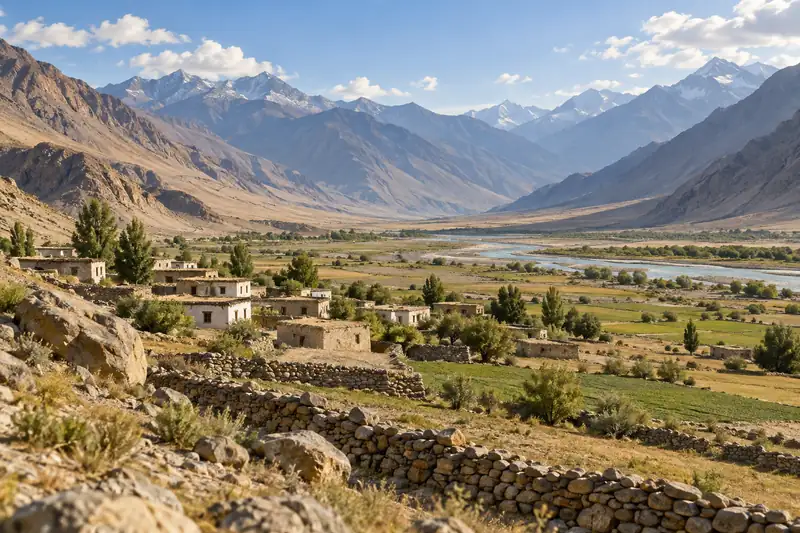 AI illustration · AI 示意图(仅供参考,非该地点实拍)
Ganbao Tibetan Village甘堡藏寨
Ganbao Zangzhai is a Jiarong Tibetan village built against a cliff at the junction of Han, Tibetan and Qiang settlement, 8 km from the county town of Lixian, Aba prefecture, Sichuan, rebuilt to the standard of a 4A-grade scenic area after the 2008 earthquake destroyed it, under a Hunan province paired-assistance programme.
Read the place guide →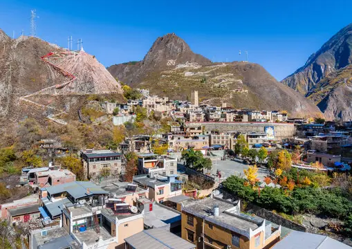 Miyaluo Autumn Foliage · 米亚罗彩林
Miyaluo Autumn Foliage米亚罗彩林
Miyaluo Autumn Foliage refers to the autumn foliage of Miyaluo town, a Jiarong Tibetan settlement 61 km northwest of the county town of Lixian, Aba prefecture, Sichuan, whose surrounding Miyaluo Provincial Nature Reserve is home to snow leopards and Sichuan snub-nosed monkeys.
Read the place guide → AI illustration · AI 示意图(仅供参考,非该地点实拍)
Emetang Flower Sea俄么塘花海
Emetang Flower Sea is the flower-covered grassland of Ewotang, in Rangkou township, Hongyuan County, Aba prefecture, Sichuan, known to local Tibetan people as 'the garden of the sky god'.
Read the place guide →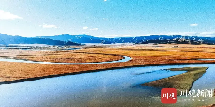 Hongyuan Moon Bay · 红原月亮湾
Hongyuan Moon Bay红原月亮湾
Hongyuan Yueliang Wan is an S-shaped bend of the Bai River, a tributary of the Yellow River, on the grassland 3 km from the county town of Hongyuan, Aba prefecture, Sichuan, named for its resemblance to a crescent moon.
Read the place guide →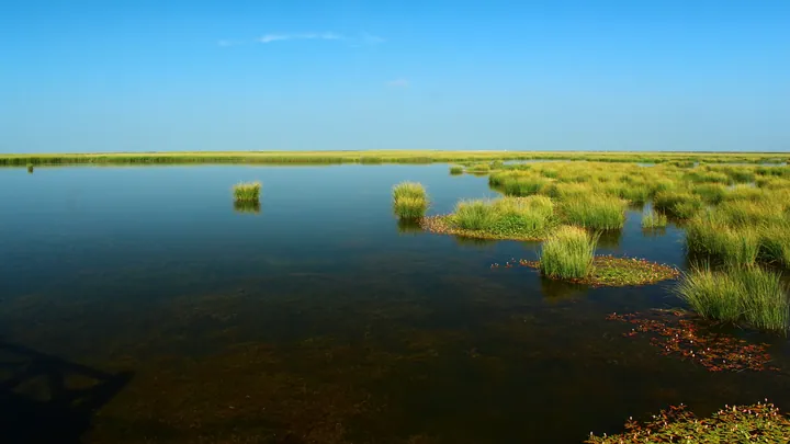 Wetland grasses and still water at Ruoergai Flower Lake (Cuorewajian Lake), Ruoergai County, Aba Prefecture · 四川省阿坝藏族羌族自治州若尔盖县若尔盖花湖(错热洼坚)湿地风光 Source-recorded photograph date: Taken on 13 August 2011.
Ruo'ergai Flower Lake若尔盖花湖
Ruo'ergai Huahu is a lake on the Re'er Dam within the Ruo'ergai Wetland National Nature Reserve, beside National Highway 213 between Ruo'ergai and Langmusi in Gansu, Aba prefecture, Sichuan, restored since 2010 as a water-conservation area for the upper Yellow River.
Read the place guide →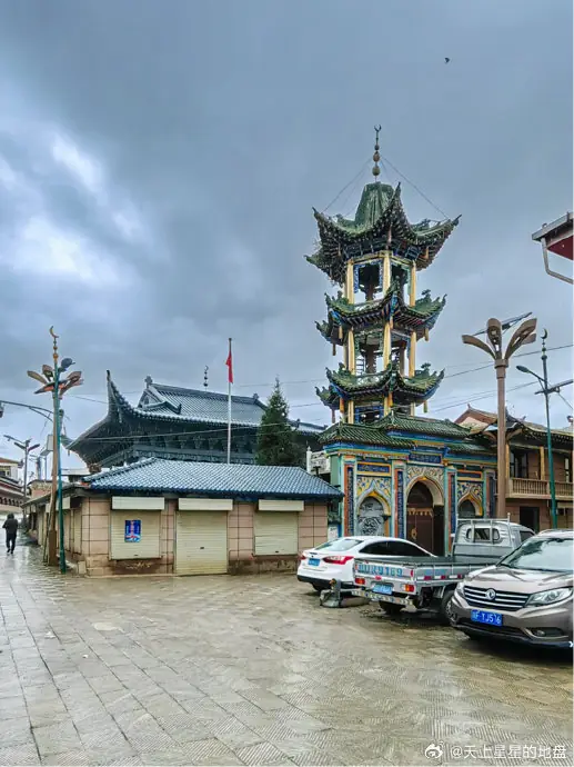 Langmusi Kirti Monastery Sichuan Side · 郎木寺四川侧格尔底寺
Langmusi Kirti Monastery Sichuan Side郎木寺四川侧格尔底寺
Langmu Si Sichuan Ce Ge Er Di Si is Gerdi Temple, a Gelug-school Tibetan Buddhist monastery in Hongxing township, Ruo'ergai County, Aba prefecture, Sichuan, on the south bank of the stream that divides the settlement of Langmusi from the Gansu monastery facing it.
Read the place guide →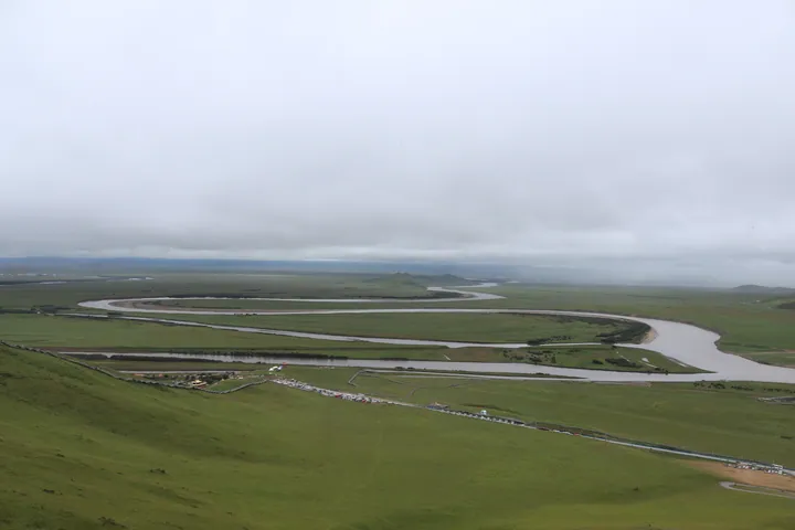 Aerial view of the Yellow River's First Bend near Ruo'ergai County, Aba Prefecture · 阿坝州若尔盖县黄河九曲第一湾俯瞰景观 Source-recorded photograph date: 2023-08-11 10:51:42.
First Bend of the Yellow River黄河九曲第一湾
Huang He Jiu Qu Di Yi Wan is the First Bend of the Yellow River, at Tangke town, Ruo'ergai County, Aba prefecture, Sichuan, where the river swings 180 degrees before turning back northwest across the grassland.
Read the place guide →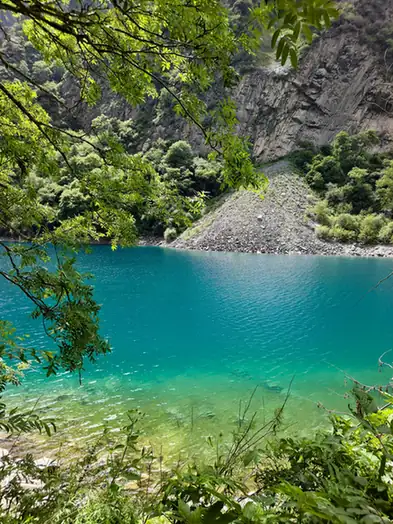 Diexi Songpinggou Valley · 叠溪松坪沟
Diexi Songpinggou Valley叠溪松坪沟
Diexi Songpinggou is a valley of barrier lakes on a Min River tributary in Diexi town, Maoxian County, Aba prefecture, Sichuan, formed when a magnitude-7.5 earthquake struck the area on 25 August 1933.
Read the place guide → The China Ancient Qiang City complex in Mao County · 茂县中国古羌城 Source-recorded photograph date: 2014-04-11 10:03:45.
China Ancient Qiang City中国古羌城
Zhongguo Gu Qiang Cheng, or China Ancient Qiang City, is a newly built Qiang-culture theme park in Pingtou village, Fengyi town, Maoxian County, Aba prefecture, Sichuan, built as a post-earthquake cultural reconstruction project rather than on a historic original site.
Read the place guide → Jinchuan Pear Blossom Valley · 金川梨花河谷
Jinchuan Pear Blossom Valley金川梨花河谷
Jinchuan Lihua Hegu is the pear-blossom valley of the Da Jinchuan river, known officially as the Shiwai Liyuan scenic area, between a spur of the Daxue mountains and the Qionglai range in Jinchuan County, Aba prefecture, Sichuan.
Read the place guide →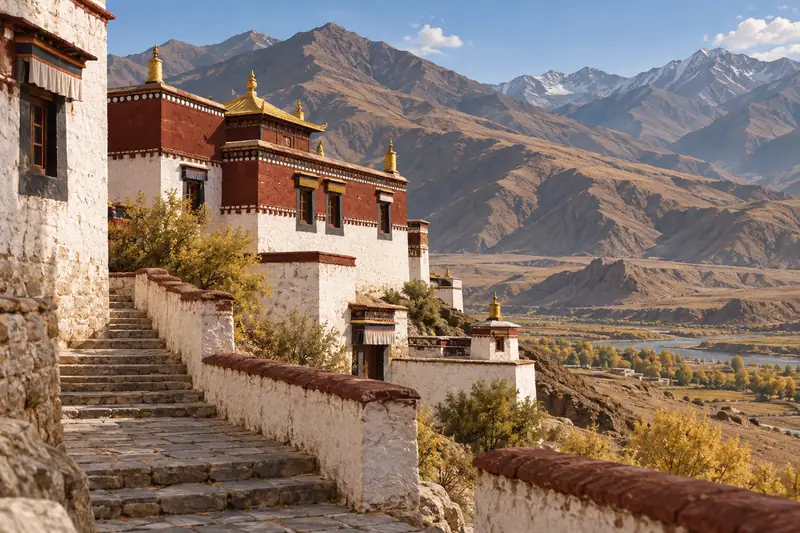 AI illustration · AI 示意图(仅供参考,非该地点实拍)
Guanyinqiao Scenic Area观音桥
Guanyinqiao is a mountain scenic area in Guanyinqiao town, Jinchuan County, in Sichuan's Aba Tibetan and Qiang Autonomous Prefecture, more than 80 km from the county seat, and it takes in the Tibetan Buddhist temple known in Tibetan as Tujiqinbo, the Guanyin temple.
Read the place guide →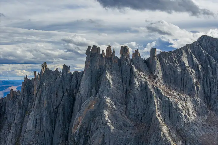 Lianbao Yeze Scenic Area · 莲宝叶则
Lianbao Yeze Scenic Area莲宝叶则
Granite range on the Sichuan–Qinghai border in Aba County, with glacier-cut peaks and more than 300 lakes; an AAAA scenic area and national geopark.
Read the place guide → The great stupa of Gerdeng Monastery (Kirti Gompa), Aba County · 阿坝格尔登寺大白塔 Source-recorded photograph date: 2003-02.
Kirti Monastery格尔登寺
Gelug monastery in Aba County, Sichuan, rebuilt in 1988, with a 49 m five-storey stupa and a 20 m clay Maitreya in its assembly hall.
Read the place guide → Exterior view of the Zhuokeji Chieftain's Official Mansion, a stone fortress in Malkang, Aba Prefecture · 阿坝州马尔康市卓克基土司官寨外观(石木结构官寨建筑) Source-recorded photograph date: 2014-09-01 11:39:17.
Zhuokeji Chieftain's Residence卓克基土司官寨
Stone-and-timber seat of the Jiarong Zhuokeji chieftains near Ma'erkang, rebuilt 1938-40, where Mao Zedong stayed on the Long March in 1935.
Read the place guide →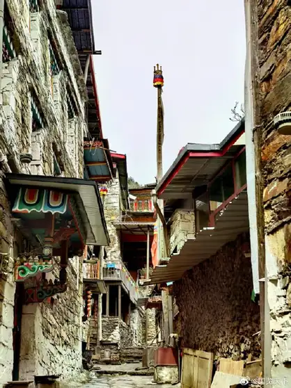 Xisuo Tibetan Village · 西索民居
Xisuo Tibetan Village西索民居
Xisuo Minju is a Jiarong Tibetan stone-built village in Xisuo village, Zhuokeji town, in Maerkang city, Aba Tibetan and Qiang Autonomous Prefecture, standing where National Highway 317 meets Provincial Highway 210 about 9 km from the Maerkang built-up area at an altitude of 2,680 metres.
Read the place guide →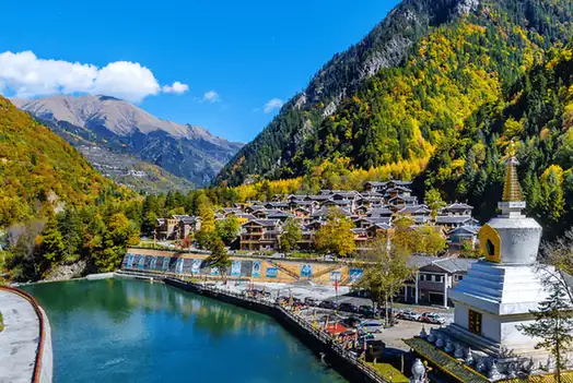 Naizigou Autumn Foliage · 奶子沟彩林
Naizigou Autumn Foliage奶子沟彩林
Naizigou is a valley in the north of Heishui County, in Sichuan's Aba Tibetan and Qiang Autonomous Prefecture, about 20 km from the county seat, whose mixed colour forest the county's own entry records as running for eighty li and names the 'eighty-li gallery'.
Read the place guide →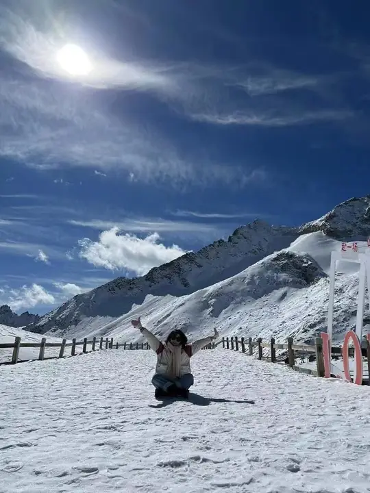 Snow-covered viewing area at Dagu Glacier · 达古冰川雪地观景区 Photograph date recorded by the source: 12 November 2021.
Dagu Glacier达古冰川
Dagu Glacier combines forested lakes and Tibetan cultural landscapes with a cable-car ascent to a much higher glacier-viewing area. Dagu Lake and Jinhou Lake offer a different experience from the exposed upper station, so the…
Read the place guide →Local life & food
Ngawa Tibetan and Qiang Autonomous Prefecture local specialties
阿坝藏族羌族自治州特色美食 · 10 specialties to discover
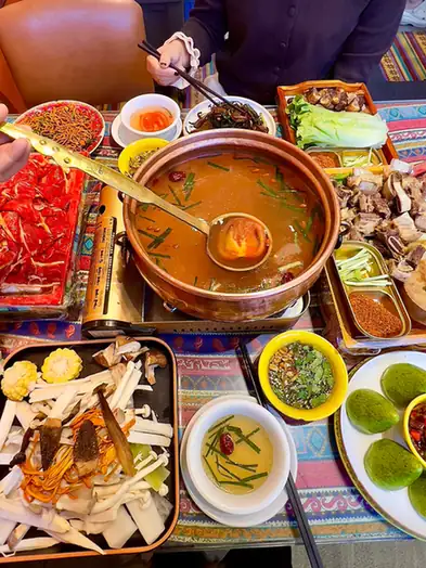 Tibetan-Style Yak Meat 藏式牦牛肉
Tibetan-Style Yak Meat (藏式牦牛肉) is listed among the local specialties of Ngawa Tibetan and Qiang Autonomous Prefecture, Sichuan. The name includes 牛肉 (beef).
Read the dish guide →Photo adjustments
EXIF orientation normalized; resized without changing aspect ratio; converted to WebP. No subject edits.
 Tibetan Butter Tea 酥油茶AI dish illustration · AI 菜品示意图
Tibetan Butter Tea (酥油茶) combines boiled brick tea with butter and salt. It is a traditional drink in Tibetan communities of Sichuan (四川), as well as Tibet (西藏) and Qinghai (青海).
Source ↗Read the dish guide → Highland Barley Cake 青稞饼AI dish illustration · AI 菜品示意图
Highland Barley Cake (青稞饼) is a baked highland-barley cake enjoyed by Tibetan people in Jiuzhaigou (九寨沟), in Sichuan’s Aba Prefecture (阿坝州). It is golden in colour, with a sweet aroma and a crisp texture.
Read the dish guide →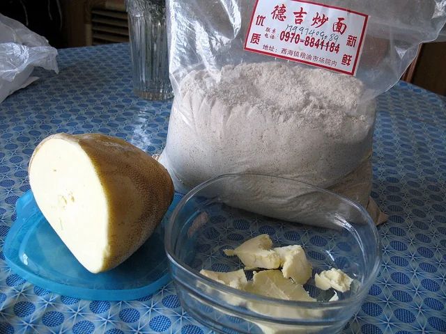 Tsampa Roasted Barley Flour 糌粑Dish photograph · see caption for context
Tsampa Roasted Barley Flour (糌粑) is an everyday Tibetan (藏族) staple in Ngawa (阿坝). In Zoige (若尔盖), barley is roasted and finely ground, then combined with tea and butter for drinking or shaped into small portions to eat.
Source ↗Read the dish guide →
Photo adjustments
EXIF orientation applied where present; resized proportionally to at most 640 px on the long edge and encoded as WebP. No crop, retouching, recoloring or subject changes.
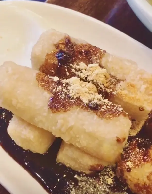 Qiang Pounded Potato Cakes 羌族洋芋糍粑
Qiang Pounded Potato Cakes (羌族洋芋糍粑) are made by hand-pounding high-starch potatoes from the Min River valley (岷江河谷).
Read the dish guide →
Photo adjustments
EXIF orientation normalized; resized without changing aspect ratio; converted to WebP. No subject edits.
 Jiuzhaigou Yak Meat Soup Hot Pot 九寨沟牦牛肉汤锅
Jiuzhaigou Yak Meat Soup Hot Pot (九寨沟牦牛肉汤锅) is listed among the local specialties of Ngawa Tibetan and Qiang Autonomous Prefecture, Sichuan. The name includes 牛肉 (beef). The term 汤 points to soup.
Read the dish guide →Photo adjustments
EXIF orientation normalized; resized without changing aspect ratio; converted to WebP. No subject edits.
 Wenchuan Cured Pork 汶川腊肉
Wenchuan Cured Pork (汶川腊肉) includes the smoke-cured pork made in Qunyi village (群益村), Xuankou town (漩口镇), Wenchuan (汶川). Winter is a busy production season there, with pork prepared for smoking and packaging.
Read the dish guide →
Photo adjustments
EXIF orientation normalized; resized without changing aspect ratio; converted to WebP. No subject edits.
 Songpan Yak Jerky 松潘牦牛肉干AI illustration · AI 示意图(仅供参考,非实拍)
Songpan Yak Jerky (松潘牦牛肉干) is a dried-meat speciality of Songpan (松潘), made from yaks raised on the county's natural pastures. It has a pronounced meat aroma and a firm, chewy texture.
Read the dish guide →All dish names · 全部菜名 (10)
- Tibetan-Style Yak Meat · 藏式牦牛肉
- Tibetan Butter Tea · 酥油茶
- Highland Barley Cake · 青稞饼
- Tsampa Roasted Barley Flour · 糌粑
- Qiang Pounded Potato Cakes · 羌族洋芋糍粑
- Jiuzhaigou Yak Meat Soup Hot Pot · 九寨沟牦牛肉汤锅
- Wenchuan Cured Pork · 汶川腊肉
- Songpan Yak Jerky · 松潘牦牛肉干
- Jinchuan Fire-Baked Bread · 金川烧馍馍
- Dough Pieces in Pickled Vegetable Broth · 酸菜面块
More dishes from across Sichuan are in the Sichuan food guide.
Counties & districts in Ngawa Tibetan and Qiang Autonomous Prefecture
13 areas belong directly to Ngawa Tibetan and Qiang Autonomous Prefecture.
13 areas
Ma'erkang 马尔康市
Barkam or Maerkang or Muerkvua is a county-level city in Ngawa Tibetan and Qiang Autonomous Prefecture, in the northwest part of Sichuan province, China. The city seat is the town of Barkam.
Explore the area →CountyWenchuan County 汶川县
Wenchuan County is a county in Ngawa Tibetan and Qiang Autonomous Prefecture, Sichuan, China. Wolong National Nature Reserve is a protected area located in Wenchuan County, which houses more than 150 highly…
Explore the area →CountyLixian 理县
Li County or Lixian, formerly known as Lifan (理番), is a county in Ngawa Tibetan and Qiang Autonomous Prefecture, Sichuan, China.
Explore the area →CountyMaoxian 茂县
Mao County or Maoxian is a county in Ngawa Prefecture, Sichuan Province, China.
Explore the area →Show fewer areas
Songpan County 松潘县
Songpan County, formerly Songzhou, is a county in northwestern Sichuan province, China, and is one of the 13 counties administered by the Ngawa Tibetan and Qiang Autonomous Prefecture.
Explore the area →CountyJiuzhaigou County 九寨沟县
Jiuzhaigou County is a county of Sichuan Province, China. It is under the administration of the Ngawa Tibetan and Qiang Autonomous Prefecture.
Explore the area →CountyJinchuan County 金川县
Jinchuan County or Quqên (Tibetan: ཆུ་ཆེན་རྫོང་།; Chinese: 金川县) is a county in the northwest of Sichuan Province, China. It is under the administration of the Ngawa Tibetan and Qiang Autonomous Prefecture.
Explore the area →CountyXiaojin County 小金县
Xiaojin County, also known as Tsanlha from its Tibetan name (Tibetan: བཙན་ལྷ་རྫོང་།), is a county in the northwest of Sichuan Province, China.
Explore the area →CountyHeishui County 黑水县
Heishui County is a county in the north of Sichuan Province, China. It is under the administration of the Ngawa Tibetan and Qiang Autonomous Prefecture.
Explore the area →CountyRangtang County 壤塘县
Zamthang County or Ndzamthang County (Tibetan: འཛམ་ཐང་རྫོང་།, Wylie: dzam thang rdzong, ZWPY: Camtang Zong), or Rangtang County is a county in the northwest of Sichuan Province, China, bordering on the Banma…
Explore the area →CountyAba County 阿坝县
Ngawa County (Tibetan: རྔ་བ་རྫོང་།, Wylie: rnga ba rdzong, ZWPY: Ngawa Zong, Chinese: 阿坝县; pinyin: Ābà Xiàn), or Aba or Ngaba, is a county in the northwest of Sichuan Province, China.
Explore the area →CountyRuo'ergai 若尔盖县
Zoigê County or Ruo'ergai County (Tibetan: མཛོད་དགེ་རྫོང་།, Wylie: mdzod dge rdzong, ZWPY: Zoigê Zong; Chinese: 若尔盖县; pinyin: Ruò'ěrgài Xiàn) is a county of Ngawa Tibetan and Qiang Autonomous Prefecture in…
Explore the area →CountyHongyuan County 红原县
Gakog (Hongyuan) County (Tibetan: སྐ་ཆུ་རྫོང་། or སྐ་ཁོག་རྫོང་།; Chinese: 红原县) is a county in the north of Sichuan Province, China.
Explore the area →No areas match this name.
Plan your visit
Getting there
Search for 阿坝藏族羌族自治州 in a map app to find stations and your accommodation.
Where to stay →Build your route
Wenchuan Special Tourism Area and Jiuzhaigou Valley are both listed here. The linked place guides have entrance and visit details.
Continue with Sichuan →More in Sichuan
Sources & geographic information
Administrative names and parent areas: Official geographic directory · Reference date 2026-09-06.
Background text adapted from Ngawa Tibetan and Qiang Autonomous Prefecture — Wikipedia contributors, under CC BY-SA 4.0. Text has been shortened and reorganized; source revision 1369267824.
Photo: Wenchuan Special Tourism Area · Source photographer · License not provided. EXIF orientation normalized; resized without changing aspect ratio; converted to WebP. No subject edits.
Photo: Jiuzhaigou Valley · Chensiyuan · CC BY-SA 4.0. Wikimedia thumbnail; fitted to the ranking-card frame.

Photo: Mount Siguniang · Johannes Böckh · CC BY-SA 3.0. Full frame retained; proportionally resized and converted to WebP. No retouching or changes to the photographed subject. Card displays may crop the view.

Photo: Mounigou Valley · EditQ · CC0. Full frame retained; proportionally resized and converted to WebP. No retouching or changes to the photographed subject. Card displays may crop the view.

Photo: Huanglong Scenic and Historic Interest Area · chensiyuan · chensiyuan — 1_huanglong_pools_aerial_2011.jpg — CC BY-SA 4.0 · CC BY-SA 4.0. The exact downloaded source bytes are separately retained and hashed. Prepared JPEG is proportionally reduced to a maximum 720-pixel long edge; full frame retained, no subject alteration. Final website rendition: full frame retained, proportionally resized to at most 720 pixels and converted to WebP. No additional retouching or subject alteration. Card displays may crop the view.

Photo: Songpan Ancient City · Bob Tan · Bob Tan — Aerial perspective of the Songpan Ancient City walls and fort. October 2023.jpg — CC BY 4.0 · CC BY 4.0. The exact downloaded source bytes are separately retained and hashed. Prepared JPEG is proportionally reduced to a maximum 720-pixel long edge; full frame retained, no subject alteration. Final website rendition: full frame retained, proportionally resized to at most 720 pixels and converted to WebP. No additional retouching or subject alteration. Card displays may crop the view.

Photo: Wolong Shenshuping Giant Panda Base · Source photographer · License not provided. EXIF orientation normalized; resized without changing aspect ratio; converted to WebP. No subject edits.
Photo: Yingxiu Earthquake Ruins and Memorial Hall · Source photographer · License not provided. EXIF orientation normalized; resized without changing aspect ratio; converted to WebP. No subject edits.
Photo: Shuimo Ancient Town · Tyg728 · CC BY-SA 4.0. Full frame retained; proportionally resized and converted to WebP. No retouching or changes to the photographed subject. Card displays may crop the view.

Photo: Taoping Qiang Village · Nekitarc · CC BY-SA 4.0. Full frame retained; proportionally resized and converted to WebP. No retouching or changes to the photographed subject. Card displays may crop the view.

Photo: Bipenggou · Culantor Lin · Culantor Lin — 畢棚溝_Bipenggou_Valley_1.jpg — CC BY-SA 2.0 · CC BY-SA 2.0. The exact downloaded source bytes are separately retained and hashed. Prepared JPEG is proportionally reduced to a maximum 720-pixel long edge; full frame retained, no subject alteration. Final website rendition: full frame retained, proportionally resized to at most 720 pixels and converted to WebP. No additional retouching or subject alteration. Card displays may crop the view.

Photo: Miyaluo Autumn Foliage · Source photographer · License not provided. EXIF orientation normalized; resized without changing aspect ratio; converted to WebP. No subject edits.
Photo: Hongyuan Moon Bay · Source photographer · License not provided. EXIF orientation normalized; resized without changing aspect ratio; converted to WebP. No subject edits.
Photo: Ruo'ergai Flower Lake · landagent · CC BY-SA 3.0. Full frame retained; proportionally resized and converted to WebP. No retouching or changes to the photographed subject. Card displays may crop the view.
.jpg)
Photo: Langmusi Kirti Monastery Sichuan Side · Source photographer · License not provided. EXIF orientation normalized; resized without changing aspect ratio; converted to WebP. No subject edits.
Photo: First Bend of the Yellow River · Liuxingy · CC BY-SA 4.0. Full frame retained; proportionally resized and converted to WebP. No retouching or changes to the photographed subject. Card displays may crop the view.

Photo: Diexi Songpinggou Valley · Source photographer · License not provided. EXIF orientation normalized; resized without changing aspect ratio; converted to WebP. No subject edits.
Photo: China Ancient Qiang City · Popolon · CC BY-SA 4.0. Full frame retained; proportionally resized and converted to WebP. No retouching or changes to the photographed subject. Card displays may crop the view.

Photo: Jinchuan Pear Blossom Valley · Source photographer · License not provided. EXIF orientation normalized; resized without changing aspect ratio; converted to WebP. No subject edits.
Photo: Lianbao Yeze Scenic Area · Source photographer · License not provided. EXIF orientation normalized; resized without changing aspect ratio; converted to WebP. No subject edits.
Photo: Kirti Monastery · Jialiang Gao (peace-on-earth.org) · CC BY-SA 3.0. Full frame retained; proportionally resized and converted to WebP. No retouching or changes to the photographed subject. Card displays may crop the view.

Photo: Zhuokeji Chieftain's Residence · 猫猫的日记本 · CC BY-SA 4.0. Full frame retained; proportionally resized and converted to WebP. No retouching or changes to the photographed subject. Card displays may crop the view.

Photo: Xisuo Tibetan Village · Source photographer · License not provided. EXIF orientation normalized; resized without changing aspect ratio; converted to WebP. No subject edits.
Photo: Naizigou Autumn Foliage · Source photographer · License not provided. EXIF orientation normalized; resized without changing aspect ratio; converted to WebP. No subject edits.
Photo: Dagu Glacier · 中文維基百科20021024 · 中文維基百科20021024 — 达古冰川.jpg — CC BY-SA 4.0 · CC BY-SA 4.0. The exact downloaded source bytes are separately retained and hashed. Prepared JPEG is proportionally reduced to a maximum 720-pixel long edge; full frame retained, no subject alteration. Final website rendition: full frame retained, proportionally resized to at most 720 pixels and converted to WebP. No additional retouching or subject alteration. Card displays may crop the view.

Map data © OpenStreetMap contributors. Pins mark approximate centres, not entrances or boundaries.