


Get to know Ruo'ergai
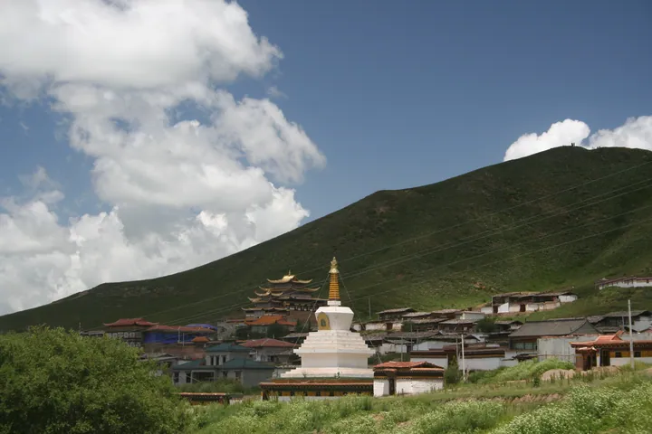
Photo adjustments
Full frame retained; proportionally resized and converted to WebP. No retouching or changes to the photographed subject. Card displays may crop the view.
- Administrative area
- County · 县
- Part of
- Ngawa Tibetan and Qiang Autonomous Prefecture
- Chinese name
- 若尔盖县
- Local areas
- County guide
Area & population
- Area in the source
- 10,620.00 km²
- Population · 2020
- 76,712
- Administrative seat
- Dagcagoin
Source: cited geographic source, as of the dates shown.
Setting and landscape
To the west, north and east the county borders Maqu (玛曲), Luqu (碌曲), Zhuoni (卓尼) and Diebu (迭部) in Gansu's Gannan Tibetan Autonomous Prefecture (甘南藏族自治州); to the south lie Jiuzhaigou (九寨沟), Songpan (松潘), Hongyuan (红原) and Aba (阿坝) counties. The mean annual temperature is 1.1°C, with a recorded low of −33.7°C.
The Ruo'ergai plateau wetland (若尔盖高原湿地), which the county government says is nurtured by both the Yangtze and the Yellow River, is described by the county government as the largest and most pristine high-altitude cold wetland in the world, holding about 10 billion cubic metres of water. The county lists more than 1,160 wild plant species and 328 recorded bird species, with ruddy shelducks and black-necked cranes along the lake shores. The Reer grassland (热尔大坝草原) is called the country's second-largest grassland after Hulunbuir (呼伦贝尔), and Flower Lake (花湖) lies within it.
What to see
At Tangke town (唐克镇), in front of Suoge Monastery (索格藏寺), the White River (白河) joins the Yellow River and the Yellow River swings back in an S-shaped loop, the First Bend of the Yellow River (黄河九曲第一湾). The county government describes it as a turn of nearly 180 degrees, the only one along the river's course. The White River rises at Gawa Daze (嘎哇达则) in Hongyuan County, and red willows line its banks.
Local lore attached to the bend tells of the Yellow River as a daughter of the snow mountain Amne Machin (阿尼玛卿) who turns back towards Xuebaoding (雪宝顶) peak in the Min Mountains before heading north-west again.
History
Ruo'ergai was set up as a county in 1953. On the Long March, the three main forces of the Red Army all passed through the county, and the county government calls it the place where the Red Army stayed longest on the north-west Sichuan plateau. It keeps 28 revolutionary sites, including the battlefield of the Baozuo campaign (包座战役) and the site of the Baxi Meeting (巴西会议会址), and more than 380 revolutionary relics. The Banyou grassland (班佑草地) and the Baxi farming area (巴西农区) are named as places Mao Zedong and Zhou Enlai crossed.
Highlights
- First Bend of the Yellow River 黄河九曲第一湾: S-shaped bend at Tangke where the White River joins the Yellow River in front of Suoge Monastery.
- Flower Lake 若尔盖花湖: Lake on the Reer grassland, lined with flowers in summer according to the county government.
- Reer grassland 热尔大坝草原: Called by the county the country's second-largest grassland after Hulunbuir.
- Baxi Meeting site 巴西会议会址: One of 28 Long March revolutionary sites kept in the county.
Sources for this guide
若尔盖县情概况_若尔盖县人民政府 · Ruo'ergai County People's Government
九曲黄河第一湾_若尔盖县人民政府 · Ruo'ergai County People's Government
Original English written from the listed sources and checked sentence by sentence against quoted extracts by a separate reviewer. Updated 2026-09-25.
Explore Ruo'ergai
Core places to explore, with English and Chinese names.
Places to explore around Ruo'ergai
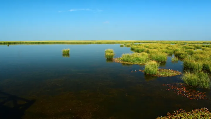 Wetland grasses and still water at Ruoergai Flower Lake (Cuorewajian Lake), Ruoergai County, Aba Prefecture · 四川省阿坝藏族羌族自治州若尔盖县若尔盖花湖(错热洼坚)湿地风光 Source-recorded photograph date: Taken on 13 August 2011.
Ruo'ergai Flower Lake若尔盖花湖
Ruo'ergai Huahu is a lake on the Re'er Dam within the Ruo'ergai Wetland National Nature Reserve, beside National Highway 213 between Ruo'ergai and Langmusi in Gansu, Aba prefecture, Sichuan, restored since 2010 as a water-conservation area for the upper Yellow River.
Read the place guide →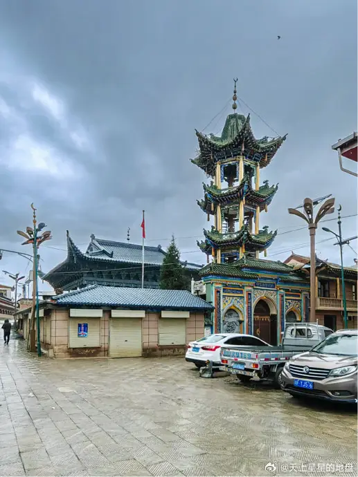 Langmusi Kirti Monastery Sichuan Side · 郎木寺四川侧格尔底寺
Langmusi Kirti Monastery Sichuan Side郎木寺四川侧格尔底寺
Langmu Si Sichuan Ce Ge Er Di Si is Gerdi Temple, a Gelug-school Tibetan Buddhist monastery in Hongxing township, Ruo'ergai County, Aba prefecture, Sichuan, on the south bank of the stream that divides the settlement of Langmusi from the Gansu monastery facing it.
Read the place guide →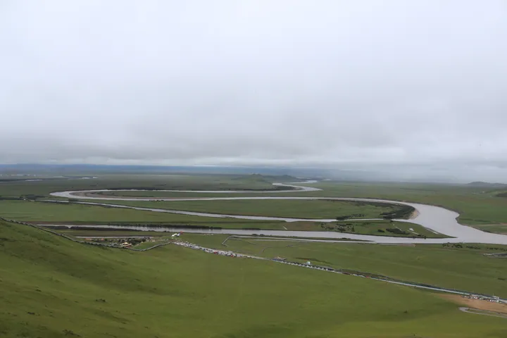 Aerial view of the Yellow River's First Bend near Ruo'ergai County, Aba Prefecture · 阿坝州若尔盖县黄河九曲第一湾俯瞰景观 Source-recorded photograph date: 2023-08-11 10:51:42.
First Bend of the Yellow River黄河九曲第一湾
Huang He Jiu Qu Di Yi Wan is the First Bend of the Yellow River, at Tangke town, Ruo'ergai County, Aba prefecture, Sichuan, where the river swings 180 degrees before turning back northwest across the grassland.
Read the place guide →Plan your visit
Getting there
Ruo'ergai is about 200 km in a straight line from central Ngawa Tibetan and Qiang Autonomous Prefecture. Search for 若尔盖县 in a map app to find stations and your accommodation.
Where to stay →Build your route
Ruo'ergai Flower Lake and Langmusi Kirti Monastery Sichuan Side are both listed here. The linked place guides have entrance and visit details.
Continue with Ngawa Tibetan and Qiang Autonomous Prefecture →More in Ngawa Tibetan and Qiang Autonomous Prefecture
Sources & geographic information
Administrative names and parent areas: Official geographic directory · Reference date 2026-09-06.
Photo: Ruo'ergai Flower Lake · landagent · CC BY-SA 3.0. Full frame retained; proportionally resized and converted to WebP. No retouching or changes to the photographed subject. Card displays may crop the view.
.jpg)
Photo: Langmusi Kirti Monastery Sichuan Side · Source photographer · License not provided. EXIF orientation normalized; resized without changing aspect ratio; converted to WebP. No subject edits.
Photo: First Bend of the Yellow River · Liuxingy · CC BY-SA 4.0. Full frame retained; proportionally resized and converted to WebP. No retouching or changes to the photographed subject. Card displays may crop the view.

Map data © OpenStreetMap contributors. Pins mark approximate centres, not entrances or boundaries.