


Get to know Huaishang District
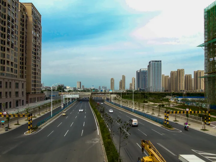
Photo adjustments
Full frame retained; proportionally resized and converted to WebP. No retouching or changes to the photographed subject. Card displays may crop the view.
- Administrative area
- District · 市辖区
- Part of
- Bengbu
- Chinese name
- 淮上区
- Local areas
- District guide
Area & population
- Area in the source
- 412.00 km²
- Population · 2020
- 283,872
- Administrative seat
- Xiaobengbu
Source: cited geographic source, as of the dates shown.
Setting and landscape
The Huai River forms the southern boundary, with Longzihu (龙子湖区), Bengshan (蚌山区) and Yuhui (禹会区) districts on the opposite bank. Wuhe County (五河县) lies to the east, Guzhen County (固镇县) to the north and Huaiyuan County (怀远县) to the west. The district measures about 38 km from east to west and 16 km from north to south, and the government calls it an important water-conservation area for Bengbu.
History
Huaishang District was set up in March 2004, with State Council approval, when Bengbu expanded across the river. In May 2014 Mohekou town (沫河口镇) was transferred to it from Wuhe County.
What to see
The Shuangdun site (双墩遗址) in Shuangdun village, Xiaobengbu town (小蚌埠镇), is a Neolithic terrace settlement about 7,300 years old, with the Huai about 4 km to the south and the Beifei River (北淝河) about 2.5 km to the north. Found in 1985 and excavated in 1986, 1991 and 1992, it yielded 607 carved symbols on pottery and other objects, and gave its name to the Shuangdun culture (双墩文化) in 2005. It became a national key protected site in 2013. Finds include a pottery human head with a tattooed-face pattern. The district government regards the symbols as one of the sources of Chinese writing, and a Shuangdun national archaeological site park received its plaque in 2025.
The tomb of Bai (柏), a ruler of the Zhongli state (钟离国) of the Spring and Autumn period, was named one of China's top ten archaeological discoveries of 2008 for its chime bells, ding cauldrons, weapons, chariot fittings and unusual burial practice. The district also lists a site where Cao Cao (曹操) is said to have camped his troops.
The Sanchahe National Wetland Park (三汊河国家湿地公园), approved in 2016 and rated a national 3A scenic area, lies where Caolaoji (曹老集) and Meiqiao (梅桥) towns meet, about 5 km from central Bengbu. It occupies an old course of the Fei River (淝河), runs about 7 km from north to south, covers some 800 hectares, and its reeds stretch for several kilometres. Lotus, gorgon nut (芡实) and water bamboo (茭白) grow in the wetland, and it has wood-style boardwalks and two bird-watching platforms.
Getting oriented
The Beijing–Taipei (京台) and Nanjing–Luoyang (宁洛) expressways meet in the district, which has five expressway interchanges including Bengbu North (蚌埠北).
Highlights
- Shuangdun site 双墩遗址: Neolithic site about 7,300 years old with 607 carved symbols; national key protected site since 2013.
- Shuangdun Spring and Autumn tomb 双墩春秋墓: Tomb of Bai, ruler of the Zhongli state, among the top ten archaeological discoveries of 2008.
- Sanchahe National Wetland Park 三汊河国家湿地公园: Reed-bed wetland on an old course of the Fei River, approved in 2016 and rated 3A.
Sources for this guide
淮上简介_蚌埠市淮上区人民政府 · Huaishang District People's Government, Bengbu
自然地理_蚌埠市淮上区人民政府 · Huaishang District People's Government, Bengbu
安徽三汊河国家湿地公园_蚌埠市人民政府 · Bengbu Municipal People's Government
双墩遗址 - 维基百科,自由的百科全书 · Wikipedia (Chinese) · CC BY-SA 4.0
安徽蚌埠双墩遗址被央视推介 · Ministry of Culture and Tourism (from Anhui Provincial Department of Culture and Tourism)
Original English written from the listed sources and checked sentence by sentence against quoted extracts by a separate reviewer. Updated 2026-09-23.
Explore Huaishang District
Core places to explore, with English and Chinese names.
Huaishang District 淮上区
Plan your visit
Getting there
Huaishang District is about 6 km in a straight line from central Bengbu. Search for 淮上区 in a map app to find stations and your accommodation.
Where to stay →More in Bengbu
Sources & geographic information
Administrative names and parent areas: Official geographic directory · Reference date 2026-09-06.
Some facts checked against 双墩遗址 — Wikipedia contributors, CC BY-SA 4.0.
Map data © OpenStreetMap contributors. Pins mark approximate centres, not entrances or boundaries.