


Get to know Yuhui District
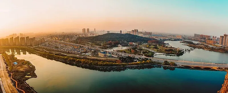
Photo adjustments
Full frame retained; proportionally resized and converted to WebP. No retouching or changes to the photographed subject. Card displays may crop the view.
- Administrative area
- District · 市辖区
- Part of
- Bengbu
- Chinese name
- 禹会区
- Local areas
- District guide
Area & population
- Area in the source
- 331.00 km²
- Population · 2020
- 325,814
Source: cited geographic source, as of the dates shown.
History
The district took its present name in January 2004, when Bengbu's former Xishi District (西市区) was renamed.
The Yuhui village site (禹会村遗址), on the bank of the Huai, holds a walled town of the early and middle Longshan culture, dated to 4,400 to 4,100 years ago. The Anhui team of the Chinese Academy of Social Sciences Institute of Archaeology reports that it found a large ritual platform there in 2007 and traced a closed circuit of walls in 2017. The western and southern walls have been eaten away by the Huai, while 300 metres of the northern wall and 600 metres of the eastern wall remain. The town is put at no less than 180,000 square metres, and describe it as the largest and highest-ranking Longshan walled town found in the middle Huai valley. The site was placed on the list for a national archaeological site park in November 2017, and work on the park began in May 2020.
What to see
Zhanggongshan Park (张公山公园) is a 110-hectare national 4A scenic area made up of Zhanggong Hill, Zhanggong Lake on its eastern side and Zhanggong Island in the lake. Tradition names the hill after a Ming general surnamed Zhang who fought for Zhu Yuanzhang (朱元璋) and retired here. The Wanghuai Pagoda (望淮塔) on the summit, 35.33 metres high with seven octagonal storeys, looks out over the Huai. At the south gate, the Pearl Maiden sculpture (珍珠玉女), finished at the end of 2012, combines a giant open mussel shell, about 20 metres high, with a maiden holding a pearl. Two boardwalks opened in 2013 link the island, whose features take clean government as their theme, to the rest of the park.
The district also lists the Huai River sluice water-conservancy scenic area (淮河闸水利风景区), Tianhe (天河), Mount Tu (涂山) and Heihu Hill (黑虎山) among its landscapes, and Yuxu (禹墟), the Temple of King Yu (禹王宫) and Diaoyutai (钓鱼台) among its historic sites.
Fengzui village (冯嘴村) is known as "China's first flower-drum lantern village". The district describes it as a source of flower-drum lantern (花鼓灯), a folk dance on the first national intangible cultural heritage list, and as one of the first national folk-culture protection projects.
Getting oriented
Bengbu port, a national class-II water port, lies to the north, the Tushan exit of the G3 Beijing–Taipei expressway to the west, and the Beijing–Shanghai and Beijing–Fuzhou railways to the east.
Highlights
- Yuhui village site 禹会村遗址: Longshan walled town of 4,400 to 4,100 years ago, at least 180,000 square metres.
- Zhanggongshan Park 张公山公园: 110-hectare 4A park with the Wanghuai Pagoda and the Pearl Maiden sculpture.
- Fengzui village 冯嘴村: Called China's first flower-drum lantern village.
Sources for this guide
禹会简介_蚌埠市禹会区人民政府 · Yuhui District People's Government, Bengbu
区情简介_蚌埠市禹会区人民政府 · Yuhui District People's Government, Bengbu
禹会村遗址:淮河中游规模最大级别最高龙山文化城址-中新网 · China News Service
张公山公园 - 维基百科,自由的百科全书 · Wikipedia (Chinese) · CC BY-SA 4.0
禹会区 - 维基百科,自由的百科全书 · Wikipedia (Chinese) · CC BY-SA 4.0
Original English written from the listed sources and checked sentence by sentence against quoted extracts by a separate reviewer. Updated 2026-09-23.
Explore Yuhui District
Core places to explore, with English and Chinese names.
Places to explore around Yuhui District
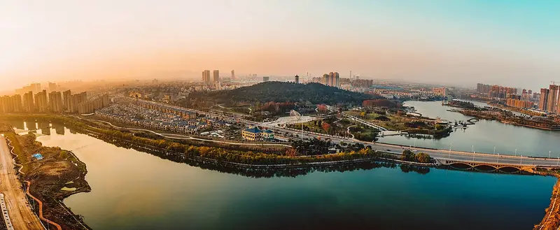 Zhanggong Mountain Park (
Plan your visit
Getting there
Yuhui District is about 5 km in a straight line from central Bengbu. Search for 禹会区 in a map app to find stations and your accommodation.
Where to stay →Build your route
Start with Zhanggong Mountain Park. The linked place guides have entrance and visit details.
Continue with Bengbu →More in Bengbu
Sources & geographic information
Administrative names and parent areas: Official geographic directory · Reference date 2026-09-06.
Some facts checked against 张公山公园 — Wikipedia contributors, CC BY-SA 4.0.
Some facts checked against 禹会区 — Wikipedia contributors, CC BY-SA 4.0.
Photo: Zhanggong Mountain Park · DKMcLaren · CC BY-SA 4.0. Full frame retained; EXIF orientation normalized, proportionally resized to at most 800 pixels and converted to WebP. No generated pixels or subject changes. Cards may crop the display.

Map data © OpenStreetMap contributors. Pins mark approximate centres, not entrances or boundaries.