


Get to know Longzihu District
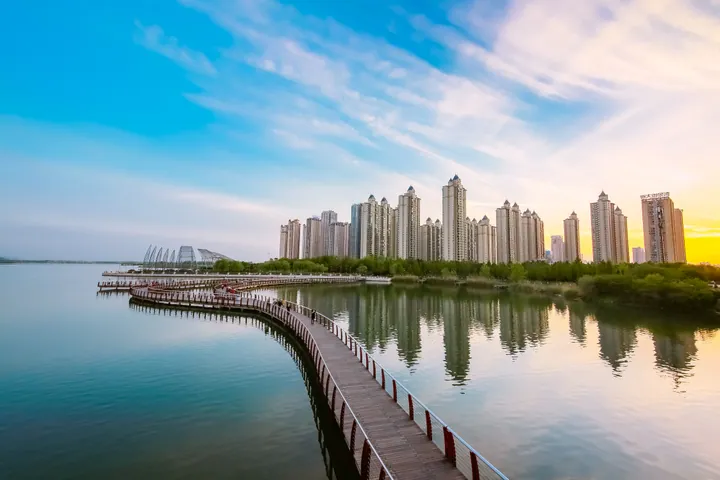
Photo adjustments
Full frame retained; proportionally resized and converted to WebP. No retouching or changes to the photographed subject. Card displays may crop the view.
- Administrative area
- District · 市辖区
- Part of
- Bengbu
- Chinese name
- 龙子湖区
- Local areas
- District guide
Area & population
- Area in the source
- 108.00 km²
- Population · 2020
- 216,875
Source: cited geographic source, as of the dates shown.
History
The district was called Dongshi District (东市区, "east city district") until 10 January 2004, when the State Council approved its renaming as Longzihu.
The district government links Bengbu's nickname "Pearl City" (珠城) to the lake shore, an old place for gathering pearls from freshwater mussels. Xu Bridge (徐桥), at the upper end of the lake, was known in the early Ming dynasty as Pearl Bridge (珍珠桥) because mussels were collected there, and a Fengyang county gazetteer of the Guangxu (光绪) reign records that locals often found pearls in mussels along the stretch from Changhuaiwei (长淮卫) to Bengbu. The bridge later took the name Xu after a widow of the Xu family paid for its repair. In the late 1970s a road bridge was built across the lake on the line of Shengli Road (胜利路) and given the old name Pearl Bridge.
Setting and landscape
Longzi Lake sits between Mount Cao (曹山) to the east, Mount Xuehua (雪华山) to the west and Mount Lu (芦山) to the south, and is used for irrigation, flood storage and fish farming. It is a provincial-level scenic area with a planned area of 51.4 square kilometres. Where the lake flows into the Huai, the play of currents gave rise to the view called "Bengbu Flowing Pearls" (蚌埠流珠), counted as the fifth of the Eight Views of Fengyang (凤阳八景).
What to see
A fish farm on the lake dates from 1958, raising carp species, shrimp and mitten crab. Wild pearl mussels disappeared from the lake, but from 1972 the farm began culturing pearls in triangle-sail mussels and cockscomb pearl mussels, and the district describes white pearl-culture floats on the water below Pearl Bridge, which it says is still a pearl-gathering place. From the Yuqu Garden (渔趣苑) at the foot of Mount Cao a zigzag bridge leads out over the farm, and the Pearl Tower (珍珠楼) looks over the lake towards the city.
Getting oriented
Bengbu Railway Station, Bengbu South high-speed station, the long-distance bus station and the eastern exit of the Bengbu–Wuhe expressway (蚌五高速) are all in the district. Anhui University of Finance and Economics (安徽财经大学) is also located here.
Highlights
- Longzi Lake 龙子湖: Provincial scenic area between Mount Cao, Mount Xuehua and Mount Lu, with pearl culture since 1972.
- Pearl Bridge 珍珠桥: Late-1970s road bridge across the lake that revived the Ming-era name of the pearl-gathering bridge.
- Pearl Tower 珍珠楼: Viewpoint over the lake and the pearl-culture floats.
Sources for this guide
龙子湖区概况_蚌埠市人民政府 · Bengbu Municipal People's Government
龙子湖十景之——龙湖采珠_蚌埠市龙子湖区人民政府 · Longzihu District People's Government, Bengbu
龙子湖区 - 维基百科,自由的百科全书 · Wikipedia (Chinese) · CC BY-SA 4.0
Original English written from the listed sources and checked sentence by sentence against quoted extracts by a separate reviewer. Updated 2026-09-23.
Explore Longzihu District
Core places to explore, with English and Chinese names.
Places to explore around Longzihu District
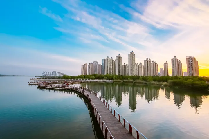 A curved wooden boardwalk over calm water at dusk, leading toward a row of high-rise towers behind a tree-lined shore; the water mirrors a blue and gold sunset sky.
Plan your visit
Getting there
Longzihu District covers the centre of Bengbu. Search for 龙子湖区 in a map app to find stations and your accommodation.
Where to stay →Build your route
Start with Longzi Lake. The linked place guides have entrance and visit details.
Continue with Bengbu →More in Bengbu
Sources & geographic information
Administrative names and parent areas: Official geographic directory · Reference date 2026-09-06.
Some facts checked against 龙子湖区 — Wikipedia contributors, CC BY-SA 4.0.
Photo: Longzi Lake · DKMcLaren · CC BY-SA 4.0. Full frame retained; proportionally resized and converted to WebP. No retouching or changes to the photographed subject. Card displays may crop the view.

Map data © OpenStreetMap contributors. Pins mark approximate centres, not entrances or boundaries.