


Get to know Xuancheng
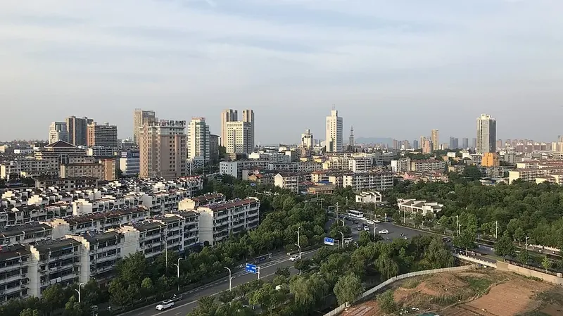
Photo adjustments
Full frame retained; proportionally resized and converted to WebP. No retouching or changes to the photographed subject. Card displays may crop the view.
- Administrative area
- Prefecture-level city · 地级市
- Part of
- Anhui
- Chinese name
- 宣城市
- Local areas
- 7 local areas
Area & population
- Area in the source
- 12,313.00 km²
- Population · 2020 census
- 2,500,063
- Administrative seat
- Xuanzhou District
Source: cited geographic source, as of the dates shown.
Setting and landscape
The land rises from plains in the north through hilly uplands to low mountains in the south, where the Huangshan range reaches in from the south-west and the Tianmu range from western Zhejiang. Qingliang Peak (清凉峰) rises to 1,787.2 m. The Qingyi (青弋江) and Shuiyang (水阳江) rivers flow north to the Yangtze, and Nanyi Lake (南漪湖), which the city calls southern Anhui's largest natural freshwater lake, drains into the Shuiyang. Jixi County (绩溪县) forms the divide between the Yangtze and Qiantang basins.
History
In 109 BC the Western Han made Wanling (宛陵), today's Xuanzhou District (宣州区), the seat of Danyang Commandery; the Jin created Xuancheng Commandery in 281, and in 1166 the Southern Song renamed Xuanzhou as Ningguo Prefecture (宁国府). The city government ranks Tang-dynasty Xuanzhou with Suzhou and Hangzhou among the three leading cities of Jiangnan, and says Li Bai came here seven times and left more than 80 poems; it calls Jingting Mountain (敬亭山) Jiangnan's foremost 'poetry mountain'. From 1938 to 1941 the New Fourth Army had its headquarters at Yunling (云岭) in Jing County (泾县).
What to see
The Yunling headquarters site, in the first batch of national key protected sites and a AAAA scenic area, keeps 12 sites, including the army command and the Communist Party's Southeast Bureau, in Hui-style buildings of the Ming, Qing and early Republic. Longchuan (龙川), a AAAAA scenic area 11 km east of the Jixi county town, is a national historic village of old houses along a water street; its Hu Family Ancestral Hall (胡氏宗祠), famed for woodcarving, and the Ming stone Yishi Shangshu Archway (奕世尚书坊) are national key protected sites. Taiji Cave (太极洞) in Guangde (广德) is a national key scenic area.
Food and local products
Xuan paper is made in Jing County from qingtan (青檀) bark mixed with rice-straw pulp in more than 140 steps; the craft entered the first national intangible heritage list in 2006 and is on UNESCO's intangible heritage list. Jixi's Hu family one-pot (胡氏一品锅), which Hu Shih (胡适) served to guests, is built in layers, usually four and up to six or seven with chicken and fish, with stock added again and again as it braises. Local products include Ningguo (宁国) hickory nuts, Shuidong (水东) candied dates and Jingting Lüxue (敬亭绿雪) green tea.
Getting oriented
The government sits in Xuanzhou District. The Hefei–Fuzhou, Shangqiu–Hefei–Hangzhou, Hangzhou–Huangshan and Xuancheng–Jixi high-speed railways serve the city, and Wuhu Xuanzhou Airport is about 21 km away.
Highlights
- Longchuan 龙川: National historic village 11 km east of the Jixi county town, with the Hu Family Ancestral Hall.
- New Fourth Army Headquarters Site, Yunling 云岭新四军军部旧址: Headquarters of 1938–1941 in Jing County, preserved in Hui-style buildings; a first-batch national key protected site.
- Jingting Mountain 敬亭山: The city government calls it Jiangnan's foremost 'poetry mountain'.
- Xuan paper 宣纸: Hand-made paper of qingtan bark and rice straw from Jing County; on UNESCO's intangible heritage list.
- Jixi Hu family one-pot 绩溪一品锅: Layered braise of vegetables and meats that Hu Shih served to guests.
Sources for this guide
宣城概况-宣城市人民政府 · Xuancheng Municipal People's Government
中国龙川(AAAAA)-宣城市人民政府 · Jixi County People's Government, on the Xuancheng city government portal
新四军军部旧址纪念馆-宣城市人民政府 · Jing County Culture and Tourism Bureau (泾县文旅局), on the Xuancheng city government portal
胡氏一品锅-宣城市人民政府 · Xuancheng Municipal Culture and Tourism Bureau, on the Xuancheng city government portal
宣纸制作技艺 - 中国非物质文化遗产网·中国非物质文化遗产数字博物馆 · China Intangible Cultural Heritage Network (ihchina.cn)
宣城市 - 维基百科,自由的百科全书 · Chinese Wikipedia · CC BY-SA 4.0
Original English written from the listed sources and checked sentence by sentence against quoted extracts by a separate reviewer. Updated 2026-09-30.
Explore Xuancheng
Core places to explore, with English and Chinese names.
Jingting Mountain 敬亭山
Taohuatan 桃花潭
Jixi Longchuan Scenic Area 绩溪龙川景区
Chujiatan River Bend 储家滩
Xialin Jiutian Silver Waterfall 夏霖九天银瀑
Taiji Cave 太极洞
Jiangcun Village 江村
China Xuan Paper Culture Park 中国宣纸文化园
Zhaji Old Village 查济古村
Yunling New Fourth Army Headquarters Site 云岭新四军军部旧址
Huihang Ancient Trail 徽杭古道
Longchuan Village 龙川
Shangzhuang Village 上庄村
Zhangshan Grand Canyon 鄣山大峡谷
Xuanzhou District 宣州区
Langxi County 郎溪县
Jing County 泾县
Jixi County 绩溪县
Jingde County 旌德县
Ningguo 宁国市
Guangde 广德市
Places to explore around Xuancheng
 Bamboo-lined path on Jingting Mountain · 敬亭山 Photograph date recorded by the source: 2025-10-04.
Jingting Mountain敬亭山
Jingting Mountain rises beside the Shuiyang River in northern Xuancheng. Poetry is central to its identity: Xie Tiao and Li Bai are among the writers strongly associated with the mountain.
Read the place guide →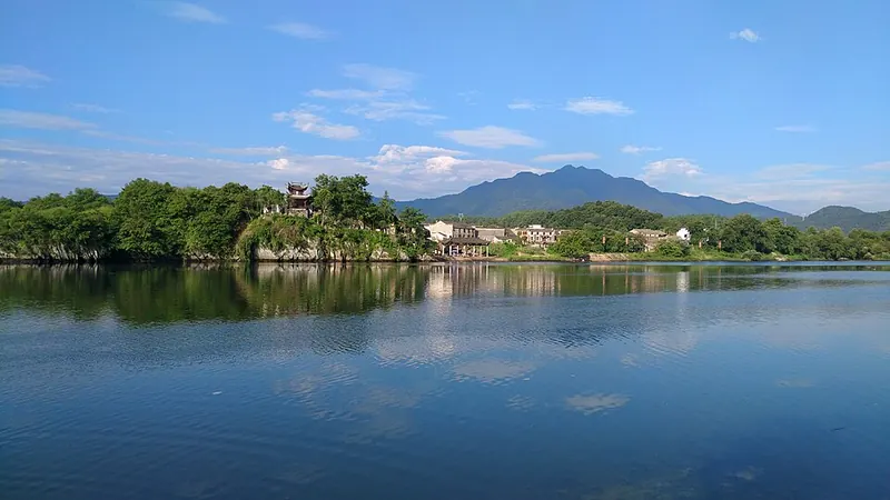 Taohuatan waters and surrounding hills · 桃花潭 Photograph date recorded by the source: 2017-08-19 07:36:27.
Taohuatan桃花潭
Taohuatan is a stretch of river remembered through Li Bai’s farewell poem to Wang Lun. Tage An Pavilion stands over the old Dongyuan ferry landing, so its lower passage physically links the street and the water. From the east…
Read the place guide →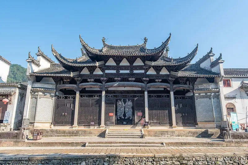 Jixi Longchuan Scenic Area (绩溪龙川景区), Jixi County. Photograph: "Longchuan Village, 2021-09-27 06".
Jixi Longchuan Scenic Area绩溪龙川景区
Longchuan is a historic village destination in Jixi, with ancestral architecture, memorial stonework and a water-side street.
Read the place guide →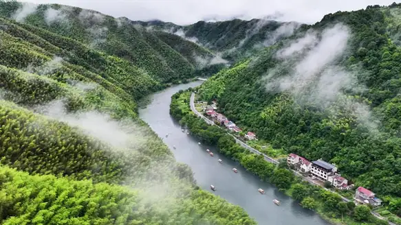 Chujiatan River Bend · 储家滩
Chujiatan River Bend储家滩
Chujiatan in Ningguo's Qinglong Township is a long, quiet river bend in Longge Village, known for mountain reflections.
Read the place guide → AI illustration · AI 示意图(仅供参考,非该地点实拍)
Xialin Jiutian Silver Waterfall夏霖九天银瀑
Xialin Jiutian Yinpu in Ningguo's Zhongxi Town is a landscape of wooded valleys, pools and waterfalls around Xialin Village.
Read the place guide →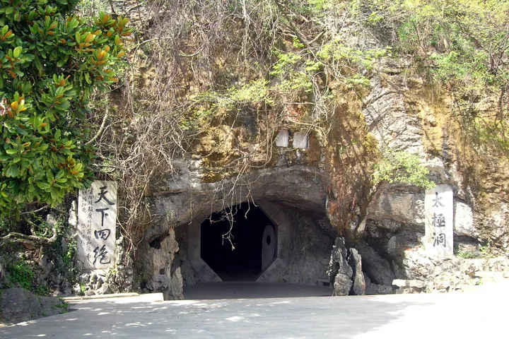 The rock-cut entrance to Taiji Cave, inscribed with the cave's name, in Guangde City, Xuancheng. · 宣城市广德市太极洞洞口,崖壁刻有洞名。 Source-recorded photograph date: Taken on 29 March 2007.
Taiji Cave太极洞
Large karst cave system in Guangde, where Anhui meets Jiangsu and Zhejiang, with a boatable underground river and Ming-era inscriptions.
Read the place guide → A large three-bay white stone memorial archway with dense relief carving and multi-tiered tiled roofs, standing on a stone-paved square; white-walled black-tiled Huizhou houses, trees and a blue sky behind, a white car at the left and an information panel at the right.
Jiangcun Village江村
Jiang Village in Jingde's Baidi Town preserves a cluster of Huizhou-style ancestral halls, houses and stone archways, many dating to the Ming and Qing periods.
Read the place guide → China Xuan Paper Culture Park · 中国宣纸文化园
China Xuan Paper Culture Park中国宣纸文化园
China Xuan Paper Culture Park in Jing County's Langqiao Town connects the history of xuan paper with the craft of making it.
Read the place guide →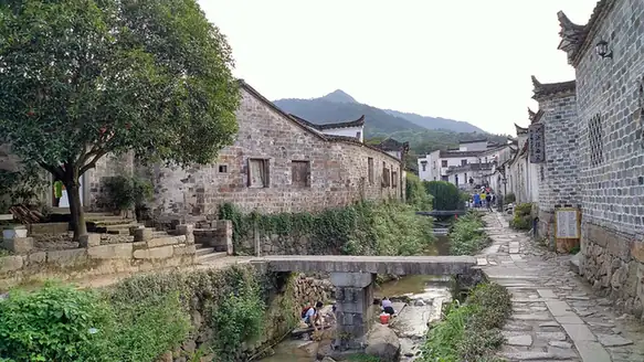 Zhaji Old Village · 查济古村
Zhaji Old Village查济古村
Chaji is a village of streamside lanes, bridges and ancestral halls in western Jing County, shaped by the Xu, Shi and Cen streams.
Read the place guide → Yunling New Fourth Army Headquarters Site · 云岭新四军军部旧址
Yunling New Fourth Army Headquarters Site云岭新四军军部旧址
The Yunling New Fourth Army Headquarters Site preserves the houses, ancestral hall and temple adapted for army work in Jing County from 1938 to 1941.
Read the place guide → Huihang Ancient Trail · 徽杭古道
Huihang Ancient Trail徽杭古道
Tang-dynasty Huizhou merchants' path from Jixi County, Anhui, towards Hangzhou, now a hiking route over the Jiangnan First Pass.
Read the place guide →Longchuan Village (龙川), Jixi County. Photograph: "Longchuan Village, 2021-09-27 06".Longchuan Village龙川
Longchuan is a Hu-clan village in Yingzhou, Jixi County, where an ancestral hall and a stone memorial arch frame a settlement beside the Dengyuan River.
Read the place guide → Shangzhuang Village · 上庄村
Shangzhuang Village上庄村
Shangzhuang is a riverside village in Jixi County whose houses connect the childhood of scholar Hu Shi with the local tradition of ink making.
Read the place guide →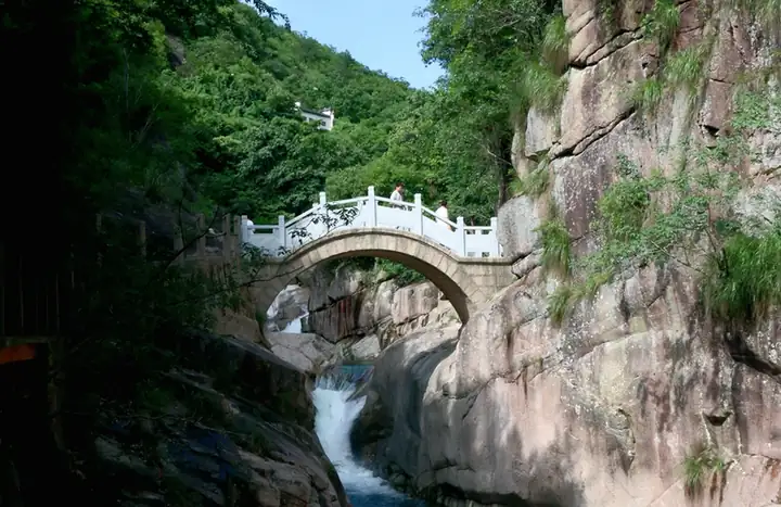 Zhangshan Grand Canyon · 鄣山大峡谷
Zhangshan Grand Canyon鄣山大峡谷
Zhangshan Grand Canyon lies in Fuling Town, Jixi County, where a stream threads between conspicuous rock formations below the southern approach to Qingliangfeng.
Read the place guide →Local life & food
Xuancheng local specialties
宣城市特色美食 · 10 specialties to discover
 Xuancheng Potstickers 宣城锅贴AI illustration · AI 示意图(仅供参考,非实拍)
Xuancheng Potstickers (宣城锅贴) are crescent-shaped, pan-fried dumplings eaten for breakfast in Xuancheng (宣城), Anhui.
Read the dish guide →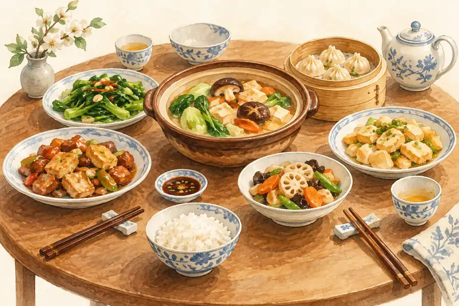 Shuiyang Three Treasures Pot 水阳三宝AI illustration · AI 示意图(仅供参考,非实拍)
Shuiyang Three Treasures Pot (水阳三宝) is a stewed pot from the town of Shuiyang (水阳镇) in Xuanzhou District (宣州区), Xuancheng (宣城), that brings together three local products: duck-foot bundles (鸭脚包), duck wings (鸭翅) and Shuiyang pressed tofu (水阳干子).
Read the dish guide → Shuiyang Duck-Foot Parcels 水阳鸭脚包
Shuiyang Duck-Foot Parcels (水阳鸭脚包) come from Shuiyang (水阳镇), a water-country town in Xuanzhou District (宣州区) of Xuancheng, Anhui.
Read the dish guide →Photo adjustments
EXIF orientation normalized; resized without changing aspect ratio; converted to WebP. No subject edits.
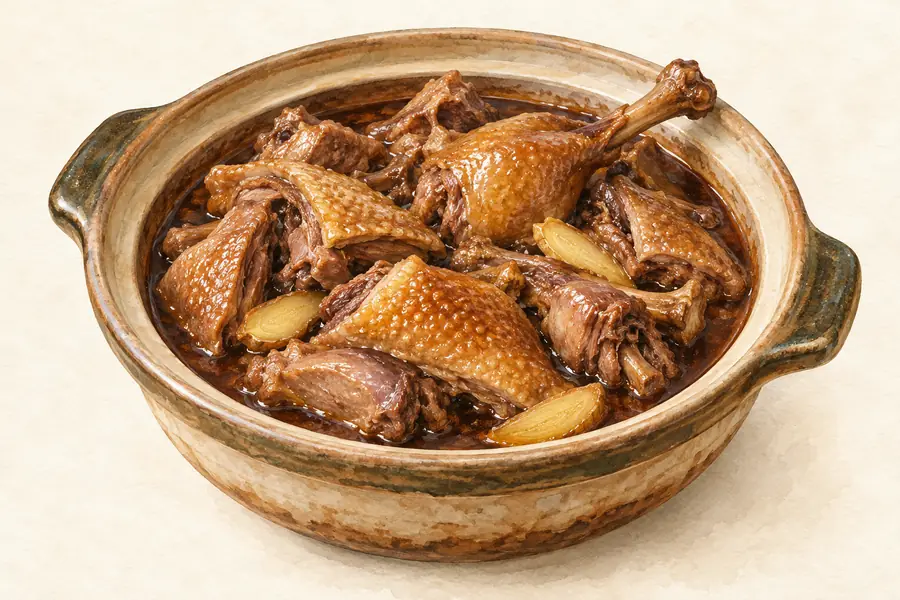 Shuiyang Duck Wings 水阳鸭翅AI illustration · AI 示意图(仅供参考,非实拍)
Shuiyang Duck Wings (水阳鸭翅) is listed among the local specialties of Xuancheng, Anhui. The name includes 鸭 (duck).
Read the dish guide → Ningguo Stuffed Griddle Cakes 宁国粑粑AI illustration · AI 示意图(仅供参考,非实拍)
Ningguo Stuffed Griddle Cakes (宁国粑粑) are thin-skinned, heavily filled flatbreads fried in a wide pan, a breakfast-stall staple of Ningguo (宁国) in Xuancheng (宣城), Anhui, and promoted by the city as one of its signature dishes.
Read the dish guide → Jixi filled griddle cakes 绩溪挞馃AI illustration · AI 示意图
The exterior has toasted patches while the center remains soft and moist. Thin dough allows the filling's flavor to lead rather than creating a bread-heavy snack.
Source ↗Read the dish guide → Jixi Layered One-Pot 绩溪一品锅
Jixi Layered One-Pot (绩溪一品锅) is the Jixi (绩溪) county form of the one-pot (一品锅), a dish in which vegetables, meat, tofu and egg dumplings are stacked in layers in a single pot and stewed together.
Read the dish guide →Photo adjustments
EXIF orientation normalized; resized without changing aspect ratio; converted to WebP. No subject edits.
 Jingxian Dried Qin Fish 泾县琴鱼干AI illustration · AI 示意图(仅供参考,非实拍)
Jingxian Dried Qin Fish (泾县琴鱼干) is made from qin fish (琴鱼), a tiny fish of the Qinxi River (琴溪) in Qinxi Township (琴溪镇), Jingxian County (泾县), Xuancheng (宣城), Anhui.
Read the dish guide →All dish names · 全部菜名 (10)
- Xuancheng Potstickers · 宣城锅贴
- Shuiyang Three Treasures Pot · 水阳三宝
- Shuiyang Duck-Foot Parcels · 水阳鸭脚包
- Shuiyang Duck Wings · 水阳鸭翅
- Ningguo Stuffed Griddle Cakes · 宁国粑粑
- Jixi filled griddle cakes · 绩溪挞馃
- Jixi Layered One-Pot · 绩溪一品锅
- Jingxian Dried Qin Fish · 泾县琴鱼干
- Jingde Chicken Stewed with Lingzhi Mushroom · 旌德灵芝炖鸡
- Langxi Houcun Candied Jujube Cake · 郎溪侯村蜜枣糕
More dishes from across Anhui are in the Anhui food guide.
Counties & districts in Xuancheng
7 areas belong directly to Xuancheng.
7 areas
Xuanzhou District 宣州区
Xuanzhou District (simplified Chinese: 宣州区; traditional Chinese: 宣州區; pinyin: Xuānzhōu Qū) is an urban district of the city of Xuancheng, Anhui Province, People's Republic of China.
Explore the area →CountyLangxi County 郎溪县
Langxi County (simplified Chinese: 郎溪县; traditional Chinese: 郎溪縣; pinyin: Lángxī Xiàn) is a county in the southeast of Anhui Province, People's Republic of China, bordering Jiangsu Province to the north.
Explore the area →CountyJing County 泾县
Jing County or Jingxian (simplified Chinese: 泾县; traditional Chinese: 涇縣; pinyin: Jīng Xiàn) is a county in the south of Anhui Province, People's Republic of China, under the jurisdiction of the…
Explore the area →CountyJixi County 绩溪县
Jixi County is a county under the administration of the prefecture-level city of Xuancheng, in the southeast of Anhui province, China, bordering Zhejiang province to the east.
Explore the area →Show fewer areas
Jingde County 旌德县
Jingde County is a county in the southeast of Anhui Province, People's Republic of China, under the jurisdiction of the prefecture-level city of Xuancheng.
Explore the area →County-level cityNingguo 宁国市
Ningguo (simplified Chinese: 宁国市; traditional Chinese: 寧國市; pinyin: Níngguó Shì) is a county-level city in the southeast of Anhui province, People's Republic of China, under the administration of Xuancheng…
Explore the area →County-level cityGuangde 广德市
Guangde is a county-level city in the southeast of Anhui Province, People's Republic of China, bordering the provinces of Jiangsu to the north and Zhejiang to the east and south.
Explore the area →No areas match this name.
Plan your visit
Getting there
Search for 宣城市 in a map app to find stations and your accommodation.
Where to stay →Build your route
Jingting Mountain and Taohuatan are about 80 km apart in a straight line. The linked place guides have entrance and visit details.
Continue with Anhui →More in Anhui
Sources & geographic information
Administrative names and parent areas: Official geographic directory · Reference date 2026-09-06.
Some facts checked against 宣城市 — Wikipedia contributors, CC BY-SA 4.0.
Photo: Jingting Mountain · HCCB3947 · CC BY-SA 4.0. Full frame retained; proportionally resized and converted to WebP. No retouching or changes to the photographed subject. Card displays may crop the view.

Photo: Taohuatan · Zhangzhugang · CC BY-SA 4.0. Full frame retained; proportionally resized and converted to WebP. No retouching or changes to the photographed subject. Card displays may crop the view.

Photo: Jixi Longchuan Scenic Area · Siyuwj · CC BY-SA 4.0. Full frame retained; EXIF orientation normalized, proportionally resized to at most 800 pixels and converted to WebP. No generated pixels or subject changes. Cards may crop the display.

Photo: Chujiatan River Bend · Source photographer · License not provided. EXIF orientation normalized; resized without changing aspect ratio; converted to WebP. No subject edits.
Photo: Taiji Cave · luchangjiang~鲁昌江 · CC BY-SA 3.0. Full frame retained; proportionally resized and converted to WebP. No retouching or changes to the photographed subject. Card displays may crop the view.

Photo: Jiangcun Village · Siyuwj · CC BY-SA 4.0. Full frame retained; proportionally resized and converted to WebP. No retouching or changes to the photographed subject. Card displays may crop the view.

Photo: China Xuan Paper Culture Park · Source photographer · License not provided. EXIF orientation normalized; resized without changing aspect ratio; converted to WebP. No subject edits.
Photo: Zhaji Old Village · Zhangzhugang · CC BY-SA 4.0. EXIF orientation normalized; resized without changing aspect ratio; converted to WebP. No subject edits.

Photo: Yunling New Fourth Army Headquarters Site · Source photographer · License not provided. EXIF orientation normalized; resized without changing aspect ratio; converted to WebP. No subject edits.
Photo: Huihang Ancient Trail · 三猎 · CC BY-SA 4.0. EXIF orientation normalized; resized without changing aspect ratio; converted to WebP. No subject edits.

Photo: Longchuan Village · Siyuwj · CC BY-SA 4.0. Full frame retained; EXIF orientation normalized, proportionally resized to at most 800 pixels and converted to WebP. No generated pixels or subject changes. Cards may crop the display.
Photo: Shangzhuang Village · 猫猫的日记本 · CC BY-SA 4.0. EXIF orientation normalized; resized without changing aspect ratio; converted to WebP. No subject edits.

Photo: Zhangshan Grand Canyon · Source photographer · License not provided. EXIF orientation normalized; resized without changing aspect ratio; converted to WebP. No subject edits.
Map data © OpenStreetMap contributors. Pins mark approximate centres, not entrances or boundaries.