


Get to know Hanting District
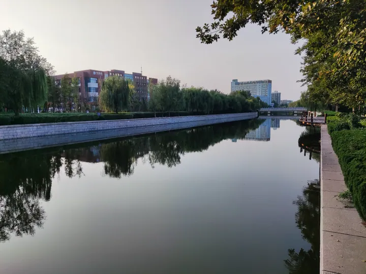
Photo adjustments
Full frame retained; proportionally resized and converted to WebP. No retouching or changes to the photographed subject. Card displays may crop the view.
- Administrative area
- District · 市辖区
- Part of
- Weifang
- Chinese name
- 寒亭区
- Local areas
- District guide
Area & population
- Area in the source
- 898.00 km²
- Population · 2014
- 355,000
Source: cited geographic source, as of the dates shown.
Setting and landscape
Hanting District borders Fangzi District (坊子区) and Weicheng District (潍城区) to the south, Changyi (昌邑市) to the east and Shouguang (寿光市) to the west. It is the home of the Weixian radish (潍县萝卜), a Weifang speciality.
History
Local tradition credits Han Zhuo (寒浞) of the Xia period with founding the ancient state of Han (寒国) here. Under Wang Mang (王莽) the old state was made a ting (亭, a local post), and the name Hanting dates from then. Kong Rong (孔融) and Xu Gan (徐干), two of the "Seven Scholars of Jian'an" (建安七子), and the Qing painter and writer Zheng Banqiao (郑板桥) all left their mark in the district.
In October 1983 Wei County (潍县) was abolished and Hanting District was created under the newly formed prefecture-level city of Weifang.
What to see
Yangjiabu (杨家埠) woodblock New Year prints and Yangjiabu kites were placed on the first national list of intangible cultural heritage. The Yangjiabu Folk Art Grand Garden (杨家埠民间艺术大观园) is a national 4A scenic area. In West Yangjiabu village (西杨家埠村), the old print workshops, dated to the Ming and Qing, became a Shandong provincial protected site in 2006.
The Qianbuxia site (前埠下遗址), a Neolithic site in Zhuli Town (朱里镇), is described by the district government as the earliest trace of human culture in the Weifang area, about 8,000 years old; it was listed as a provincial protected site in 2006. Other old sites include the mound of Han Zhuo (寒浞冢), the Yu Wang Terrace (禹王台), the Lujiakou (鲁家口) cultural site and a single-arch bridge from the Jin dynasty. The legend of Liu Yi delivering a letter (柳毅传书), a national intangible heritage item, is said to have originated here.
Getting oriented
Weifang North high-speed railway station (潍坊北站) stands in Hanting. Four expressways cross the district: Qingdao–Yinchuan (青银), Weifang–Laiyang (潍莱), Rongcheng–Wuhai (荣乌) and Weifang–Rizhao (潍日), together with national highways 206 and 309. Weifang Port (潍坊港) in the north is a national first-class open port. Qingdao airport is about 100 kilometres away and Jinan airport about 170 kilometres.
Highlights
- Yangjiabu Folk Art Grand Garden 杨家埠民间艺术大观园: National 4A scenic area built around Yangjiabu New Year prints and kites, both on the first national intangible heritage list.
- West Yangjiabu old print workshops 寒亭西杨家埠木版年画旧作坊: Ming and Qing workshop buildings, a Shandong provincial protected site since 2006.
- Qianbuxia site 前埠下遗址: Neolithic site in Zhuli, about 8,000 years old, provincial protected site since 2006.
- Weixian radish 潍县萝卜: Weifang radish speciality grown in Hanting.
Sources for this guide
寒亭概况 · Hanting District People's Government, Weifang
寒亭区 - 维基百科,自由的百科全书 · Wikipedia (Chinese) · CC BY-SA 4.0
寒亭西杨家埠木版年画旧作坊 - 维基百科,自由的百科全书 · Wikipedia (Chinese) · CC BY-SA 4.0
寒亭前埠下古文化遗址 - 维基百科,自由的百科全书 · Wikipedia (Chinese) · CC BY-SA 4.0
Original English written from the listed sources and checked sentence by sentence against quoted extracts by a separate reviewer. Updated 2026-09-23.
Explore Hanting District
Core places to explore, with English and Chinese names.
Hanting District 寒亭区
Plan your visit
Getting there
Hanting District is about 8 km in a straight line from central Weifang. Search for 寒亭区 in a map app to find stations and your accommodation.
Where to stay →More in Weifang
Sources & geographic information
Administrative names and parent areas: Official geographic directory · Reference date 2026-09-06.
Some facts checked against 寒亭区 — Wikipedia contributors, CC BY-SA 4.0.
Some facts checked against 寒亭西杨家埠木版年画旧作坊 — Wikipedia contributors, CC BY-SA 4.0.
Some facts checked against 寒亭前埠下古文化遗址 — Wikipedia contributors, CC BY-SA 4.0.
Map data © OpenStreetMap contributors. Pins mark approximate centres, not entrances or boundaries.