


Get to know Shouguang
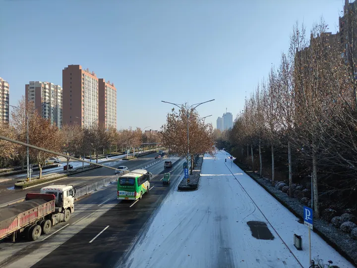
Photo adjustments
Full frame retained; proportionally resized and converted to WebP. No retouching or changes to the photographed subject. Card displays may crop the view.
- Administrative area
- County-level city · 县级市
- Part of
- Weifang
- Chinese name
- 寿光市
- Local areas
- County-level city guide
Area & population
- Area in the source
- 2,200.00 km²
- Population · 2018
- 1,103,110
Source: cited geographic source, as of the dates shown.
Setting and landscape
Shouguang borders Hanting District (寒亭区) to the east, Guangrao County (广饶县) to the west, and Qingzhou (青州市) and Changle County (昌乐县) to the south, with 56 kilometres of coastline to the north. Nearly all of it is plain or tidal flat, crossed by many rivers, creeks and channels. The city describes its climate as dry in spring, hot and rainy in summer, cool in autumn and dry and cold with little snow in winter.
History
Shouguang County was set up under the Western Han. Its name is traced to a Warring States text in which local elders asked the ruler of Qi (齐国) for long life. In December 1868 a Nian army (捻军) was destroyed here, and on 1 June 1993 the county became a city.
The city calls itself the home of three sages: the agronomist Jia Sixie (贾思勰), who wrote the farming treatise Qimin Yaoshu (齐民要术) here in the Northern Wei; Cangjie (仓颉), honoured as the sage of writing; and Sushashi (夙沙氏), honoured as the sage of salt.
Food and local products
Shouguang grows vegetables in very large quantities and has winter-warm greenhouses (冬暖式蔬菜大棚); Wikipedia describes the city's wholesale market as China's largest vegetable distribution centre. The China (Shouguang) International Vegetable Sci-tech Fair (中国(寿光)国际蔬菜科技博览会) was first held in April 2000 and became an approved annual event in 2004. Since 2001 it has opened at the Vegetable High-tech Demonstration Park (蔬菜高科技示范园) in Luocheng (洛城), a national 4A scenic area since 2009, where exhibits have included plant factories and pipe cultivation.
On the coast in the north, the area around Yangkou Port (羊口港), also called Yangjiaogou (羊角沟), is among China's main producers of raw salt and has long been called the "salt capital".
What to see
Jingshan (静山), in farmland about 8 kilometres south-west of the city in Sunjiaji (孙家集), is a rock outcrop only about 0.6 metres above the ground whose top stands 49.5 metres above sea level. Media have called it "China's smallest mountain"; it has been a county-level protected site since September 1983.
Getting oriented
The city centre lies in the south-west of Shouguang's territory, 37.5 kilometres in a straight line from Weifang, 165 kilometres from Jinan and 400 kilometres from Beijing. The Qingdao–Yinchuan (青银) and Rongcheng–Wuhai (荣乌) expressways cross the city and carry vegetables out of both its southern and northern parts.
Highlights
- Vegetable High-tech Demonstration Park 蔬菜高科技示范园: Opening venue of the annual vegetable fair since 2001; national 4A scenic area since 2009.
- Jingshan 静山: Rock outcrop about 0.6 m above the fields, dubbed 'China's smallest mountain'; county protected site since 1983.
- Yangkou Port 羊口港: Coastal area in the north known as the 'salt capital' for raw salt production.
Sources for this guide
寿光概况 · Shouguang Municipal People's Government
自然地理 · Shouguang Municipal People's Government
寿光市 - 维基百科,自由的百科全书 · Wikipedia (Chinese) · CC BY-SA 4.0
静山 (寿光) - 维基百科,自由的百科全书 · Wikipedia (Chinese) · CC BY-SA 4.0
中国(寿光)国际蔬菜科技博览会 - 维基百科,自由的百科全书 · Wikipedia (Chinese) · CC BY-SA 4.0
Original English written from the listed sources and checked sentence by sentence against quoted extracts by a separate reviewer. Updated 2026-09-23.
Explore Shouguang
Core places to explore, with English and Chinese names.
Shouguang 寿光市
Plan your visit
Getting there
Shouguang is about 35 km in a straight line from central Weifang. Search for 寿光市 in a map app to find stations and your accommodation.
Where to stay →More in Weifang
Sources & geographic information
Administrative names and parent areas: Official geographic directory · Reference date 2026-09-06.
Some facts checked against 寿光市 — Wikipedia contributors, CC BY-SA 4.0.
Some facts checked against 静山 (寿光) — Wikipedia contributors, CC BY-SA 4.0.
Some facts checked against 中国(寿光)国际蔬菜科技博览会 — Wikipedia contributors, CC BY-SA 4.0.
Map data © OpenStreetMap contributors. Pins mark approximate centres, not entrances or boundaries.