


Get to know Yunzhou District
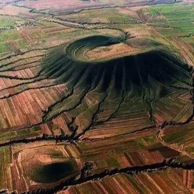
Photo adjustments
EXIF orientation normalized; resized without changing aspect ratio; converted to WebP. No subject edits.
- Administrative area
- District · 市辖区
- Part of
- Datong
- Chinese name
- 云州区
- Local areas
- District guide
Volcanoes and earth formations
The geopark comprises the volcanic field, Sanggan River (桑干河) and Qiulinyu (秋林峪) scenic areas. Heishan (黑山) has a Ming dynasty beacon tower on its summit; Haotian Temple (昊天寺) stands on the crater of Haotian Mountain (昊天山). The Datong Earth Forest (大同土林) is a separate landscape of gullies northeast of Duzhuang Village (杜庄村).
Courtyard heritage and daylilies
The Lü Family Courtyard (吕家大院), at Luozhenying Village (落阵营村), dates to the Qing Guangxu reign and retains more than a hundred rooms. Daylilies (黄花), also called xuancao (萱草), are a local food product: the plant flowers in summer, and its fleshy flower buds are used as food.
Sources for this guide
走进云州 - 云州区人民政府 · Yunzhou District Government
大同火山群国家级地质公园 - 旅游观光 - 云州区人民政府 · Yunzhou District Government
Original English written from the listed sources and checked sentence by sentence against quoted extracts by a separate reviewer. Updated 2026-09-26.
Explore Yunzhou District
Core places to explore, with English and Chinese names.
Places to explore around Yunzhou District
 Datong Volcanic Field ·
 Plan your visit
Getting there
Yunzhou District is about 20 km in a straight line from central Datong. Search for 云州区 in a map app to find stations and your accommodation.
Where to stay →Build your route
Start with Datong Volcanic Field. The linked place guides have entrance and visit details.
Continue with Datong →More in Datong
Sources & geographic information
Administrative names and parent areas: Official geographic directory · Reference date 2026-09-06.
Photo: Datong Volcanic Field · Source photographer · License not provided. EXIF orientation normalized; resized without changing aspect ratio; converted to WebP. No subject edits.
Map data © OpenStreetMap contributors. Pins mark approximate centres, not entrances or boundaries.