


Get to know Chengxiang District
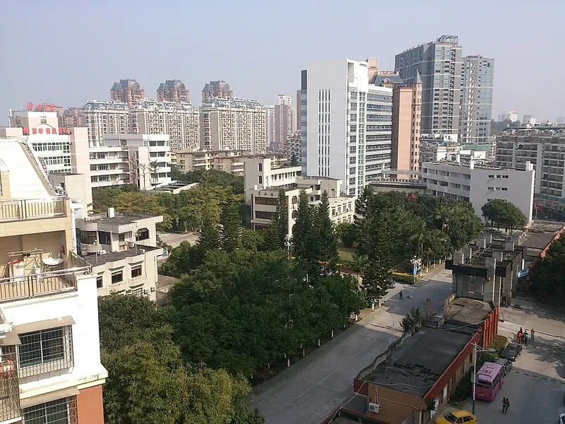
Photo adjustments
Full frame retained; proportionally resized and converted to WebP. No retouching or changes to the photographed subject. Card displays may crop the view.
- Administrative area
- District · 市辖区
- Part of
- Putian
- Chinese name
- 城厢区
- Local areas
- District guide
Area & population
- Area in the source
- 483.70 km²
- Population · 2020 census
- 547,422
Source: cited geographic source, as of the dates shown.
History
The area has belonged to Putian County since the county was founded in 568. In 1279 the seat of Xinghua circuit (兴化路) and its suburbs were split into four wards (厢), run by a ward office that gave Chengxiang, "the city wards", its name. The district itself dates from 1984. The district government credits it with 175 successful candidates in the imperial jinshi exams and names Zheng Lu (郑露), who first brought teaching to Putian in the Southern and Northern dynasties, and the Southern Song poet Liu Kezhuang (刘克庄) among its figures. Puxian opera (莆仙戏), called a living fossil of Song and Yuan southern drama, entered the first national intangible heritage list in 2006.
What to see
Mulan Weir (木兰陂), begun in the Northern Song where the Mulan River meets the tides of Xinghua Bay (兴化湾), is a granite overflow weir 219.13 metres long with 33 piers and 32 sluices, feeding more than 120 kilometres of canals. It lies about 4 kilometres outside Putian's south gate, is a national key protected site and is listed as a World Heritage Irrigation Structure. Guanghua Temple (广化寺), counted among Fujian's "four great monasteries", has the Shijia Wenfo Pagoda (释迦文佛塔), the district's other national key protected site.
Jiulong Valley (九龙谷) national forest park in Changtai (常太镇) holds the lower five of the nine cascades of Jiuli Lake (九鲤湖), also called "Lower Jiuli"; the Ming traveller Xu Xiake (徐霞客) crossed its gorge on foot. Shouxi Park (绶溪公园) is a 4A scenic area, Phoenix Mountain (凤凰山) a provincial scenic area and Tianma Mountain (天马山) a provincial forest park. Twelve of Putian's old "Twenty-Four Views" lie in the district.
Setting and local products
The district holds 23.5 kilometres of the Mulan River and the Dongzhen Reservoir (东圳水库), Fujian's second-largest artificial lake and Putian's main water store. The coastline runs for about 24 kilometres. Loquat, longan, lychee and olive are the district's "four famous fruits", alongside grouper, prawns and sea cucumber, and Yangbian village (洋边村) in Changtai is called "China's first loquat village". The Fuzhou–Xiamen railway, national road G324 and the Fuzhou–Quanzhou expressway pass through the district.
Highlights
- Mulan Weir 木兰陂: Northern Song granite weir on the Mulan River; national key protected site and World Heritage Irrigation Structure.
- Guanghua Temple 广化寺: One of Fujian's four great monasteries, with the nationally protected Shijia Wenfo Pagoda.
- Jiulong Valley 九龙谷: National forest park in Changtai holding the lower five cascades of Jiuli Lake.
- Dongzhen Reservoir 东圳水库: Fujian's second-largest artificial lake and Putian's main water store.
Sources for this guide
莆田市城厢区情简介 · Chengxiang District People's Government, Putian
木兰陂(木兰溪)介绍 · Chengxiang District People's Government, Putian
九龙谷国家森林公园 · Chengxiang District People's Government, Putian
城厢区 - 维基百科,自由的百科全书 · Wikipedia (Chinese) · CC BY-SA 4.0
Original English written from the listed sources and checked sentence by sentence against quoted extracts by a separate reviewer. Updated 2026-09-23.
Explore Chengxiang District
Core places to explore, with English and Chinese names.
Places to explore around Chengxiang District
 AI illustration · AI
 Plan your visit
Getting there
Chengxiang District is about 4 km in a straight line from central Putian. Search for 城厢区 in a map app to find stations and your accommodation.
Where to stay →Build your route
Start with Nanshan Guanghua Temple. The linked place guides have entrance and visit details.
Continue with Putian →More in Putian
Sources & geographic information
Administrative names and parent areas: Official geographic directory · Reference date 2026-09-06.
Some facts checked against 城厢区 — Wikipedia contributors, CC BY-SA 4.0.
Map data © OpenStreetMap contributors. Pins mark approximate centres, not entrances or boundaries.