


Get to know Hanjiang District
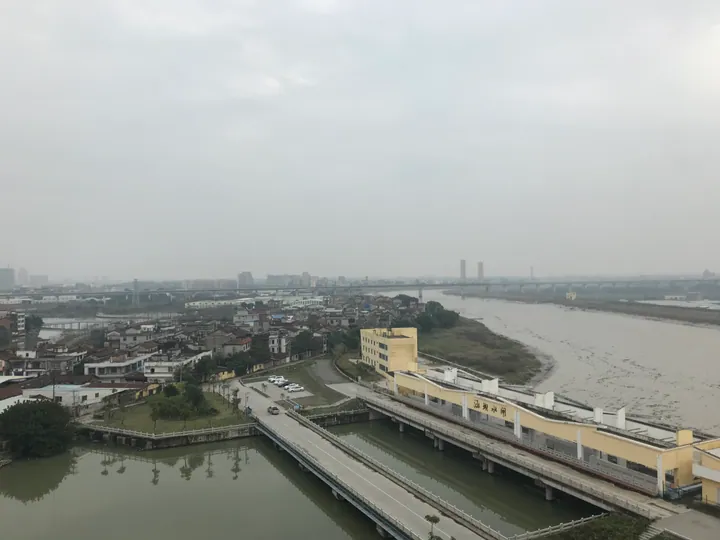
Photo adjustments
Full frame retained; proportionally resized and converted to WebP. No retouching or changes to the photographed subject. Card displays may crop the view.
- Administrative area
- District · 市辖区
- Part of
- Putian
- Chinese name
- 涵江区
- Local areas
- District guide
Area & population
- Area in the source
- 753.90 km²
- Population · 2020
- 479,605
Source: cited geographic source, as of the dates shown.
Setting and landscape
The land falls from northwest to southeast. The mountains of Xinxian (新县镇), Zhuangbian (庄边镇) and Dayang (大洋乡) are offshoots of the Daiyun range (戴云山) averaging about 800 metres, topped by Wangjiang Mountain (望江山) at 1,083.4 metres. The Mulan River, the largest stream in central Fujian, crosses the south and enters Xinghua Bay at Sanjiangkou (三江口), slowing and splitting into a web of channels, ponds and lakes. Baitang Lake (白塘湖) is the largest lake in the district, and the Qiulu River winds for 60 kilometres past underground hot springs. The shore runs about 27.6 kilometres with wide tidal flats.
History
In 627, under the Tang, people enclosed land from the sea and built a culvert-sluice (涵) to drain it, so the place was first called Hantou (涵头). The name Hanjiang appeared in the Song, after the Liu family first dug the Shuixin River (水心河). The area stayed part of Putian County until June 1984, when it became a city district, and in May 2002 seven townships, including Jiangkou (江口) and Dayang, were added from Putian County. The district government names the historian Zheng Qiao (郑樵), the Song top graduate Huang Gongdu (黄公度) and Chen Yinggong (陈应功), credited with pioneering the sun-drying of salt in the Song, among its people.
What to see
Ruiyun Mountain Forest Park (瑞云山森林公园) is the district's 4A scenic area, and the memorial park of the Minzhong revolutionary command (闽中司令部纪念园) in Dayang is a 3A site. Temples and old buildings include Nangshan Temple (囊山寺) in Nangshan village, Guohuan Temple (国欢寺), the Li Fu shrine (李富祠) in Yangwei and the Jiaji Thatched Hall (夹漈草堂) in Gongxi village. The Luomutian (萝苜田) historic block, a banyan more than 1,100 years old called "the first banyan of Fujian", the Baiyu Mountain gorge (白玉山峡谷) and the Jiulongtan waterfalls (九龙潭瀑布群) are also on the district's list.
Food and local products
Lychee, longan, loquat and persimmon are the district's four main fruits. Duotou razor clams (哆头缢蛏), Jiangkou oysters (江口牡蛎) and Duotou tusun jelly (哆头土笋冻) are its best-known seafood. Snacks include Jiangkou braised noodles (江口卤面), braised tofu (焖豆腐), oyster cakes (蛎饼), Xinxian square cake (新县方糕) and Dayang malt candy (大洋麦芽糖); the Lin family's malt candy in Tuyang village (兔洋村) is a municipal intangible heritage item. At the Double Ninth festival families steam a nine-layer cake (九重粿).
Highlights
- Wangjiang Mountain 望江山: Highest peak in the district at 1,083.4 metres, in the Daiyun offshoots of the north.
- Baitang Lake 白塘湖: Largest lake in the district, in Yangwei village of Baitang.
- Nangshan Temple 囊山寺: Temple in Nangshan village, listed among the district's historic sites.
- Ruiyun Mountain Forest Park 瑞云山森林公园: The district's 4A scenic area.
- Dayang malt candy 大洋麦芽糖: The Lin family's malt candy in Tuyang village is a municipal intangible heritage item.
Sources for this guide
涵江区的自然资源 · Hanjiang District People's Government, Putian
旅游资源 · Hanjiang District Culture and Tourism Bureau
历史沿革 · Hanjiang District People's Government, Putian
涵江区 - 维基百科,自由的百科全书 · Wikipedia (Chinese) · CC BY-SA 4.0
Original English written from the listed sources and checked sentence by sentence against quoted extracts by a separate reviewer. Updated 2026-09-23.
Explore Hanjiang District
Core places to explore, with English and Chinese names.
Places to explore around Hanjiang District
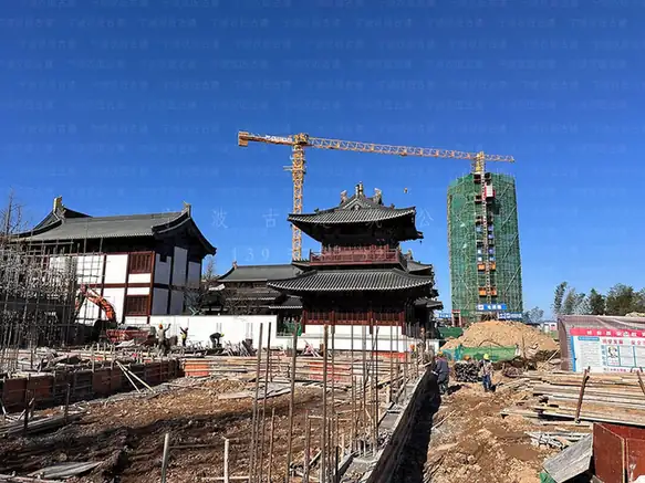 Nangshan Temple ·
 Plan your visit
Getting there
Hanjiang District is about 10 km in a straight line from central Putian. Search for 涵江区 in a map app to find stations and your accommodation.
Where to stay →Build your route
Start with Nangshan Temple. The linked place guides have entrance and visit details.
Continue with Putian →More in Putian
Sources & geographic information
Administrative names and parent areas: Official geographic directory · Reference date 2026-09-06.
Some facts checked against 涵江区 — Wikipedia contributors, CC BY-SA 4.0.
Photo: Nangshan Temple · Source photographer · License not provided. EXIF orientation normalized; resized without changing aspect ratio; converted to WebP. No subject edits.
Map data © OpenStreetMap contributors. Pins mark approximate centres, not entrances or boundaries.