


Get to know Xiuyu District
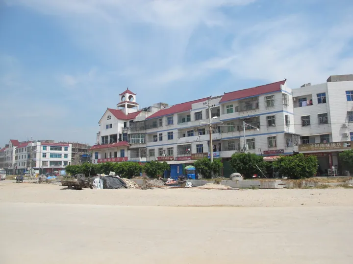
Photo adjustments
Full frame retained; proportionally resized and converted to WebP. No retouching or changes to the photographed subject. Card displays may crop the view.
- Administrative area
- District · 市辖区
- Part of
- Putian
- Chinese name
- 秀屿区
- Local areas
- District guide
Area & population
- Area in the source
- 684.81 km²
- Population · 2010
- 570,741
Source: cited geographic source, as of the dates shown.
Setting and landscape
The three bays cut the land into three peninsulas, Daitou (埭头半岛), Zhongmen (忠门半岛) and Liquan (醴泉半岛), and these peninsulas make up the whole district on the mainland. The ground is mostly weathered granite terraces and small rounded hills; the highest peak, Dahan Mountain (大蚶山), reaches only 399.1 metres. Across Meizhou Bay lies Quangang (泉港) in Quanzhou, and across Xinghua Bay lies Fuqing (福清).
Offshore the district counts 204 islands and reefs. Nanri Island (南日岛) is described by the district as Fujian's largest outlying island, and Meizhou Island (湄洲岛) lies to the south. The climate is south-subtropical and maritime: hot summers often touched by typhoons, and dry autumns. The district lists eight wetlands, among them Xinghua Bay and Pinghai Bay, and its wetland area includes about 43 hectares of mangrove.
What to see
The district government names Pinghai Tianhou Temple (平海天后宫), Tianyun Cave scenic area (天云洞风景区), Houhai fishing village (后海渔村) and the Tuhai wetland (土海湿地景区) as its main sights. The Tianhou temple stands in Pinghai village in Pinghai town (平海镇); it was listed as a Fujian protected site in 1996 and joined the seventh batch of national key protected sites in 2013.
Food and local products
The district lists sea salt, fishing, harbours and islands among its marine resources. Nanri abalone (南日鲍), from Nanri town, is a Chinese geographical-indication product. On land, a fine-grained granite from the district is known as "Pinghai rust stone" (平海锈石).
Getting oriented
Putian railway station stands inside the district. It is the terminus of the Xiangtang–Putian railway (向莆铁路) and its junction with the Fuzhou–Xiamen railway (福厦铁路), and the Shenyang–Haikou expressway (沈海高速) also crosses the district. Xiuyu Port on Meizhou Bay is open as a national first-class port of entry. Taiwan faces the district across the strait, and the district puts Taichung harbour at 72 nautical miles.
Highlights
- Pinghai Tianhou Temple 平海天后宫: Temple in Pinghai village, a national key protected site since 2013.
- Nanri Island 南日岛: Described by the district as Fujian's largest outlying island.
- Tuhai wetland 土海湿地景区: Listed by the district government among its main tourist sights.
- Nanri abalone 南日鲍: Abalone from Nanri town, a Chinese geographical-indication product.
Sources for this guide
秀屿区 - 维基百科,自由的百科全书 · Chinese Wikipedia · CC BY-SA 4.0
区情概貌 _ 秀屿概况 _ 莆田市秀屿区人民政府 · Xiuyu District People's Government, Putian
平海天后宫 - 维基百科,自由的百科全书 · Chinese Wikipedia · CC BY-SA 4.0
Original English written from the listed sources and checked sentence by sentence against quoted extracts by a separate reviewer. Updated 2026-09-23.
Explore Xiuyu District
Core places to explore, with English and Chinese names.
Xiuyu District 秀屿区
Plan your visit
Getting there
Xiuyu District is about 15 km in a straight line from central Putian. Search for 秀屿区 in a map app to find stations and your accommodation.
Where to stay →More in Putian
Sources & geographic information
Administrative names and parent areas: Official geographic directory · Reference date 2026-09-06.
Some facts checked against 秀屿区 — Wikipedia contributors, CC BY-SA 4.0.
Some facts checked against 平海天后宫 — Wikipedia contributors, CC BY-SA 4.0.
Map data © OpenStreetMap contributors. Pins mark approximate centres, not entrances or boundaries.