


Get to know Longhai District
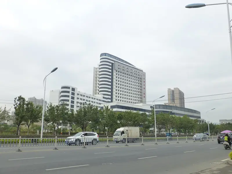
Photo adjustments
EXIF orientation normalized; resized without changing aspect ratio; converted to WebP. No subject edits.
- Administrative area
- District · 市辖区
- Part of
- Zhangzhou
- Chinese name
- 龙海区
- Local areas
- District guide
Area & population
- Area in the source
- 1,117.17 km²
- Population · 2020
- 952,000
Source: cited geographic source, as of the dates shown.
Setting and landscape
Longhai lies on the alluvial plain of the lower Jiulong: hills close it in on the north, west and south, the centre is flat, and the south-east opens to the sea. The highest point is Dajian Mountain (大尖山) in Chengxi town (程溪镇), at 953.6 metres. The North Stream (北溪) and West Stream (西溪) of the Jiulong meet at Dashazhou (大沙洲); below that, the islands of Humao (浒茂) and Wujiao (乌礁) split the river into three channels known together as the Jinjiang (锦江). The district government lists the Jiulong estuary mangroves (九龙江口红树林) among its natural landscapes. The climate is south-subtropical monsoon, and typhoons arrive mainly between July and September.
History
Longhai joins two old counties. Longxi County (龙溪县) was created in 540 under the Liang dynasty; Haicheng County (海澄县) was created in January 1567 with its seat at Yuegang (月港), today's Haicheng town (海澄镇). The district government calls Ming-dynasty Yuegang an important starting port of the Maritime Silk Road and the largest foreign-trade port of its day. The two counties merged as Longhai County in 1960 with its seat at Shima (石码), became a county-level city in 1993 and a district of Zhangzhou in 2021.
What to see
Daimei Ancient Village (埭美古村) in Dongyuan town (东园镇) is described by the town as the largest and best-preserved group of traditional southern Fujian houses in Zhangzhou. On the coast of Longjiao She Ethnic Township (隆教畲族乡), the Baitang Bay tourist area (白塘湾旅游区), rated national 3A, has a 3.2-kilometre crescent beach and the ancient crater of Niutou Mountain (牛头山古火山口), nicknamed the "terracotta army of the sea". Close by are Zhenhai Wei (镇海卫), a garrison town built in 1387, and Mount Nantaiwu (南太武山), a Song-dynasty scenic spot that faces Mount Beitaiwu on Kinmen (金门) across the water. At Baijiao (白礁), the Ciji Temple (慈济宫) honours Wu Tao (吴夲), worshipped as Baosheng Dadi (保生大帝).
Food and local products
Baishui tribute candy (白水贡糖) and Fugong red bayberries (浮宫杨梅) are among Longhai's seven national geographical-indication products. Longhai also grows lychees, citrus and longans, and of its many flowers the narcissus is the best known. Local opera includes gezai opera (歌仔戏), also called Xiang opera (芗剧).
Getting oriented
The district government sits in Shima Subdistrict (石码街道). Longhai shares its bay with Xiamen and has a 25.22-kilometre land border with it, and the Fuzhou–Xiamen and Xiamen–Shenzhen railways both pass through. Offshore, Longhai lies 4 nautical miles from Dadan Island (大担岛) and 9.4 nautical miles from Kinmen.
Highlights
- Daimei Ancient Village 埭美古村: Described by Dongyuan town as Zhangzhou's largest and best-preserved group of traditional southern Fujian houses.
- Baitang Bay tourist area 白塘湾旅游区: National 3A coastal area with a 3.2 km crescent beach and the ancient Niutou Mountain crater.
- Mount Nantaiwu 南太武山: Scenic spot opened in the Song dynasty, facing Mount Beitaiwu on Kinmen.
- Baijiao Ciji Temple 白礁慈济宫: Temple of Baosheng Dadi, a belief on the national intangible-heritage list.
- Fugong red bayberry 浮宫杨梅: National geographical-indication fruit from Fugong town.
Sources for this guide
龙海区情简介(2025) · 漳州市龙海区人民政府
地理环境 · 漳州市龙海区人民政府(龙海区党史方志室)
建制沿革 · 漳州市龙海区人民政府(龙海区党史方志室)
东园镇概况 · 漳州市龙海区人民政府(龙海区东园镇)
国家3A级旅游景区白塘湾旅游区 · 漳州市龙海区人民政府(龙海区文化体育和旅游局)
龙海区 · 维基百科 · CC BY-SA 4.0
Original English written from the listed sources and checked sentence by sentence against quoted extracts by a separate reviewer. Updated 2026-09-23.
Explore Longhai District
Core places to explore, with English and Chinese names.
Places to explore around Longhai District
 Daimei Old Village ·
 Plan your visit
Getting there
Longhai District is about 15 km in a straight line from central Zhangzhou. Search for 龙海区 in a map app to find stations and your accommodation.
Where to stay →Build your route
Start with Daimei Old Village. The linked place guides have entrance and visit details.
Continue with Zhangzhou →More in Zhangzhou
Sources & geographic information
Administrative names and parent areas: Official geographic directory · Reference date 2026-09-06.
Some facts checked against 龙海区 — Wikipedia contributors, CC BY-SA 4.0.
Photo: Daimei Old Village · Source photographer · License not provided. EXIF orientation normalized; resized without changing aspect ratio; converted to WebP. No subject edits.
Map data © OpenStreetMap contributors. Pins mark approximate centres, not entrances or boundaries.