


Get to know Gulang County
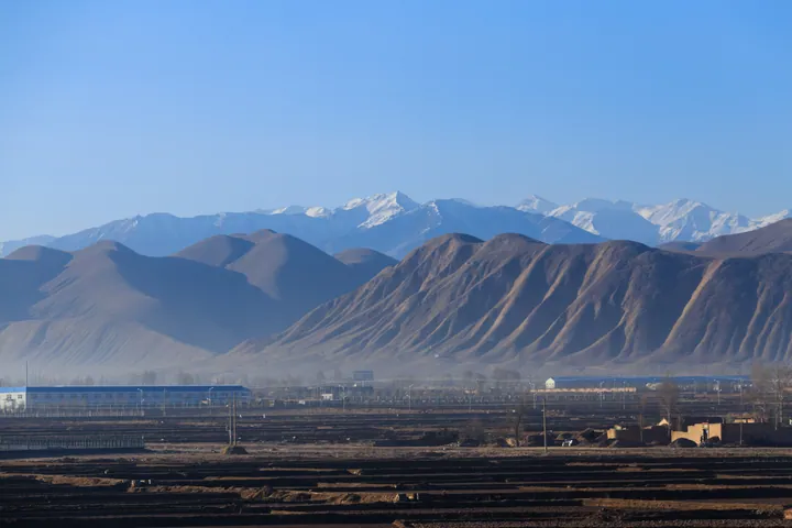
Photo adjustments
Full frame retained; proportionally resized and converted to WebP. No retouching or changes to the photographed subject. Card displays may crop the view.
- Administrative area
- County · 县
- Part of
- Wuwei
- Chinese name
- 古浪县
- Local areas
- County guide
Area & population
- Area in the source
- 5,103.00 km²
- Population · 2018
- 388,700
- Administrative seat
- Gulang Town
Source: cited geographic source, as of the dates shown.
History
In 121 BC the Han set up three counties here, among them Cangsong (苍松) and Xuci (揟次), under Wuwei commandery. In 701 Guo Zhen (郭震), military governor of Liangzhou (凉州), built Herong fort (和戎城) at a gorge on the southern edge of Liangzhou to control the road used by the Tibetans. From 764 the area was held by the Tibetan empire (吐蕃) for more than 240 years. In 1377 the Ming officer Jiang Heng (江亨) renamed the place Gulang after an old river name and built Gulang's walled town. The Qing made it Gulang county in 1724. From 1958 to 1961 the county was merged into Tianzhu.
What to see
The county's promoted history route links the old post town of Heisongyi (黑松驿), the ruins of the Ming Great Wall at Sishui (泗水明长城遗址) and the historic building groups of Dajing (大靖) and Tumen (土门), known for their brick carving. The Gulang Campaign Memorial Hall (古浪战役纪念馆) tells the story of the Red Army's Western Route Army fighting at Gulang.
Gulang is one of China's key monitored counties for desertification. In the early 1980s six villagers, later known as the "six old men", went into the shifting sands of Babusha (八步沙) and contracted to fix 75,000 mu of dunes; three generations of workers at what is now the Babusha forest farm have since planted 217,000 mu. The Babusha Sand Control Memorial Hall (八步沙六老汉治沙纪念馆) shows their tools, records and film. In the desert, Xiliang Nüguo (西凉女国) offers sand sliding, desert off-road rides and camel rides.
Getting oriented
National Highway 312 and the Lanzhou–Xinjiang railway (兰新铁路) run north–south through the county, while Provincial Road 308 and the Gan–Wu railway (干武铁路) cross it east–west. Gulang North (古浪北站) is the county's high-speed rail station.
Highlights
- Babusha Sand Control Memorial Hall 八步沙六老汉治沙纪念馆: Tells the story of the six villagers and three generations who planted the Babusha dunes.
- Sishui Ming Great Wall ruins 泗水明长城遗址: On the county's promoted history route.
- Gulang Campaign Memorial Hall 古浪战役纪念馆: On the Western Route Army battles at Gulang.
- Dajing and Tumen historic buildings 大靖、土门古建筑群: Old courtyard buildings with brick carving.
Sources for this guide
古浪县人民政府 古浪新闻 丝路要塞承千年古韵 红色古浪揽八方游客 · Gulang County People's Government
古浪县人民政府 古浪新闻 赓续红廉薪火 畅游人文古浪——古浪县红色经典精品旅游线路推介 · Gulang County People's Government
古浪县 - 维基百科,自由的百科全书 · Wikipedia (Chinese) · CC BY-SA 4.0
Original English written from the listed sources and checked sentence by sentence against quoted extracts by a separate reviewer. Updated 2026-09-23.
Explore Gulang County
Core places to explore, with English and Chinese names.
Places to explore around Gulang County
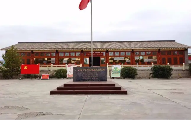 Babusha Six Old Men Sand Control Memorial Hall ·
 Plan your visit
Getting there
Gulang County is about 55 km in a straight line from central Wuwei. Search for 古浪县 in a map app to find stations and your accommodation.
Where to stay →Build your route
Start with Babusha Six Old Men Sand Control Memorial Hall. The linked place guides have entrance and visit details.
Continue with Wuwei →More in Wuwei
Sources & geographic information
Administrative names and parent areas: Official geographic directory · Reference date 2026-09-06.
Some facts checked against 古浪县 — Wikipedia contributors, CC BY-SA 4.0.
Photo: Babusha Six Old Men Sand Control Memorial Hall · Source photographer · License not provided. EXIF orientation normalized; resized without changing aspect ratio; converted to WebP. No subject edits.
Map data © OpenStreetMap contributors. Pins mark approximate centres, not entrances or boundaries.