


Get to know Tianzhu Tibetan Autonomous County
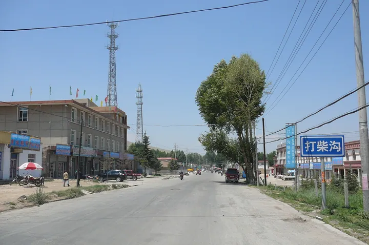
Photo adjustments
Full frame retained; proportionally resized and converted to WebP. No retouching or changes to the photographed subject. Card displays may crop the view.
- Administrative area
- Autonomous county · 自治县
- Part of
- Wuwei
- Chinese name
- 天祝藏族自治县
- Local areas
- Autonomous county guide
Area & population
- Area in the source
- 7,149.00 km²
- Population · 2020
- 151,031
- Administrative seat
- Rabgyai (Huazangsi)
Source: cited geographic source, as of the dates shown.
Setting and landscape
Tianzhu is where the Qinghai-Tibet, Loess and Inner Mongolian plateaus meet: mountain country, mostly grassland and forest. The Wushaoling (乌鞘岭) range runs east to west through the middle of the county, with a plateau monsoon climate to its south and a semi-arid one to its north. The ridge is also the watershed between the Yellow River system and the Shiyang River (石羊河). The Qilian Mountains National Nature Reserve covers 61.4 percent of the county.
History
Qiang, Yuezhi and Xiongnu herders used this land before Han rule began under Emperor Wu; from the Tang dynasty onward Tibetans became the main population. The name Tianzhu, adopted in 1936, joins the first characters of two monasteries, Tiantang (天堂寺) and Zhugong (祝贡寺). The autonomous county dates from 1955, and the county government calls it China's first minority autonomous county, a name given by Premier Zhou Enlai.
What to see
Tiantang Monastery (天堂寺), a Gelug monastery in Tiantang town near the Datong River (大通河), became a teaching college in 1647. Its Tsongkhapa Hall, built in 2002, holds a gilded wooden Tsongkhapa statue 23 metres high, listed by the county government as the largest seated wooden Tsongkhapa figure in Asia. The county also names Dalong Monastery (达隆寺), called Bao'en Temple (报恩寺) by the Kangxi Emperor, and Dongda Monastery (东大寺), whose murals show a complete Journey to the West.
The Wushaoling pass, about 3,000 metres high, was a key crossing on the old Silk Road between the Hexi Corridor and Chang'an (长安). Remains of the Han-era Great Wall and beacon towers survive at the foot of the range; the county government lists the Wushaoling section as the highest-altitude stretch of the Great Wall. Huarui Tibetan folk songs (华锐藏族民歌) are on the national intangible heritage list.
Food and local products
The white yak (白牦牛) is found only in Tianzhu, and the altitude and cold climate are credited with giving its beef and mutton their fine flavour. The county also promotes its highland quinoa and summer vegetables.
Getting oriented
The county seat is Huazangsi town (华藏寺镇). Lanzhou (兰州) lies 120 kilometres away and Wuwei city 130 kilometres. The Lanzhou–Xinjiang Railway, the G30 expressway and National Highway 312 cross the county, the railway through the 20.05-kilometre Wushaoling Tunnel.
Highlights
- Tiantang Monastery 天堂寺: Gelug monastery in Tiantang town with a 23-metre gilded wooden Tsongkhapa statue in a hall built in 2002.
- Wushaoling pass 乌鞘岭: Silk Road pass about 3,000 metres high on the watershed between the Yellow River and the Shiyang River.
- Wushaoling Great Wall 乌鞘岭长城: Provincially protected stretch of wall, listed by the county as the highest-altitude section of the Great Wall.
- White yak 白牦牛: Yak breed found only in Tianzhu.
Sources for this guide
天祝藏族自治县人民政府 天祝简介 · Tianzhu Tibetan Autonomous County People's Government
天祝藏族自治县 - 维基百科,自由的百科全书 · Wikipedia (Chinese) · CC BY-SA 4.0
天堂寺 - 维基百科,自由的百科全书 · Wikipedia (Chinese) · CC BY-SA 4.0
乌鞘岭 - 维基百科,自由的百科全书 · Wikipedia (Chinese) · CC BY-SA 4.0
Original English written from the listed sources and checked sentence by sentence against quoted extracts by a separate reviewer. Updated 2026-09-30.
Explore Tianzhu Tibetan Autonomous County
Core places to explore, with English and Chinese names.
Places to explore around Tianzhu Tibetan Autonomous County
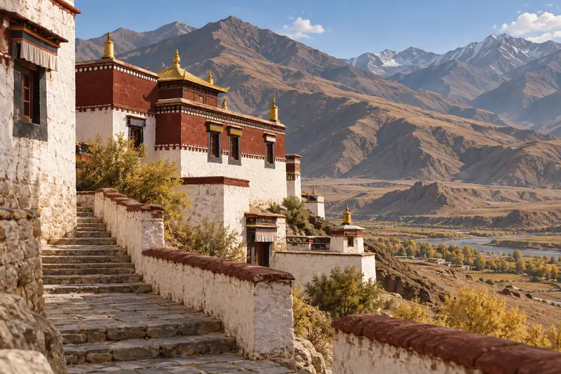 AI illustration · AI 示意图(仅供参考,非该地点实拍)
Tiantang Monastery天堂寺
Gelug monastery in Tianzhu, Gansu, founded as a college in 1647, rebuilt after 1981, with a 23 m gilded wooden Tsongkhapa in its 2002 main hall.
Read the place guide → AI illustration · AI 示意图(仅供参考,非该地点实拍)
Wushaoling Pass Official Viewpoint乌鞘岭正规开放观景点
Wushao Ling (乌鞘岭) is a mountain ridge in Tianzhu Tibetan Autonomous County, Wuwei, Gansu, at the eastern end of the Qilian range, with a viewing platform at 3,052 m and a main peak at 3,562 m.
Read the place guide →Plan your visit
Getting there
Tianzhu Tibetan Autonomous County is about 115 km in a straight line from central Wuwei. Search for 天祝藏族自治县 in a map app to find stations and your accommodation.
Where to stay →Build your route
Tiantang Monastery and Wushaoling Pass Official Viewpoint are both listed here. The linked place guides have entrance and visit details.
Continue with Wuwei →More in Wuwei
Sources & geographic information
Administrative names and parent areas: Official geographic directory · Reference date 2026-09-06.
Some facts checked against 天祝藏族自治县 — Wikipedia contributors, CC BY-SA 4.0.
Some facts checked against 天堂寺 — Wikipedia contributors, CC BY-SA 4.0.
Some facts checked against 乌鞘岭 — Wikipedia contributors, CC BY-SA 4.0.
Map data © OpenStreetMap contributors. Pins mark approximate centres, not entrances or boundaries.