


Get to know Wuwei

Photo adjustments
Full frame retained; proportionally resized and converted to WebP. No retouching or changes to the photographed subject. Card displays may crop the view.
- Administrative area
- Prefecture-level city · 地级市
- Part of
- Gansu
- Chinese name
- 武威市
- Local areas
- 4 local areas
Area & population
- Area in the source
- 33,000.00 km²
- Population · 2020
- 1,464,955
- Administrative seat
- Liangzhou District
Source: cited geographic source, as of the dates shown.
Setting and landscape
The prefecture lies between the Qilian Mountains (祁连山) and the Tengger Desert (腾格里沙漠), where the Loess, Qinghai–Tibet and Mongolian–Xinjiang plateaus meet. The south has glaciers and high ranges such as Wushaoling (乌鞘岭); oases alternate with gobi along the corridor in the middle, and gobi, desert and low hills fill the north. Most rivers rise in the Qilian and belong to the Shiyang River (石羊河) system.
History
In 121 BC the Han general Huo Qubing (霍去病) defeated the Xiongnu, the Hexi Corridor came under Han rule, and the new commandery was named Wuwei, “martial might”, to display the army’s prowess. Its seat, Guzang (姑臧), is today’s Liangzhou District (凉州区). The Former, Later, Southern and Northern Liang states of the Sixteen Kingdoms period and the Da Liang of the late Sui all had their capitals here, and the Buddhist translator Kumarajiva (鸠摩罗什) spent 17 years here. In 1247 the Sakya leader Sakya Pandita (萨迦班智达) and the Mongol prince Godan (阔端) held talks in Liangzhou that set the terms of Tibet’s submission to the Mongol Empire; the Liangzhou Meeting Memorial (凉州会盟纪念馆), in the former Baita Temple (白塔寺), commemorates them. Liangzhou Xianxiao (凉州贤孝), storytelling in song traditionally performed by blind singers who accompany themselves in the local dialect, entered the first national intangible heritage list in 2006.
What to see
The Leitai Han Tomb (雷台汉墓), inside the city, yielded the bronze horse in September 1969. The Wuwei Confucian Temple (武威文庙), founded in 1439, joins a Wenchang Palace, the temple proper and a Confucian school, and the city government calls it the “crown of the academies of Longyou”. Both are national key protected sites, as are the Tiantishan Grottoes (天梯山石窟), 50 km south of the city, begun under the Northern Liang and dubbed by the city government the “forefather of grottoes”; the main cave holds a 28-metre seated Buddha. In Tianzhu Tibetan Autonomous County (天祝藏族自治县), Tiantang Temple (天堂寺) grew from a Bon monastery founded in the Tang.
Food and local products
The local set meal known as the “three carts” (三套车) combines hand-pulled xingmian noodles (行面) in a braised-meat broth, braised pork, and fu tea (茯茶) brewed with rock sugar, red dates and longan, nicknamed Liangzhou’s “local coffee”.
Getting oriented
The city government sits in Liangzhou District; Minqin (民勤县) and Gulang (古浪县) counties and Tianzhu make up the rest of the prefecture. The Lanzhou–Xinjiang Railway (兰新铁路) and the Gantang–Wuwei Railway (干武铁路) meet here, and the Zhongchuan–Wuwei section of the Lanzhou–Zhangye high-speed railway (兰张高铁) is in service.
Highlights
- Leitai Han Tomb 雷台汉墓: Han tomb inside the city where the bronze Horse Treading on a Flying Swallow was unearthed in September 1969.
- Wuwei Confucian Temple 武威文庙: Temple complex on Chongwen Street founded in 1439, with a Wenchang Palace, the temple and a Confucian school.
- Tiantishan Grottoes 天梯山石窟: Northern Liang grottoes 50 km south of the city, with a 28-metre seated Buddha in the main cave.
- Three carts set meal 三套车: Xingmian noodles, braised pork and fu tea served together as one meal.
Sources for this guide
武威市人民政府 武威简介 武威市情 · Wuwei Municipal People's Government
武威市人民政府 历史沿革 历史沿革 · Wuwei Municipal People's Government (city Party history and gazetteer research centre)
武威市人民政府 特色景点 天梯山石窟 · Wuwei Municipal People's Government
武威市人民政府 特色景点 凉州会盟纪念馆 · Wuwei Municipal People's Government
武威市人民政府 特色景点 雷台景区 · Wuwei Municipal People's Government
武威市人民政府 特色景点 文庙景区 · Wuwei Municipal People's Government
武威市人民政府 特色景点 天堂寺 · Wuwei Municipal People's Government
贤孝(凉州贤孝) - 中国非物质文化遗产网·中国非物质文化遗产数字博物馆 · China Intangible Cultural Heritage Network (ihchina.cn)
【甘快看】武威“三套车”把味蕾的灵魂安放给你_本网原创_中国甘肃网 · Gansu Daily group, China Gansu Net (gscn.com.cn)
武威市 - 维基百科,自由的百科全书 · Wikipedia (Chinese) · CC BY-SA 4.0
Original English written from the listed sources and checked sentence by sentence against quoted extracts by a separate reviewer. Updated 2026-09-30.
Explore Wuwei
Core places to explore, with English and Chinese names.
Tiantishan Grottoes 天梯山石窟
Wuwei Confucian Temple 武威文庙
Leitai Han Culture Museum 雷台汉文化博物馆
Wuwei Baita Temple 武威白塔寺
Wuwei Confucian Temple and Western Xia Museum 武威文庙与西夏博物馆
Baita Temple Site 白塔寺遗址
Leitai Han Tomb 雷台汉墓
Babusha Six Old Men Sand Control Memorial Hall 八步沙六老汉治沙纪念馆
Tiantang Monastery 天堂寺
Wushaoling Pass Official Viewpoint 乌鞘岭正规开放观景点
Rui'an Fortress 瑞安堡
Su Wu Desert Scenic Area 苏武沙漠景区
Liangzhou District 凉州区
Minqin County 民勤县
Gulang County 古浪县
Tianzhu Tibetan Autonomous County 天祝藏族自治县
Places to explore around Wuwei
 The great Buddha and attendant figures in the open cliff face at Tiantishan Grottoes, Wuwei. Photographed on 28 August 2019.
Tiantishan Grottoes天梯山石窟
Tiantishan’s Buddhist caves stand beside the Huangyang River reservoir, a setting that changed the site’s preservation history. Some sculptures and murals were removed when the reservoir was built, while the great cave was…
Read the place guide →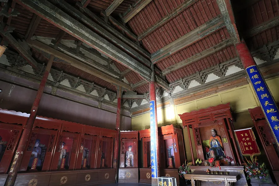 The interior of Dacheng Hall at Wuwei Confucian Temple. Photographed on 30 December 2013.
Wuwei Confucian Temple武威文庙
Wuwei’s Confucian Temple brings together a temple to Confucius and a separate Wenchang precinct associated with literary attainment. That pairing gives the complex a clear theme: learning was both an educational practice and an…
Read the place guide → Leitai Han Culture Museum · 雷台汉文化博物馆
Leitai Han Culture Museum雷台汉文化博物馆
Leitai is the archaeological setting where the bronze galloping horse and a remarkable procession of bronze horses, vehicles and attendants were discovered. Its interpretation focuses on the wealth, movement and ceremonial life…
Read the place guide → The White Dagoba Temple stupa cluster in Wuwei, seen across farmland with mountains behind · 武威白塔寺塔群,远眺祁连山 Source-recorded photograph date: 2013-12-30 10:12:46.
Wuwei Baita Temple武威白塔寺
Baita Temple is associated with Sakya Pandita’s stay in Liangzhou and the region’s thirteenth-century Tibetan Buddhist history. The present landscape combines preserved remains with substantial reconstruction, including the main…
Read the place guide → Wuwei Confucian Temple and Western Xia Museum · 武威文庙与西夏博物馆
Wuwei Confucian Temple and Western Xia Museum武威文庙与西夏博物馆
The Wuwei Confucian Temple and Western Xia Museum (武威文庙与西夏博物馆) are two parts of one institution in Liangzhou District, Wuwei, Gansu — a Ming-dynasty temple complex and a museum of Western Xia material housed within the same administration.
Read the place guide → Baita Temple Site · 白塔寺遗址
Baita Temple Site白塔寺遗址
Baita Temple (白塔寺) is a Tibetan Buddhist temple site at Baita village in Wunan town, Liangzhou District, Wuwei, Gansu, where a 13th-century meeting was held and where the Sakya leader Sakya Pandita died.
Read the place guide → The stairway and gate approach to the Leitai Han Tomb site, Liangzhou District, Wuwei · 雷台汉墓入口台阶与山门,武威市凉州区 Source-recorded photograph date: Taken on 29 September 2011.
Leitai Han Tomb雷台汉墓
Brick tomb under the Leitai terrace in Wuwei, Gansu, where the bronze Galloping Horse was found in 1969; its date is still debated.
Read the place guide →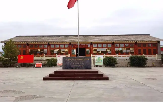 Babusha Six Old Men Sand Control Memorial Hall · 八步沙六老汉治沙纪念馆
Babusha Six Old Men Sand Control Memorial Hall八步沙六老汉治沙纪念馆
The Babusha Six Old Men Sand Control Memorial Hall (八步沙六老汉治沙纪念馆) is a memorial museum at the Babusha forest farm in northern Gulang County, Wuwei, Gansu, on the southern edge of the Tengger Desert.
Read the place guide → AI illustration · AI 示意图(仅供参考,非该地点实拍)
Tiantang Monastery天堂寺
Gelug monastery in Tianzhu, Gansu, founded as a college in 1647, rebuilt after 1981, with a 23 m gilded wooden Tsongkhapa in its 2002 main hall.
Read the place guide → AI illustration · AI 示意图(仅供参考,非该地点实拍)
Wushaoling Pass Official Viewpoint乌鞘岭正规开放观景点
Wushao Ling (乌鞘岭) is a mountain ridge in Tianzhu Tibetan Autonomous County, Wuwei, Gansu, at the eastern end of the Qilian range, with a viewing platform at 3,052 m and a main peak at 3,562 m.
Read the place guide → The rammed-earth fortress walls of Rui'an Bao, Minqin County · 甘肃省武威市民勤县瑞安堡城墙 Source-recorded photograph date: Taken on 29 September 2011.
Rui'an Fortress瑞安堡
Ruianbao (瑞安堡), commonly known as Wangtuan Baozi, is a fortified private residence of 1938 at Santaocun in Sanlei town, 3.5 km south-west of the Minqin county seat in Wuwei, Gansu, listed as a Major Historical and Cultural Site Protected at the National Level in 2006.
Read the place guide → AI illustration · AI 示意图(仅供参考,非该地点实拍)
Su Wu Desert Scenic Area苏武沙漠景区
Suwu Desert Scenic Area (苏武沙漠景区) is a national 4A-rated desert-culture attraction in Minqin County, Wuwei, Gansu, built around an international desert sculpture camp and six sections including a stargazing town.
Read the place guide →Local life & food
Wuwei local specialties
武威市特色美食 · 9 specialties to discover
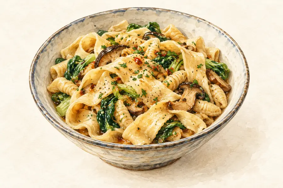 Wuwei Santaoche Set Meal 武威三套车AI illustration · AI 示意图(仅供参考,非实拍)
Wuwei Santaoche Set Meal (武威三套车) is the three-part meal of Wuwei (武威), the old Liangzhou (凉州): red-date fu tea (茯茶), braised pork and a bowl of hand-pulled xingmian (行面) noodles in gravy.
Read the dish guide → Liangzhou Cold Noodles 凉州凉面Reference photo of a similar dish · 同类菜品参考照片
Liangzhou Cold Noodles (凉州凉面) are alkaline wheat noodles eaten cold under a hot gravy in Liangzhou (凉州), the old name of Wuwei (武威) in Gansu.
Read the dish guide →
Photo adjustments
Full frame retained; EXIF orientation normalized, proportionally resized to at most 800 pixels and converted to WebP. No generated pixels or subject changes. Cards may crop the display.
 Cold Noodle Sheets 面皮子AI illustration · AI 示意图(仅供参考,非实拍)
Cold Noodle Sheets (面皮子) are a cold wheat-flour dish from Wuwei (武威) in Gansu, where local media call it Liangzhou mianpizi (凉州面皮子).
Read the dish guide → Wuwei Millet Broth with Fried Dough Twists 米汤油馓子AI illustration · AI 示意图(仅供参考,非实拍)
Wuwei Millet Broth with Fried Dough Twists (米汤油馓子) is the morning meal of Wuwei (武威), Gansu: a bowl of broth cooked from yellow millet and lentils, with fried dough strands (sanzi, 馓子) broken into it.
Read the dish guide →Braised Mutton with Rolled Dough 羊肉垫卷子AI illustration · AI 示意图(仅供参考,非实拍)
Braised Mutton with Rolled Dough (羊肉垫卷子) is a lamb dish of Yongchang County (永昌县) in Jinchang (金昌), Gansu, in which coiled lengths of oiled wheat dough are cooked in the pot with the lamb and its broth.
Read the dish guide →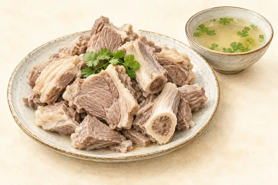 Minqin Mutton 民勤羊肉AI illustration · AI 示意图(仅供参考,非实拍)
Minqin Mutton (民勤羊肉) is sheep meat from Minqin County (民勤县) in Wuwei (武威), Gansu, an oasis on the lower Shiyang River (石羊河) in the north-east of the Hexi Corridor, held between the Tengger (腾格里) and Badain Jaran (巴丹吉林) deserts.
Read the dish guide → Liangzhou Giant Mooncake 凉州大月饼AI illustration · AI 示意图(仅供参考,非实拍)
Liangzhou Giant Mooncake (凉州大月饼) is the Mid-Autumn cake of Wuwei (武威) in Gansu, a layered, patterned cake whose defining feature, in the words of the Wuwei city government, is simply that it is big.
Read the dish guide → Fried Flatbread Rolled with Sticky Rice Cake 油饼卷糕AI illustration · AI 示意图(仅供参考,非实拍)
Fried Flatbread Rolled with Sticky Rice Cake (油饼卷糕) is a Dragon Boat Festival food of Wuwei (武威) in Gansu: a steamed cake of glutinous rice with red dates and raisins, rolled inside a freshly fried wheat flatbread.
Read the dish guide →All dish names · 全部菜名 (9)
- Wuwei Santaoche Set Meal · 武威三套车
- Liangzhou Cold Noodles · 凉州凉面
- Cold Noodle Sheets · 面皮子
- Wuwei Millet Broth with Fried Dough Twists · 米汤油馓子
- Braised Mutton with Rolled Dough · 羊肉垫卷子
- Minqin Mutton · 民勤羊肉
- Liangzhou Giant Mooncake · 凉州大月饼
- Fried Flatbread Rolled with Sticky Rice Cake · 油饼卷糕
- Sheep Offal Soup · 羊杂碎
More dishes from across Gansu are in the Gansu food guide.
Counties & districts in Wuwei
4 areas belong directly to Wuwei.
4 areas
Liangzhou District 凉州区
Liangzhou District (simplified Chinese: 凉州区; traditional Chinese: 涼州區; pinyin: Liángzhōu Qū) is a district and the seat of the city of Wuwei, Gansu province, China, bordering Inner Mongolia to the east.
Explore the area →CountyMinqin County 民勤县
Minqin County is a county of Gansu province, China. It is under the jurisdiction of Wuwei City. Its postal code is 733300, and its population in 1999 was 281,826 people.
Explore the area →CountyGulang County 古浪县
Gulang County is a county in central Gansu province, China, bordering Inner Mongolia to the northeast. It is under the administration of Wuwei City.
Explore the area →Autonomous countyTianzhu Tibetan Autonomous County 天祝藏族自治县
Bairi Tibetan Autonomous County (Tibetan: དཔའ་རིས་བོད་རང་སྐྱོང་རྫོང༌།), also known as Tianzhu from its Chinese name, is in the prefecture-level city of Wuwei in the central part of Gansu province, China…
Explore the area →No areas match this name.
Plan your visit
Getting there
Search for 武威市 in a map app to find stations and your accommodation.
Where to stay →Build your route
Tiantishan Grottoes and Wuwei Confucian Temple are about 40 km apart in a straight line. The linked place guides have entrance and visit details.
Continue with Gansu →More in Gansu
Sources & geographic information
Administrative names and parent areas: Official geographic directory · Reference date 2026-09-06.
Some facts checked against 武威市 — Wikipedia contributors, CC BY-SA 4.0.
Photo: Tiantishan Grottoes · Hiroooooo · CC BY-SA 3.0. Proportionally resized and converted to WebP without cropping, retouching or changing the photographed subject.

Photo: Wuwei Confucian Temple · Zhangzhugang · CC BY-SA 4.0. Proportionally resized and converted to WebP without cropping, retouching or changing the photographed subject.

Photo: Leitai Han Culture Museum · Source photographer · License not provided. EXIF orientation normalized; resized without changing aspect ratio; converted to WebP. No subject edits.
Photo: Wuwei Baita Temple · Zhangzhugang · CC BY-SA 4.0. Full frame retained; proportionally resized and converted to WebP. No retouching or changes to the photographed subject. Card displays may crop the view.

Photo: Wuwei Confucian Temple and Western Xia Museum · Source photographer · License not provided. EXIF orientation normalized; resized without changing aspect ratio; converted to WebP. No subject edits.
Photo: Baita Temple Site · Source photographer · License not provided. EXIF orientation normalized; resized without changing aspect ratio; converted to WebP. No subject edits.
Photo: Leitai Han Tomb · guan · CC BY 3.0. Full frame retained; proportionally resized and converted to WebP. No retouching or changes to the photographed subject. Card displays may crop the view.
.jpg)
Photo: Babusha Six Old Men Sand Control Memorial Hall · Source photographer · License not provided. EXIF orientation normalized; resized without changing aspect ratio; converted to WebP. No subject edits.
Photo: Rui'an Fortress · guan · CC BY 3.0. Full frame retained; proportionally resized and converted to WebP. No retouching or changes to the photographed subject. Card displays may crop the view.
.jpg)
Map data © OpenStreetMap contributors. Pins mark approximate centres, not entrances or boundaries.