


Get to know Raoping County
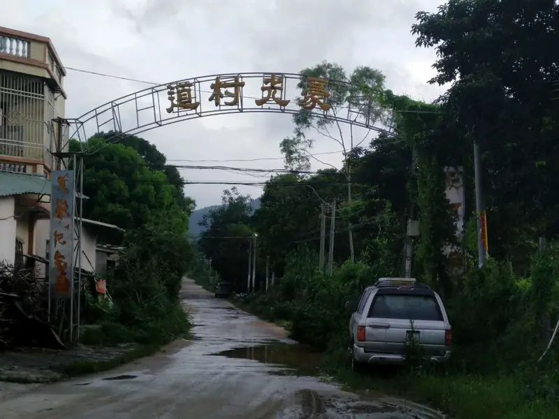
Photo adjustments
Full frame retained; EXIF orientation normalized, proportionally resized to at most 800 pixels and converted to WebP. No generated pixels or subject changes. Cards may crop the display.
- Administrative area
- County · 县
- Part of
- Chaozhou
- Chinese name
- 饶平县
- Local areas
- County guide
Area & population
- Area in the source
- 1,670.00 km²
- Population · 2020
- 817,442
Source: cited geographic source, as of the dates shown.
Setting and landscape
Mountains close the county on the east, north and west, with valleys, basins and plain in the middle. The highest peak, Xiyan Mountain (西岩山), reaches 1,256 metres. The Huanggang River rises in the far north and runs 87.2 kilometres through the county to the sea; the south is its delta, with islands and bays. Haishan Island (海山岛), the largest of 47 islands, has been joined to the mainland by land reclaimed from the sea after 1949. The Tangxi Reservoir (汤溪水库) on the middle river, built in 1958–1959 and known as North Lake, holds 72 islands.
History
The name means "always fertile, always at peace". Raoping was carved out of Haiyang County and became a county in 1477 under the Ming; its old seat was at Sanrao (三饶), and the seat moved to Huanggang (黄冈) in 1953. Dacheng (大埕所城) was a fortress where Qi Jiguang (戚继光) and others fought Japanese pirates, and the 1907 Huanggang uprising is described as a forerunner of the 1911 Revolution. The north is Hakka-speaking and the south speaks Teochew.
What to see
Raoping has more than 700 old fortified buildings and walled villages. The best known, Daoyun Lou (道韵楼) in Nanlian village, Sanrao town, was built in 1587 and became a national protected site in 2006. Qinglan Geopark (青岚地质公园) in Zhangxi (樟溪) is a national geopark of granite caves, stone forest, gorges and groups of rock potholes. The Zhelin Wind Pagoda (柘林镇风塔), a seven-storey granite tower of 1353, is a provincial protected site, and Longfu Temple (隆福寺) on Haishan dates from the Jin dynasty. On Xi'ao Island (西澳岛) at Zhelin egrets gather.
Food and local products
Lingtou Dancong tea (岭头单丛茶), an oolong from Lingtou village in Fubin (浮滨), has eel-yellow leaves and an orange-red liquor with a honeyed floral aroma. It and Gaotang caipu (高堂菜脯), crisp, sweet preserved radish, are national geographical-indication products. The county traces the lion-head goose (狮头鹅) to Xilou village in Fubin. Other local foods are Da'ao blood clams (大澳珠蚶), Fushan dried persimmons (浮山柿饼) and Huanggang baodou cakes (宝斗饼), eight-cornered pastries filled with mung-bean paste and winter melon.
Highlights
- Daoyun Lou 道韵楼: Fortified building of 1587 in Sanrao town, a national protected site since 2006.
- Qinglan Geopark 青岚地质公园: National geopark of granite caves, stone forest and rock potholes in Zhangxi.
- Zhelin Wind Pagoda 柘林镇风塔: Seven-storey granite pagoda built in 1353, a provincial protected site.
- Lingtou Dancong tea 岭头单丛茶: Oolong from Lingtou village, Fubin, a national geographical-indication product.
- Gaotang caipu 高堂菜脯: Preserved radish from Gaotang town, a national geographical-indication product.
Sources for this guide
自然地理 - 潮州市饶平县人民政府网站 · Raoping County People's Government
走进饶平 - 潮州市饶平县人民政府网站 · Raoping County People's Government
资源物产 - 潮州市饶平县人民政府网站 · Raoping County People's Government
饶平县 - 维基百科,自由的百科全书 · Wikipedia (Chinese) · CC BY-SA 4.0
Original English written from the listed sources and checked sentence by sentence against quoted extracts by a separate reviewer. Updated 2026-09-23.
Explore Raoping County
Core places to explore, with English and Chinese names.
Places to explore around Raoping County
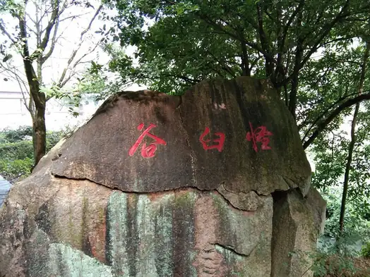 Qinglan Rock Potholes · 青岚冰臼
Qinglan Rock Potholes青岚冰臼
Qinglan is a valley in Raoping County, Chaozhou, along which rock hollows differing in size and shape are distributed. Its water-erosion landforms are one of the stated themes of Qinglan National Geopark, which is made up of the Qinglan-Xianglushan area and the Pingxi area in Zhangxi and Fubin towns.
Read the place guide →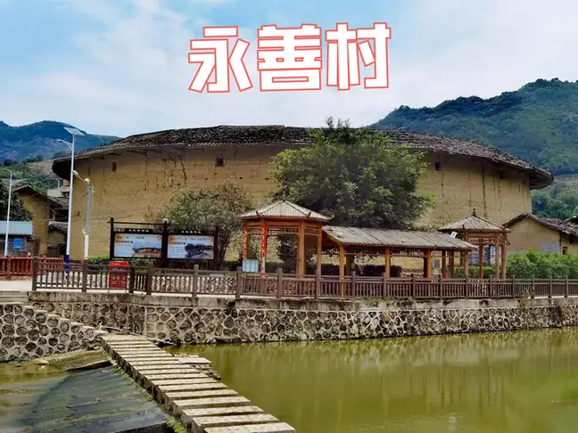 Raoping Tulou Visitor Sites · 饶平土楼公开参观点
Raoping Tulou Visitor Sites饶平土楼公开参观点
The catalogue heading covers Raoping County's earthen-walled communal buildings; the one the Raoping County government names and describes is Daoyun Lou, at Nanlian village in Sanrao town, in the northern hills of Chaozhou municipality. It is an octagonal rammed-earth building of the Ming, listed since 2006 as a national key cultural relic protection unit.
Read the place guide →Plan your visit
Getting there
Raoping County is about 40 km in a straight line from central Chaozhou. Search for 饶平县 in a map app to find stations and your accommodation.
Where to stay →Build your route
Qinglan Rock Potholes and Raoping Tulou Visitor Sites are both listed here. The linked place guides have entrance and visit details.
Continue with Chaozhou →More in Chaozhou
Sources & geographic information
Administrative names and parent areas: Official geographic directory · Reference date 2026-09-06.
Some facts checked against 饶平县 — Wikipedia contributors, CC BY-SA 4.0.
Photo: Qinglan Rock Potholes · Source photographer · License not provided. EXIF orientation normalized; resized without changing aspect ratio; converted to WebP. No subject edits.
Photo: Raoping Tulou Visitor Sites · Source photographer · License not provided. EXIF orientation normalized; resized without changing aspect ratio; converted to WebP. No subject edits.
Map data © OpenStreetMap contributors. Pins mark approximate centres, not entrances or boundaries.