


Get to know Xiangqiao District
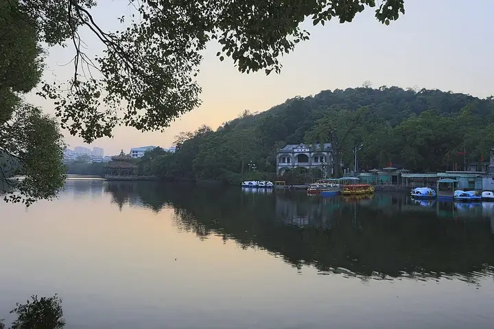
Photo adjustments
Full frame retained; resized proportionally to a maximum dimension of 960 pixels and converted to WebP quality 88. No crop, retouch, generated elements, or subject alteration. Final website rendition: full frame retained, proportionally resized to at most 720 pixels and converted to WebP. No additional retouching or subject alteration. Card displays may crop the view.
- Administrative area
- District · 市辖区
- Part of
- Chaozhou
- Chinese name
- 湘桥区
- Local areas
- District guide
Area & population
- Area in the source
- 176.00 km²
Source: cited geographic source, as of the dates shown.
Setting and landscape
The district covers about 325 square kilometres. Mountains and hills in the north give way to plain in the south, and the Han River cuts across it from north-west to south-east. Bijia Mountain (笔架山), Jinshan (金山), Hulu Hill (葫芦山) and the river frame the old city, a setting the district calls "three hills and one river guarding the city walls". The climate is a warm, wet south subtropical monsoon climate with long summers and short winters.
History
The area belonged to Haiyang County (海阳县), created in 331. The name Chaozhou dates from 591, when the Sui set up a prefecture of that name, and from the Tang to the Qing the district's land stayed in Haiyang. In 1914 Haiyang was renamed Chao'an (潮安) because a county in Shandong had the same name. Xiangqiao District was created in December 1991, when Chaozhou became a prefecture-level city, and opened its offices on 23 April 1992.
What to see
Guangji Bridge (广济桥), the Xiangzi Bridge of local speech, crosses the Han River outside the old east gate. It began in 1171 as a pontoon bridge; piers were built out from both banks until 23 stood in 1228, and in 1435 twelve towers were added. The bridge combines arch, beam and pontoon spans, with an opening section of 18 boats. About 520 metres long with 21 old piers, it was restored to its Ming form between 2003 and 2007 and has been a national key protected site since 1988.
On the east bank, Hanwengong Temple (韩文公祠) stands at the western foot of Bijia Mountain and honours the Tang writer Han Yu (韩愈). It has been on this site since 1189, and its main halls are Ming and Qing. Kaiyuan Temple (开元寺) on Kaiyuan Road (开元路), founded in 738 and first called Lotus Temple (莲花寺), has been a national key protected site since 2001. Paifang Street (牌坊街) was among the first national tourism and leisure streets, and the Ministry of Culture named Taiping Street and Yixingjia Lane (太平街义兴甲巷) a famous historic and cultural street of China. The district counts seven national key protected sites and more than 50 old streets and lanes.
The district keeps protection bases for Chaozhou woodcarving (潮州木雕), Chaozhou embroidery (潮绣) and hand-thrown red-clay teapots (手拉朱泥壶), and venues for Teochew opera (潮剧), Chaozhou music and gongfu tea (工夫茶艺). Its intangible heritage list runs to 106 items, 13 of them national.
Highlights
- Guangji Bridge 广济桥: Han River bridge begun in 1171 that joins stone spans with an opening section of 18 boats; national key protected site since 1988.
- Hanwengong Temple 韩文公祠: Shrine to the Tang writer Han Yu at the foot of Bijia Mountain, on its present site since 1189.
- Kaiyuan Temple 开元寺: Buddhist temple founded in 738; national key protected site since 2001.
- Paifang Street 牌坊街: Old-city street in the first group of national tourism and leisure streets.
Sources for this guide
区情区貌 - 潮州市湘桥区人民政府网站 · Xiangqiao District People's Government, Chaozhou
文化旅游 - 潮州市湘桥区人民政府网站 · Xiangqiao District Tourism Bureau, Chaozhou
历史沿革 - 潮州市湘桥区人民政府网站 · Xiangqiao District People's Government, Chaozhou
【自然资源】 - 潮州市湘桥区人民政府网站 · Xiangqiao District People's Government, Chaozhou
湘桥区 - 维基百科,自由的百科全书 · Wikipedia (Chinese) · CC BY-SA 4.0
广济桥 (潮州) - 维基百科,自由的百科全书 · Wikipedia (Chinese) · CC BY-SA 4.0
韩文公祠 - 维基百科,自由的百科全书 · Wikipedia (Chinese) · CC BY-SA 4.0
开元寺 (潮州) - 维基百科,自由的百科全书 · Wikipedia (Chinese) · CC BY-SA 4.0
Original English written from the listed sources and checked sentence by sentence against quoted extracts by a separate reviewer. Updated 2026-09-25.
Explore Xiangqiao District
Core places to explore, with English and Chinese names.
Places to explore around Xiangqiao District
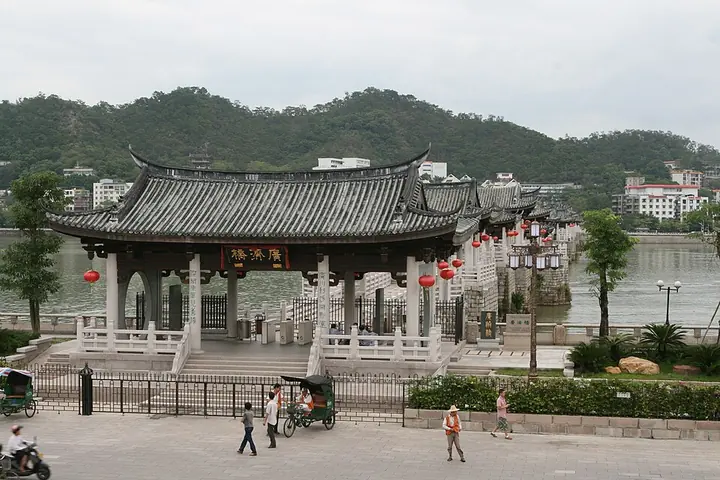 The entrance and covered spans of Guangji Bridge · 潮州广济桥 Photograph date recorded by the source: 27 September 2008.
Guangji Bridge广济桥
Guangji Bridge crosses the Han River at the eastern edge of Chaozhou’s old city. Its unusual design combines fixed bridge sections with a central floating connection formed from boats. Pavilions stand along the bridge, giving…
Read the place guide →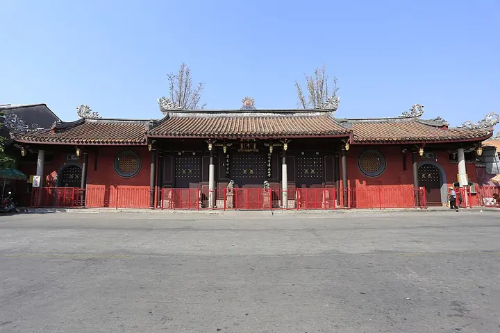 The gate of Kaiyuan Temple in Chaozhou · 潮州开元寺 Photograph date recorded by the source: 26 October 2013, 14:13:09.
Kaiyuan Temple (Chaozhou)开元寺
Kaiyuan Temple is a Buddhist temple within Chaozhou’s Xiangqiao district. It belongs to the tradition of temples named for the Tang Kaiyuan reign, with later generations adding and repairing structures through several dynasties…
Read the place guide →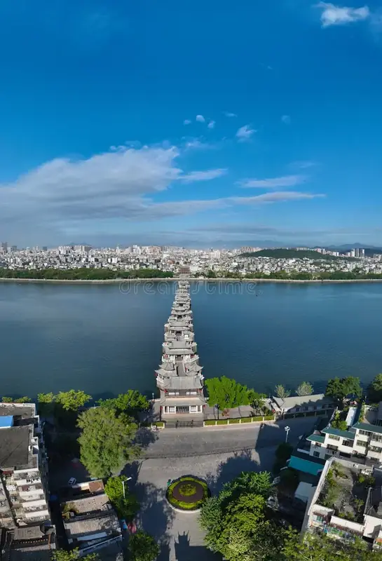 Chaozhou Ancient City · 潮州古城
Chaozhou Ancient City潮州古城
Chaozhou's old city is the historic core of Chaozhou in eastern Guangdong, within Xiangqiao District, the municipality's central-southern district. Its north-south axis is Taiping Road, an alignment kept since the Tang and Song, and its eastern side is closed by the Guangjimen gate tower with the Han River beyond.
Read the place guide →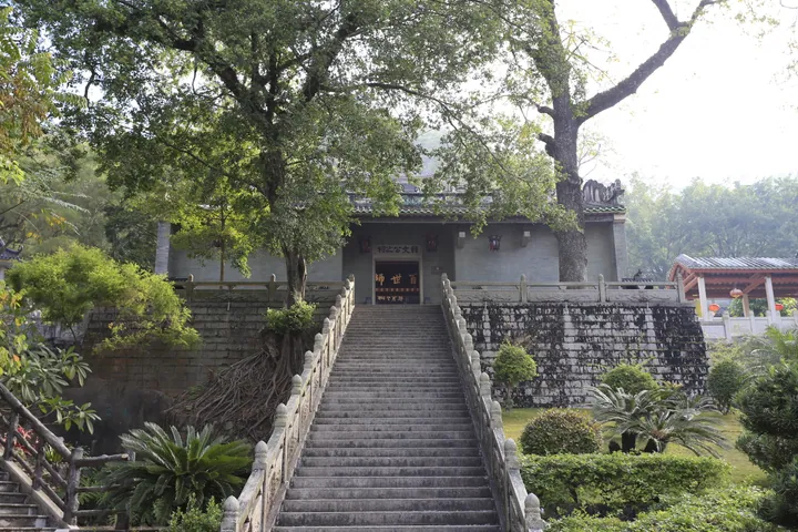 Stone stairway leading up to Han Yu Memorial Temple, Chaozhou · 潮州韩文公祠石阶 Source-recorded photograph date: 2013-10-27 09:04:35.
Han Yu Memorial Temple韩文公祠
Chaozhou's shrine to the Tang writer Han Yu, on this hillside since 1189, with a 56-step stair, old steles and an oak garden.
Read the place guide →Plan your visit
Getting there
Xiangqiao District covers the centre of Chaozhou. Search for 湘桥区 in a map app to find stations and your accommodation.
Where to stay →Build your route
Guangji Bridge and Kaiyuan Temple (Chaozhou) are less than 1 km apart. The linked place guides have entrance and visit details.
Continue with Chaozhou →More in Chaozhou
Sources & geographic information
Administrative names and parent areas: Official geographic directory · Reference date 2026-09-06.
Some facts checked against 湘桥区 — Wikipedia contributors, CC BY-SA 4.0.
Some facts checked against 广济桥 (潮州) — Wikipedia contributors, CC BY-SA 4.0.
Some facts checked against 韩文公祠 — Wikipedia contributors, CC BY-SA 4.0.
Some facts checked against 开元寺 (潮州) — Wikipedia contributors, CC BY-SA 4.0.
Photo: Guangji Bridge · 小杰杰 · CC BY 3.0. Full frame retained; proportionally resized and converted to WebP. No retouching or changes to the photographed subject. Card displays may crop the view.

Photo: Kaiyuan Temple (Chaozhou) · Zhangzhugang · CC BY-SA 4.0. Full frame retained; proportionally resized and converted to WebP. No retouching or changes to the photographed subject. Card displays may crop the view.

Photo: Chaozhou Ancient City · Source photographer · License not provided. EXIF orientation normalized; resized without changing aspect ratio; converted to WebP. No subject edits.
Photo: Han Yu Memorial Temple · Zhangzhugang · CC BY-SA 3.0. Full frame retained; proportionally resized and converted to WebP. No retouching or changes to the photographed subject. Card displays may crop the view.

Map data © OpenStreetMap contributors. Pins mark approximate centres, not entrances or boundaries.