


Get to know Huilai County
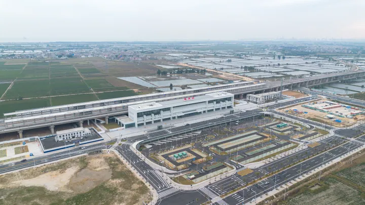
Photo adjustments
Full frame retained; proportionally resized and converted to WebP. No retouching or changes to the photographed subject. Card displays may crop the view.
- Administrative area
- County · 县
- Part of
- Jieyang
- Chinese name
- 惠来县
- Local areas
- County guide
Area & population
- Area in the source
- 1,207.00 km²
- Population · 2020
- 1,040,779
Source: cited geographic source, as of the dates shown.
Setting and landscape
Chaoyang (潮阳) lies to the east, Lufeng (陆丰) to the west and Puning (普宁) to the north; the county stretches 67 km from east to west. The Dananshan range runs across the whole north, where the highest peak, Litoushandong (犁头山东), reaches 822.7 m, and the land drops towards the sea, with the west higher than the east. The largest plain is Zongpuyang (总铺洋) on the middle and lower Long River (龙江), and sandy shores line the coast of towns such as Jinghai (靖海), Shenquan (神泉) and Qianzhan (前詹); the coastline is broken by many headlands and bays. The whole county is south of the Tropic of Cancer, averaging 21°C and about 1,723 mm of rain a year, with no snow and little frost; severe tropical storms often strike in summer and autumn.
History and customs
Under the Qin and Han the area belonged to Jieyang county. Huilai was created in 1524, the third year of the Ming Jiajing reign, from parts of Chaoyang and Haifeng, and stayed under Chaozhou prefecture until the end of the Qing. It was abolished in 1958, restored in March 1961, and has been administered by Jieyang since 1992. Most people speak Teochew (潮州话), with a small Hakka minority. Within the Chaoshan region, the county town alone holds a Da Huojiao (打火醮), a ten-yearly festival of receiving, worshipping and sending off the gods to pray that fire will not strike.
What to see
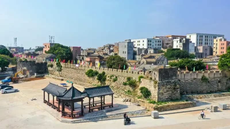
The Ming-dynasty Jinghai ancient city wall (靖海古城墙) in Jinghai town and the Qing-dynasty Aojiao Fort (澳角炮台) at Aojiao village (澳角村), Shenquan, are Guangdong provincial protected sites, as is the Qing walled village of Baonei (堡内古寨), which keeps its east and north gates, old lanes, wells and a Guandi temple. On Shibeishan Cape (石碑山角), southwest of Jinghai, a lighthouse was first built in 1882; the present 68 m reinforced-concrete tower dates from 1989. In 1996 the cape was named one of China's territorial-sea baseline points.
Food and local products
Pork-trotter rice, braised trotters served with rice and side dishes, is traced to Longjiang town (隆江镇), and migrant workers carried it to Guangzhou and Shenzhen after the reform era began. Longjiang trotters, fish balls, lychee, abalone and pineapple are known as Huilai's "five treasures", and the county is known as a "home of lychee" in China. Local snacks include Tangtian rolls (塘田卷章) and oyster omelette (蚵仔煎).
Highlights
- Jinghai ancient city wall 靖海古城墙: Ming-dynasty wall in Jinghai town, a Guangdong provincial protected site.
- Shibeishan Cape Lighthouse 石碑山灯塔: First built in 1882; the present 68 m tower dates from 1989, on a territorial-sea baseline point.
- Aojiao Fort 澳角炮台: Qing-dynasty fort at Aojiao village, Shenquan, a provincial protected site.
- Longjiang pork-trotter rice 隆江猪脚饭: Braised trotters with rice, traced to Longjiang town.
Sources for this guide
地理位置 - 惠来县人民政府 · Huilai County People's Government
惠来县 - 维基百科,自由的百科全书 · Wikipedia (Chinese) · CC BY-SA 4.0
惠来县各级文物保护单位列表 - 维基百科,自由的百科全书 · Wikipedia (Chinese) · CC BY-SA 4.0
石碑山角 - 维基百科,自由的百科全书 · Wikipedia (Chinese) · CC BY-SA 4.0
猪脚饭 - 维基百科,自由的百科全书 · Wikipedia (Chinese) · CC BY-SA 4.0
Original English written from the listed sources and checked sentence by sentence against quoted extracts by a separate reviewer. Updated 2026-09-23.
Explore Huilai County
Core places to explore, with English and Chinese names.
Places to explore around Huilai County
 Jinghai Ancient City ·
 Plan your visit
Getting there
Huilai County is about 60 km in a straight line from central Jieyang. Search for 惠来县 in a map app to find stations and your accommodation.
Where to stay →Build your route
Start with Jinghai Ancient City. The linked place guides have entrance and visit details.
Continue with Jieyang →More in Jieyang
Sources & geographic information
Administrative names and parent areas: Official geographic directory · Reference date 2026-09-06.
Some facts checked against 惠来县 — Wikipedia contributors, CC BY-SA 4.0.
Some facts checked against 惠来县各级文物保护单位列表 — Wikipedia contributors, CC BY-SA 4.0.
Some facts checked against 石碑山角 — Wikipedia contributors, CC BY-SA 4.0.
Some facts checked against 猪脚饭 — Wikipedia contributors, CC BY-SA 4.0.
Photo: Jinghai Ancient City · Source photographer · License not provided. EXIF orientation normalized; resized without changing aspect ratio; converted to WebP. No subject edits.
Map data © OpenStreetMap contributors. Pins mark approximate centres, not entrances or boundaries.