


Get to know Jiaoling County
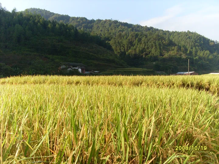
Photo adjustments
Full frame retained; proportionally resized and converted to WebP. No retouching or changes to the photographed subject. Card displays may crop the view.
- Administrative area
- County · 县
- Part of
- Meizhou
- Chinese name
- 蕉岭县
- Local areas
- County guide
Area & population
- Area in the source
- 957.00 km²
- Population · 2020 census
- 184,355
Source: cited geographic source, as of the dates shown.
Setting and landscape
Mountains ring the county and the land slopes from north to south. The Shiku River (石窟河) runs the length of it from north to south through a narrow valley basin; hills, slopes and mountains make up about 80 percent of the area. The county government notes selenium-rich soils and forest over about 79 percent of the land, and Jiaoling was named a China longevity county in 2011.
History
The county was founded in 1633, under the Ming, as Zhenping County (镇平县) in Chaozhou prefecture. It passed to Jiaying (嘉应) in 1733 and took the name Jiaoling in 1914. The county government points to its long cultural history and the old epithet "Zou and Lu of eastern Lingnan" (岭东邹鲁), after the homelands of Mencius and Confucius, and it was part of the original Central Soviet Area.
What to see
The Changtan scenic area (长潭旅游区), a national 4A site 5 kilometres northwest of the county town, is built around the long, deep Changtan Reservoir, nicknamed the "Sun Moon Lake of Lingnan". It is a provincial nature reserve with more than 800 tree ferns (桫椤), egrets that gather over the lake in September and October, and the Gaotai Nunnery (高台庵), likened to the Hanging Temple and to a "golden turtle clinging to a wall".
The former residence of Qiu Fengjia (丘逢甲故居) in Fengjia village, Wenfu town (文福镇), was built in 1896. Its plan has two halls and four side wings wrapped by a weilong (围龙), a half-moon row of rooms, with 55 rooms in all. It has been a national protected site since 2006.
Food and local products
Jiaoling green tea (蕉岭绿茶), Sanzhen Chinese yam (三圳淮山), Guiling honey (桂岭蜂蜜) and Jiaoling winter bamboo shoots (蕉岭冬笋) are national geographical-indication products. The county also grows moso bamboo and silk-seedling rice.
Highlights
- Changtan scenic area 长潭旅游区: National 4A reservoir area and provincial nature reserve, 5 km northwest of the county town.
- Former residence of Qiu Fengjia 丘逢甲故居: House built in 1896 with a half-moon weilong enclosure; national protected site since 2006.
- Gaotai Nunnery 高台庵: Shrine in the Changtan area, likened to the Hanging Temple.
- Sanzhen Chinese yam 三圳淮山: National geographical-indication product.
Sources for this guide
蕉岭县概况_蕉岭概况_蕉岭县人民政府门户网站 · Jiaoling County People's Government
长潭旅游区_旅游景点_蕉岭县人民政府门户网站 · Jiaoling County People's Government
丘逢甲故居_旅游景点_蕉岭县人民政府门户网站 · Jiaoling County People's Government
蕉岭县 - 维基百科,自由的百科全书 · Wikipedia (Chinese) · CC BY-SA 4.0
Original English written from the listed sources and checked sentence by sentence against quoted extracts by a separate reviewer. Updated 2026-09-23.
Explore Jiaoling County
Core places to explore, with English and Chinese names.
Places to explore around Jiaoling County
 AI illustration · AI
 Plan your visit
Getting there
Jiaoling County is about 40 km in a straight line from central Meizhou. Search for 蕉岭县 in a map app to find stations and your accommodation.
Where to stay →Build your route
Start with Changtan Scenic Area. The linked place guides have entrance and visit details.
Continue with Meizhou →More in Meizhou
Sources & geographic information
Administrative names and parent areas: Official geographic directory · Reference date 2026-09-06.
Some facts checked against 蕉岭县 — Wikipedia contributors, CC BY-SA 4.0.
Map data © OpenStreetMap contributors. Pins mark approximate centres, not entrances or boundaries.