


Get to know Pingyuan County
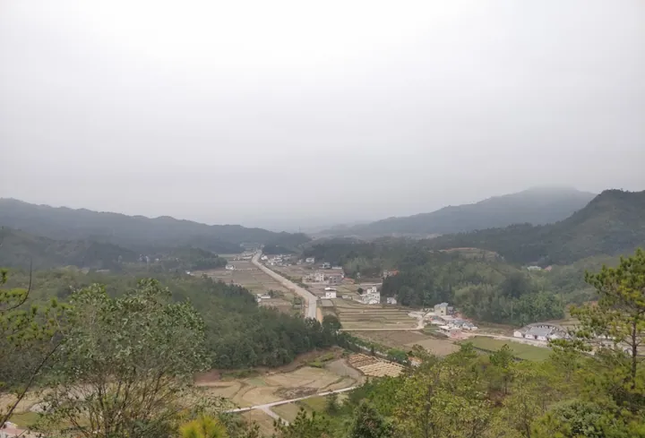
Photo adjustments
Full frame retained; proportionally resized and converted to WebP. No retouching or changes to the photographed subject. Card displays may crop the view.
- Administrative area
- County · 县
- Part of
- Meizhou
- Chinese name
- 平远县
- Local areas
- County guide
Area & population
- Area in the source
- 1,381.00 km²
- Population · 2020 census
- 190,482
Source: cited geographic source, as of the dates shown.
History
Pingyuan was created in 1562, in the Ming dynasty, from border land taken from four counties in three provinces, with its seat at Haojudu, today's Renju town (仁居镇). The name refers to its position between Wuping and Anyuan (安远). It first answered to Ganzhou (赣州府) in Jiangxi; in 1564 the Jiangxi and Fujian land was returned and the county passed to Chaozhou (潮州府) in Guangdong. In 1634 part of it went to form Zhenping, now Jiaoling, and from 1733 it was one of the five counties of Jiaying (嘉应州), the old name of Meizhou. Today the county seat is Dazhe town (大柘镇).
Most people are Hakka and speak Hakka. The county is the home of the early Hakka scholar Cheng Min (程旼), and many Hakka families in the Liudui (六堆) area of Taiwan trace their ancestry here. Its best-known folk art is the boat-lantern dance (船灯舞).
What to see
Tourism in Pingyuan rests mainly on its Danxia landform scenery. Wuzhishi (五指石), the Five Finger Rock scenic area, takes its name from peaks shaped like five raised fingers. The county culture and tourism bureau lists a high-level cliff walkway, Guifei Valley (贵妃谷), Shilin Temple (石林寺), Congming Spring (聪明泉) and the narrow Yixiantian (一线天) passage among its sights, along with old plum trees and cliff inscriptions; from the walkway the view takes in three provinces. It became a national 4A scenic area in 2015.
At Shizheng town (石正镇), three linked ridges, Nantai (南台山), Qingyun (青云山) and Zilin (紫林山), run for 5.2 kilometres and together look like a Buddha lying on his back, with the body in Guangdong and the feet in Jiangxi. The Nantai Reclining Buddha scenic area sits in the red cliffs of Nantai Mountain National Forest Park and has a glass walkway and viewing platforms. The county government also recommends the Red Fourth Army Memorial Hall (红四军纪念馆), which reopened with a new exhibition on 12 July 2021.
Food and local products
Renju town is known for hongjun doufutou (红菌豆腐头), which the county government describes as red outside, white inside, and sweet, chewy and tender. Huang ban (黄粄), a pounded rice cake, is something every Pingyuan household makes for the Spring Festival, to serve guests and give to family; a local mountain song praises the strong backs of the women who pound it. Navel oranges and oil-tea camellia are the county's characteristic crops.
Highlights
- Wuzhishi (Five Finger Rock) 五指石: Danxia peaks shaped like five fingers; national 4A scenic area since 2015, with a cliff walkway looking over three provinces.
- Nantai Reclining Buddha 南台卧佛: Three linked ridges 5.2 km long at Shizheng town that resemble a reclining Buddha spanning Guangdong and Jiangxi.
- Hongjun doufutou 红菌豆腐头: Speciality of Renju town: red outside, white inside, sweet, chewy and tender.
- Huang ban 黄粄: Pounded rice cake made in every household for the Spring Festival.
Sources for this guide
平远县 - 维基百科,自由的百科全书 · Chinese Wikipedia · CC BY-SA 4.0
五指石景区 国家AAAA级旅游景区 · Pingyuan County Culture, Radio, TV, Tourism and Sports Bureau (Pingyuan County People's Government portal)
红菌豆腐头 · Pingyuan County People's Government
韧香黄粄 · Pingyuan County People's Government
南台卧佛山景区 国家AAA级旅游景区 · Pingyuan County People's Government
红四军纪念馆 · Pingyuan County People's Government
Original English written from the listed sources and checked sentence by sentence against quoted extracts by a separate reviewer. Updated 2026-09-23.
Explore Pingyuan County
Core places to explore, with English and Chinese names.
Places to explore around Pingyuan County
 Five Finger Rock ·
 Plan your visit
Getting there
Pingyuan County is about 45 km in a straight line from central Meizhou. Search for 平远县 in a map app to find stations and your accommodation.
Where to stay →Build your route
Start with Five Finger Rock. The linked place guides have entrance and visit details.
Continue with Meizhou →More in Meizhou
Sources & geographic information
Administrative names and parent areas: Official geographic directory · Reference date 2026-09-06.
Some facts checked against 平远县 — Wikipedia contributors, CC BY-SA 4.0.
Photo: Five Finger Rock · Source photographer · License not provided. EXIF orientation normalized; resized without changing aspect ratio; converted to WebP. No subject edits.
Map data © OpenStreetMap contributors. Pins mark approximate centres, not entrances or boundaries.