


Get to know Fangchenggang
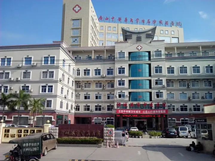
Photo adjustments
Full frame retained; proportionally resized and converted to WebP. No retouching or changes to the photographed subject. Card displays may crop the view.
- Administrative area
- Prefecture-level city · 地级市
- Part of
- Guangxi
- Chinese name
- 防城港市
- Local areas
- 4 local areas
Area & population
- Area in the source
- 6,181.00 km²
- Population · 2022
- 1,059,100
- Administrative seat
- Gangkou District
Source: cited geographic source, as of the dates shown.
Setting and landscape
The Shiwanda Mountains (十万大山) run for more than 130 kilometres across the middle of the prefecture, peaking at 1,462 metres on Shuliang Ridge (薯良岭) in Shangsi (上思). They split the rivers: the Fangcheng (防城河) and Beilun (北仑河) flow south to the sea, while the Ming River (明江) flows north through Shangsi, whose basin forms the north of the prefecture. The lower eastern branch of the Beilun is the border with Vietnam. On the coast three peninsulas alternate with three bays, and the prefecture has a national nature reserve for golden camellias (金花茶).
History
Archaeological finds show people living here more than 5,000 years ago. Before the Song, people around today's Fangcheng District (防城区) lived inside wooden stockades built against raiders, and in 972 the place was renamed Fangcheng (防城); Fangcheng County followed in 1888. From March 1968 the port was built as the main starting point of a covert sea route supplying Vietnam against the United States, and the prefecture-level city was created in 1993.
What to see
Wanwei (万尾), Wutou (巫头) and Shanxin (山心) form the Jingdao scenic area; Golden Beach (金滩), about 11 kilometres long on the south side of Wanwei, faces Vietnam across the water. At the Ha Festival (哈节), the grandest Jing festival, villages sing for three days in their Ha pavilions (哈亭), led by a man playing a stringed instrument and two women singers. Bailang Beach (白浪滩), on the east coast of the Jiangshan Peninsula (江山半岛), is about 6 kilometres long and up to 2.8 kilometres wide at the lowest tide. At Dongxing the border-gate scenic area lines the Beilun opposite Mong Cai (芒街), and the city describes Zhushan (竹山), at the river mouth, as the south-westernmost fishing village on the mainland.
Food and local products
Dongxing counts Red Girl sweet potatoes (红姑娘红薯), Jing vermicelli (京族粉丝) and the Jing "wind-blown" cake (京族风吹饼) as its three treasures; the sweet potato has been grown for more than 200 years and gained geographical-indication status in 2010. Shangsi fragrant glutinous rice (上思香糯) is also a geographical-indication product, and local chicken breeds include Guangpo chicken (光坡鸡) from Gangkou District and the short-legged Dongzhong chicken (峒中矮鸡).
Getting oriented
The city government sits in Gangkou District (港口区), 141 kilometres from Nanning (南宁) and 49 kilometres from Mong Cai.
Highlights
- Jing Islands and Golden Beach 京族三岛: Wanwei, Wutou and Shanxin in Dongxing; Golden Beach on the south side of Wanwei is about 11 km long.
- Ha Festival 哈节: The grandest Jing festival: three days of singing in village Ha pavilions.
- Bailang Beach 白浪滩: Beach on the east coast of the Jiangshan Peninsula, about 6 km long and up to 2.8 km wide at the lowest tide.
- Shiwanda Mountains 十万大山: Range running more than 130 km across the prefecture; highest peak Shuliang Ridge, 1,462 m.
- Red Girl sweet potato 红姑娘红薯: Dongxing sweet potato grown for more than 200 years; geographical-indication status in 2010.
Sources for this guide
防城港市概况 - 防城港概况 - 防城港市人民政府 - · Fangchenggang Municipal People's Government
自然地理 - 自然地理 - 防城港市人民政府 - · Fangchenggang Municipal People's Government
建置沿革 - 历史文化 - 防城港市人民政府 - · Fangchenggang Municipal People's Government
民俗 - 历史文化 - 防城港市人民政府 - · Fangchenggang Municipal People's Government
土特产品 - 自然地理 - 防城港市人民政府 - · Fangchenggang Municipal People's Government (Fangchenggang Agriculture and Rural Affairs Bureau)
防城港市AAAA(4A)级景区名录 - 旅游防城港 - 防城港市人民政府 - · Fangchenggang Municipal People's Government
Original English written from the listed sources and checked sentence by sentence against quoted extracts by a separate reviewer. Updated 2026-09-30.
Explore Fangchenggang
Core places to explore, with English and Chinese names.
Places to explore around Fangchenggang
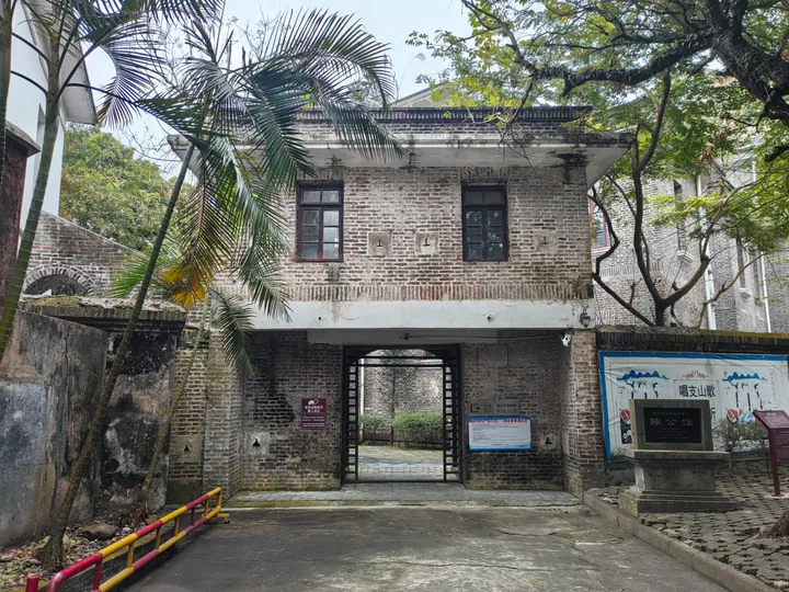 A two-storey grey brick house seen frontally: an arched carriage entrance under a flat lintel, two shuttered windows above, a stone plaque reading 陈公馆 on the right, a blue information board and a banner on the boundary wall; palms and a dark tree overhead.
Dongxing东兴
Dongxing’s city visit can focus on the built landscape beside the border rather than a border crossing itself. The Ho Chi Minh pavilion near the port area has a hexagonal tiled roof and an inscribed stone recording a diplomatic…
Read the place guide →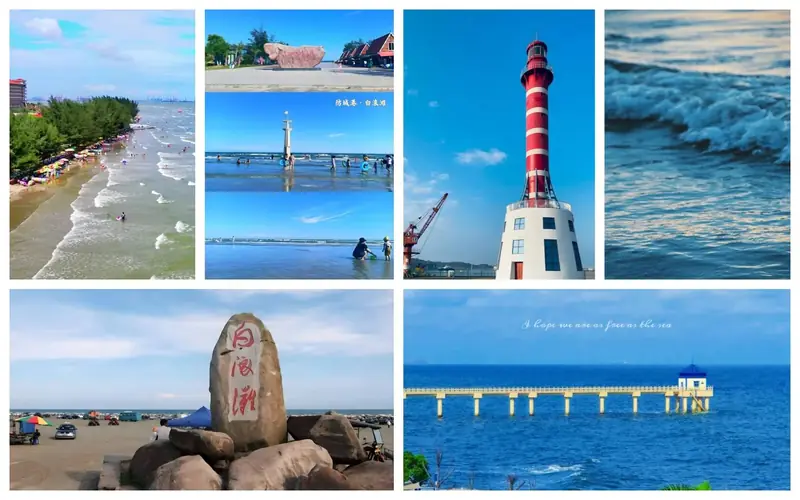 Bailang Beach · 白浪滩
Bailang Beach白浪滩
Bailang is a broad, gently sloping beach on the northeastern side of Jiangshan Peninsula. Its name refers to the parallel lines of white surf often seen approaching the shore, while the alternative name Dapingpo reflects the…
Read the place guide → AI illustration · AI 示意图(仅供参考,非该地点实拍)
Shiwandashan National Forest Park十万大山国家森林公园
Shiwandashan Guojia Senlin Gongyuan (十万大山国家森林公园) is a national forest park in the southeast of Shangsi County, Fangchenggang, covering 20.37 square kilometres with forest cover recorded above 98 per cent.
Read the place guide → AI illustration · AI 示意图(仅供参考,非该地点实拍)
Wanwei Golden Beach万尾金滩
Wanwei Jintan (万尾金滩) is the beach on Wanwei Island that forms the core of the Jingdao (Jing Islands) scenic area in Jiangping town, Dongxing, at the settlement area of the Jing people near the southwestern end of China's mainland coastline.
Read the place guide →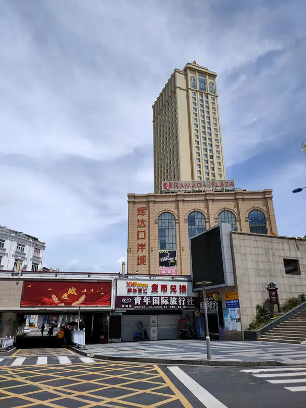 Dongxing Border Port Old Town · 东兴口岸老城
Dongxing Border Port Old Town东兴口岸老城
Dongxing Kou'an (东兴口岸) is Dongxing's national first-class port of entry on the China-Vietnam border, centred on the 'national gate' at the exit of the Beilun River bridge; the city government describes it as the only national first-class port where a Chinese and a Vietnamese city directly adjoin one another.
Read the place guide →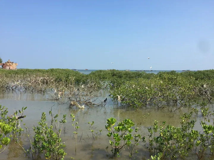 Mangrove wetland fringing the coast at Leshan Ancient Fishing Village, Gangkou District, Fangchenggang · 防城港市港口区簕山古渔村沿海的红树林 Source-recorded photograph date: 2020-10-10.
Leshan Ancient Fishing Village簕山古渔村
Leshan Gu Yu Cun (簕山古渔村) is an old fishing village on the southeast side of the Qisha peninsula, Gangkou District, Fangchenggang, described by the regional broadcasting authority as one of the relatively complete surviving old fishing villages in Guangxi and selected in 2015 as a National Village with Distinctive Scenery and Tourism.
Read the place guide →Local life & food
Fangchenggang local specialties
防城港市特色美食 · 8 specialties to discover
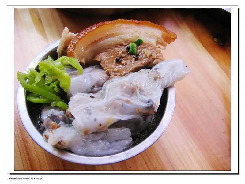 Fangcheng Rolled Rice Noodle Sheets 防城卷粉
Fangcheng Rolled Rice Noodle Sheets (防城卷粉) are thin sheets made from fresh rice batter rolled around a filling of pork and wood-ear mushroom, a traditional snack of Fangchenggang (防城港), Guangxi.
Read the dish guide →Photo adjustments
EXIF orientation normalized; resized without changing aspect ratio; converted to WebP. No subject edits.
 Seafood Rice Noodles 海鲜粉
Seafood Rice Noodles (海鲜粉) are rice noodles cooked together with seafood, a traditional noodle dish that People's Daily Online describes as a snack of the Beibu Gulf (北部湾) coast and of coastal Southeast Asia.
Read the dish guide →
Photo adjustments
EXIF orientation normalized; resized without changing aspect ratio; converted to WebP. No subject edits.
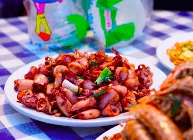 Leshan Old Fishing Village Seafood 簕山古渔村海鲜
Leshan Old Fishing Village Seafood (簕山古渔村海鲜) is the shellfish, crab, prawn and sandworm catch of Leshan old fishing village (簕山古渔村) in Fangchenggang (防城港), Guangxi, eaten at the seafood stalls (大排档) in the village.
Read the dish guide →Photo adjustments
EXIF orientation normalized; resized without changing aspect ratio; converted to WebP. No subject edits.
 Jing Wind-Dried Rice Crackers 京族风吹饼AI illustration · AI 示意图(仅供参考,非实拍)
Jing Wind-Dried Rice Crackers (京族风吹饼), also called bingla (冰喇), are large, thin rice crackers made by the Jing people (京族) of the Fangchenggang (防城港) coast in Guangxi.
Read the dish guide → Jing Sun-Dried Rice Noodles 京族米粉Reference photo of a similar dish · 同类菜品参考照片
Jing Sun-Dried Rice Noodles (京族米粉) are hand-cut, sun-dried rice noodles of the Jing people (京族) in Dongxing (东兴), Fangchenggang, Guangxi.
Read the dish guide →
Photo adjustments
Full frame retained; EXIF orientation normalized, proportionally resized to at most 800 pixels and converted to WebP. No generated pixels or subject changes. Cards may crop the display.
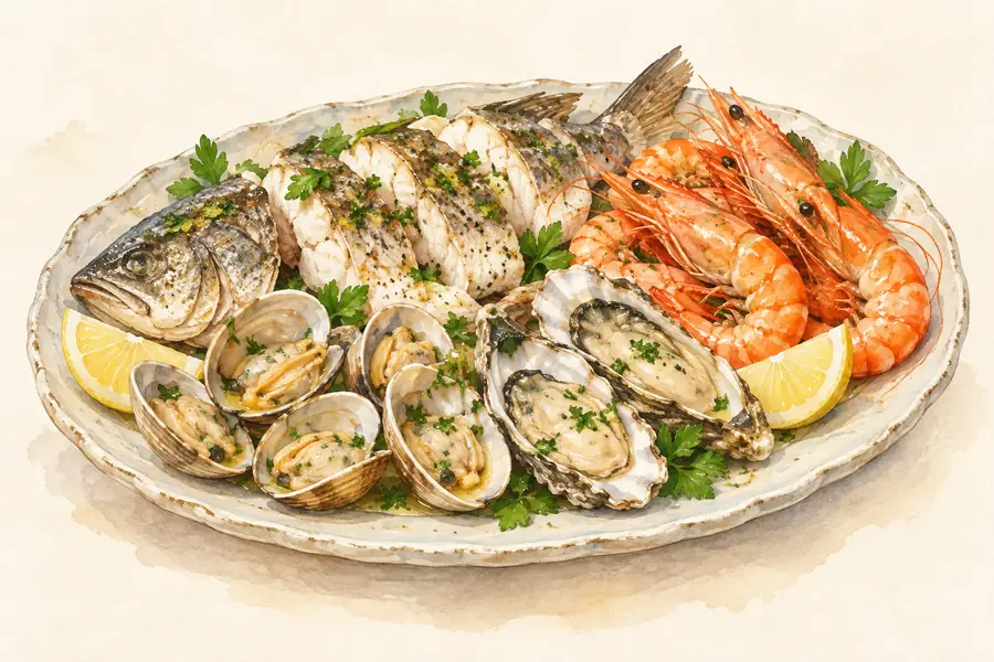 Qisha Fishing Port Seafood 企沙海鲜AI illustration · AI 示意图(仅供参考,非实拍)
Qisha Fishing Port Seafood (企沙海鲜) is the fresh catch landed and eaten at Qisha fishing port (企沙渔港) in Qisha town (企沙镇), Gangkou District (港口区), Fangchenggang (防城港), Guangxi.
Read the dish guide →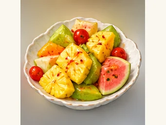 Guangxi pickled fruit 酸嘢AI illustration · AI 示意图
Crunch is central: firm fruit and vegetables retain a refreshing bite beneath the tart dressing. Different items absorb seasoning at different rates.
Source ↗Read the dish guide → Guangpo White-Cut Chicken 白切光坡鸡AI illustration · AI 示意图(仅供参考,非实拍)
Guangpo White-Cut Chicken (白切光坡鸡) is white-cut chicken made from the Guangpo chicken (光坡鸡), a local meat breed of Fangchenggang (防城港) in Guangxi.
Read the dish guide →All dish names · 全部菜名 (8)
More dishes from across Guangxi are in the Guangxi food guide.
Counties & districts in Fangchenggang
4 areas belong directly to Fangchenggang.
4 areas
Gangkou District 港口区
Gangkou is a district of the city of Fangchenggang, Guangxi, China.
Explore the area →DistrictFangcheng District 防城区
Fangcheng (postal: Fongshing, Chinese: 防城; pinyin: Fángchéng; Zhuang language: Fangzcwngz Gih) is a district of the city of Fangchenggang, Guangxi, China.
Explore the area →CountyShangsi County 上思县
Shangsi County is a county in the southwest of Guangxi, China. It is the northernmost county-level division of Fangchenggang City.
Explore the area →County-level cityDongxing 东兴市
Dongxing is a county-level city within Fangchenggang, Guangxi, China, on the border with Móng Cái, Vietnam. The city spans an area of 549 square kilometers, and has a population of approximately 130,000 as of…
Explore the area →No areas match this name.
Plan your visit
Getting there
Search for 防城港市 in a map app to find stations and your accommodation.
Where to stay →Build your route
Dongxing and Bailang Beach are about 35 km apart in a straight line. The linked place guides have entrance and visit details.
Continue with Guangxi →More in Guangxi
Sources & geographic information
Administrative names and parent areas: Official geographic directory · Reference date 2026-09-06.
Photo: Dongxing · Yumeto · CC BY-SA 4.0. Full frame retained; proportionally resized and converted to WebP. No retouching or changes to the photographed subject. Card displays may crop the view.

Photo: Bailang Beach · Source photographer · License not provided. EXIF orientation normalized; resized without changing aspect ratio; converted to WebP. No subject edits.
Photo: Dongxing Border Port Old Town · Source photographer · License not provided. EXIF orientation normalized; resized without changing aspect ratio; converted to WebP. No subject edits.
Photo: Leshan Ancient Fishing Village · 安条矶子 · CC BY-SA 4.0. Full frame retained; proportionally resized and converted to WebP. No retouching or changes to the photographed subject. Card displays may crop the view.

Map data © OpenStreetMap contributors. Pins mark approximate centres, not entrances or boundaries.