


Get to know Jiangkou County
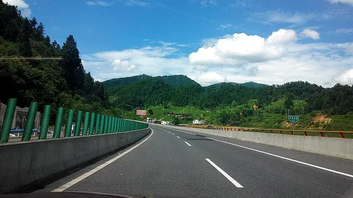
Photo adjustments
Full-frame source proportionally resized and converted to WebP for display. No subject alteration. Source-supplied marks and edits remain; cards may crop the view.
- Administrative area
- County · 县
- Part of
- Tongren City
- Chinese name
- 江口县
- Local areas
- County guide
Area & population
- Area in the source
- 1,869.00 km²
- Population · 2010
- 172,753
- Administrative seat
- Shuangjiang
Source: cited geographic source, as of the dates shown.
Setting and landscape
The land falls to the east from three sides, from 2,570.5 metres on Fenghuangshan (凤凰山) to 275 metres at the lowest point. The Taiping (太平河), Minxiao (闵孝河), Taoying (桃映河) and Cheba (车坝河) rivers all drain to the Yuan River (沅江) in the Yangtze basin. High mountains and gorges fill the north-west and south-east, the centre is a broad low valley of rice and rapeseed, and the karst south has peak clusters, caves and underground rivers.
Fanjingshan, a sacred mountain of Chinese Buddhism, has been a national nature reserve since 1978 and a UNESCO World Heritage Site since 2018. The Qing-era old temple on its Golden Summit (金顶古庙) and the Ming and Qing inscriptions carved into the cliff there are provincial protected sites listed under Jiangkou.
What to see
Zhaisha Dong Village (寨沙侗寨) sits at the foot of Fanjingshan, 10 kilometres from the county town, across a suspension bridge over the Taiping River. Around its central square stand a drum tower, built like all Dong drum towers with an odd number of eave tiers, and a song hall for festivals; most houses are newly built two-storey wooden stilt houses.
Yunshe (云舍村) in Taiping town is promoted by the county as the "first Tujia village of China" (中国土家第一村), and its Qing buildings are a provincial protected site. Its Longtan River (龙潭河) is billed as the world's shortest river. Two 1936 Red Army sites in Shuangjiang (双江), the Mowan meeting site (磨湾红军会师旧址) and the headquarters of the Red Sixth Army Group (红六军团司令部旧址), are also provincially protected.
Jiangkou Nuo drama (傩戏), on the provincial intangible heritage list since 2009, pairs more than 30 short plays with over a dozen feats, including climbing a ladder of blades and walking barefoot over burning charcoal.
Food and local products
The county's specialty is the luobo pig (萝卜猪), known for thin skin and tender meat; its blood and offal are stewed in a large pot of sour soup as luobo pig paotang (萝卜猪刨汤). Cold-water fish (冷水鱼) and rice tofu (米豆腐) are other local dishes. In Zhaisha, Dong households drink ginger tea boiled from ginger, tea leaves, charred chilli and salt.
Highlights
- Fanjingshan 梵净山: Highest peak of the Wuling Mountains and a UNESCO World Heritage Site since 2018; part of it lies in Jiangkou.
- Zhaisha Dong Village 寨沙侗寨: Dong village at the foot of Fanjingshan with a drum tower and song hall.
- Yunshe Village 云舍村: Tujia village with a provincially protected group of Qing buildings and the short Longtan River.
- Luobo pig paotang 萝卜猪刨汤: Local pig breed's blood and offal stewed in sour soup.
Sources for this guide
自然地理 · Jiangkou County People's Government
寨沙侗寨 · Jiangkou County People's Government
神秘江口文化 · Jiangkou County People's Government
江口云舍:暑期旅游热门选择 · Jiangkou County People's Government
领略江口风情,品味三餐之味 · Jiangkou County People's Government
江口县 - 维基百科 · Wikipedia (Chinese) · CC BY-SA 4.0
江口县各级文物保护单位列表 - 维基百科 · Wikipedia (Chinese) · CC BY-SA 4.0
Fanjingshan - Wikipedia · Wikipedia (English) · CC BY-SA 4.0
Original English written from the listed sources and checked sentence by sentence against quoted extracts by a separate reviewer. Updated 2026-09-24.
Explore Jiangkou County
Core places to explore, with English and Chinese names.
Places to explore around Jiangkou County
 Yunshe Village · 云舍村
Yunshe Village云舍村
Yunshe is a Tujia village under Taiping town in Jiangkou County, Tongren, Guizhou, built along the bank of the Taiping river inside the Fanjingshan Taipinghe scenic area. Its name comes from the Tujia language and means 'the place where the monkeys drink water'; it was on the first national list of Chinese Traditional Villages in 2012.
Read the place guide → Zhaisha Dong Village · 寨沙侗寨
Zhaisha Dong Village寨沙侗寨
Zhaisha is a Dong village at the foot of Fanjingshan in Jiangkou County, Tongren, Guizhou, about 10 kilometres from the county town and standing beside the Taiping river. It is a natural village where the county's Dong population lives together, laid out around a square with a bell-and-drum tower.
Read the place guide →Plan your visit
Getting there
Jiangkou County is about 35 km in a straight line from central Tongren City. Search for 江口县 in a map app to find stations and your accommodation.
Where to stay →Build your route
Yunshe Village and Zhaisha Dong Village are both listed here. The linked place guides have entrance and visit details.
Continue with Tongren City →More in Tongren City
Sources & geographic information
Administrative names and parent areas: Official geographic directory · Reference date 2026-09-06.
Some facts checked against 江口县 — Wikipedia contributors, CC BY-SA 4.0.
Some facts checked against 江口县各级文物保护单位列表 — Wikipedia contributors, CC BY-SA 4.0.
Some facts checked against Fanjingshan — Wikipedia contributors, CC BY-SA 4.0.
Photo: Yunshe Village · Source photographer · License not provided. EXIF orientation normalized; resized without changing aspect ratio; converted to WebP. No subject edits.
Photo: Zhaisha Dong Village · Source photographer · License not provided. EXIF orientation normalized; resized without changing aspect ratio; converted to WebP. No subject edits.
Map data © OpenStreetMap contributors. Pins mark approximate centres, not entrances or boundaries.