


Get to know Xiongxian
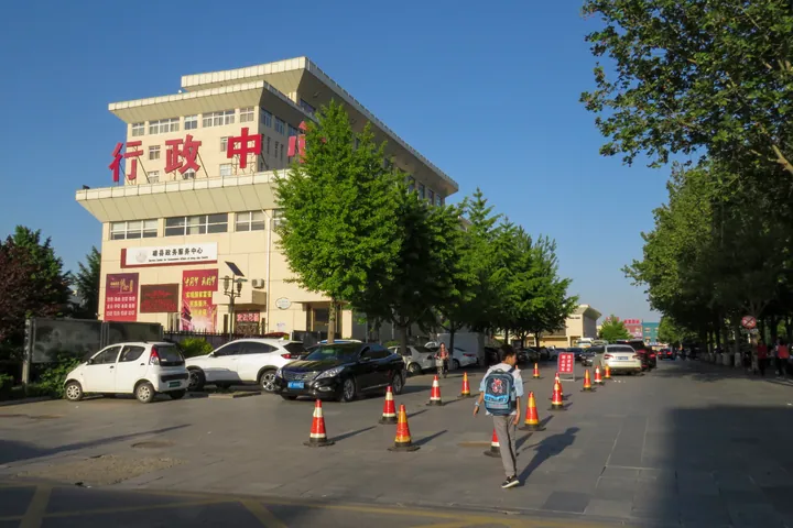
Photo adjustments
Full frame retained; proportionally resized and converted to WebP. No retouching or changes to the photographed subject. Card displays may crop the view.
- Administrative area
- County · 县
- Part of
- Baoding
- Chinese name
- 雄县
- Local areas
- County guide
Setting and landscape
The county lies on the lower reaches of the Juma River (拒马河). The land is flat, 8 to 14 metres above sea level, and slopes gently from north-west to south-east. Baiyangdian, a freshwater lake that holds water all year, is 4 kilometres from the county town, and Anxin County (安新县) faces Xiongxian across it.
Hot water lies under almost half the county: the county government puts the bedrock geothermal field at 320 square kilometres, with water coming out at 55 to 88 °C. Xiongxian was named a "hometown of hot springs in China" (中国温泉之乡) in 2006 and 2011, and its geothermal heating scheme made it, in the county's words, North China's first smoke-free city in winter.
History
In 694 BC the State of Yan (燕) moved its capital to Linyi (临易), at today's Guxian village (古贤村) in Rongcheng County (容城县); the Han-dynasty Yi County (易县) was governed from the same village, 6 kilometres north-west of the present town. The name comes from 959, when Emperor Shizong of the Later Zhou (后周) took the Waqiao Pass (瓦桥关) back from the Liao and set up Xiongzhou (雄州) there. The Tang-era Guiyi County (归义县) was split along the Baigou River (白沟河), with the south under the Song and the north under the Liao. Xiongzhou was reduced to Xiong County in 1374 under the Ming.
That frontier left the border tunnels (边关地道遗址), underground passages dug in the early Northern Song against Liao raids. Found in the mid-20th century in Xiongxian and four other counties, they became a national key protected site in 2006, and a Song–Liao ancient tunnel ruins park (宋辽古地道遗址公园) has been set up in Xiongxian.
Music and martial arts
Xiongxian ancient music (雄县古乐), a form of central Hebei wind-and-percussion music, joined the national intangible heritage list in 2008. It belongs to the "northern music" branch, dates back to the Song and Yuan, and is kept alive by four village music societies at Yaguchen (亚古城), Kaikou (开口), Zhaogang (赵岗) and Duzhuang (杜庄). The music is written in gongche notation (工尺谱) and led by large and small guan pipes (管), with sheng mouth organs, flutes and the yunluo gong set (云锣). Xiongxian eagle-claw fanzi boxing (雄县鹰爪翻子拳) is also on the national list.
Getting oriented
The county town lies 108 kilometres south of Beijing, 100 kilometres west of Tianjin (天津) and 70 kilometres east of Baoding. Xiong'an railway station (雄安站) is in Zangang (昝岗镇), and the Tianjin–Baoding Railway (津保铁路) and the Beijing–Xiong'an intercity railway (京雄城际铁路) serve the county.
Highlights
- Baiyangdian 白洋淀: Freshwater lake 4 km from the county town.
- Song–Liao border tunnels 边关地道遗址: Early Northern Song defence tunnels against the Liao; national key protected site since 2006.
- Xiongxian ancient music 雄县古乐: Wind-and-percussion music kept by four village societies; national intangible heritage since 2008.
- Eagle-claw fanzi boxing 雄县鹰爪翻子拳: A martial art on the national intangible-heritage list.
Sources for this guide
雄县人民政府网——雄县概况 · Xiongxian People's Government
雄县人民政府网——自然地理 · Xiongxian People's Government
雄县人民政府网——历史沿革 · Xiongxian People's Government
冀中笙管乐(雄县古乐) - 中国非物质文化遗产网·中国非物质文化遗产数字博物馆 · China Intangible Cultural Heritage Network (ihchina.cn)
雄县 - 维基百科,自由的百科全书 · Wikipedia (Chinese) · CC BY-SA 4.0
边关地道遗址 - 维基百科,自由的百科全书 · Wikipedia (Chinese) · CC BY-SA 4.0
Original English written from the listed sources and checked sentence by sentence against quoted extracts by a separate reviewer. Updated 2026-09-24.
Explore Xiongxian
Core places to explore, with English and Chinese names.
Plan your visit
Getting there
Xiongxian is about 55 km in a straight line from central Baoding. Search for 雄县 in a map app to find stations and your accommodation.
Where to stay →More in Baoding
Sources & geographic information
Administrative names and parent areas: Official geographic directory · Reference date 2026-09-06.
Some facts checked against 雄县 — Wikipedia contributors, CC BY-SA 4.0.
Some facts checked against 边关地道遗址 — Wikipedia contributors, CC BY-SA 4.0.
Map data © OpenStreetMap contributors. Pins mark approximate centres, not entrances or boundaries.