


Get to know Shenzhou
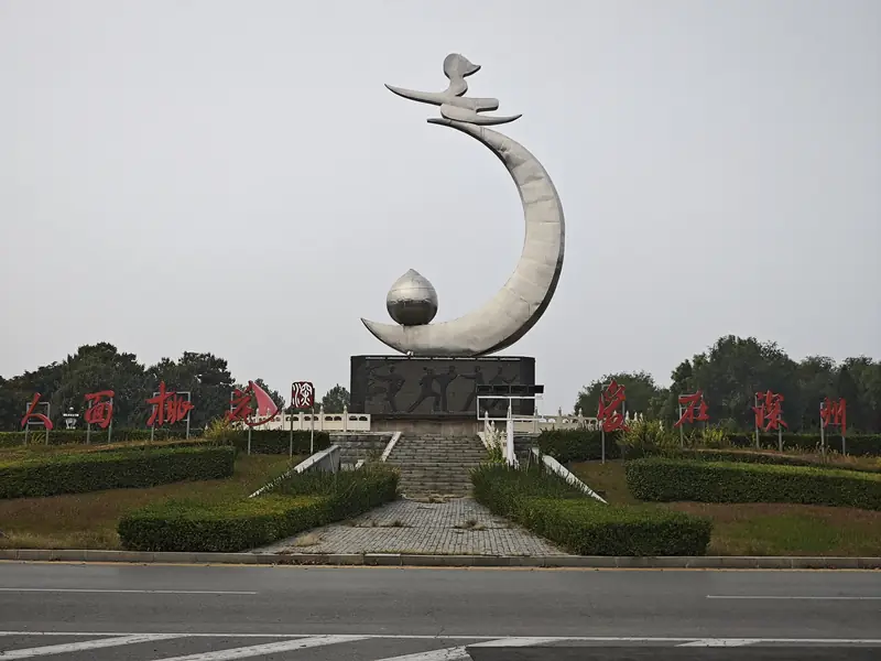
Photo adjustments
EXIF orientation normalized; resized without changing aspect ratio; converted to WebP. No subject edits.
- Administrative area
- County-level city · 县级市
- Part of
- Hengshui
- Chinese name
- 深州市
- Local areas
- County-level city guide
Area & population
- Area in the source
- 1,252.00 km²
- Population · 2017
- 613,000
Source: cited geographic source, as of the dates shown.
History
Shenzhou prefecture was first created in 596, under the Sui; the Yuanhe Junxian Tuzhi (元和郡县图志) records that it was named after the old walled town of Shen (深城) to its west. In 1412 the prefectural seat moved to Wujiazhuang (吴家庄), the site of today's city, and in 1724 the Qing raised Shenzhou to a directly administered prefecture over Wuqiang (武强), Raoyang (饶阳) and Anping. It became Shen County in 1913 and the city of Shenzhou on 4 July 1994.
Xinhua gives the old name as Boling (博陵). Wikipedia calls the city the birthplace of Xingyiquan (形意拳), a boxing style on the national intangible heritage list, and martial-arts meets are held here every year.
What to see
The Yingyi Charity Granary (盈亿义仓) in Shenzhou town was built in 1898 as a northern courtyard compound in two parts, offices in the east yard and storage in the west, with 51 rooms that could hold more than 26,000 shi of grain. It became a national protected site in 2013, and since a restoration from 2014 to 2019 it has housed the Shenzhou Granary Museum (深州市粮仓博物馆), with five themed exhibitions on grain growing, food and granary systems.
The Dadechang money shop (大德昌钱庄) is a provincial protected site; Shenzhou's mayor, speaking to Xinhua, says it records the town's prosperity under the Qing. The Xingyiquan Culture Town (形意拳小镇) has a Xingyiquan culture park, the former home of Li Laoneng (李老能) and a practice ground. Wikipedia also lists Xinglong Temple (兴隆寺) among the main sights. In the urban area, some 800 mu of the old city moat remain as open water.
Food and local products
The Shenzhou honey peach (深州蜜桃) has been grown for more than 2,000 years, was sent to successive courts as tribute and is nicknamed the "king of peaches". The Peach Sightseeing Garden (蜜桃观光园) is a national 3A scenic area, and the orchards flower in early April. The city's other national geographical-indication products include Shenzhou yellow chives (深州黄韭), Shenzhou Ya pears (深州鸭梨) and Shenzhou black pigs (深州黑猪). Shenzhou also has an old pear orchard that the mayor describes as a thousand years old.
Highlights
- Yingyi Charity Granary 盈亿义仓: Courtyard granary built in 1898 with 51 rooms, a national protected site since 2013 and now the Shenzhou Granary Museum.
- Shenzhou honey peach 深州蜜桃: Grown for more than 2,000 years and once sent as tribute; nicknamed the king of peaches.
- Peach Sightseeing Garden 蜜桃观光园: National 3A scenic area among the peach orchards, in flower in early April.
- Xingyiquan Culture Town 形意拳小镇: Xingyiquan culture park, the former home of Li Laoneng and a practice ground.
Sources for this guide
深州市 - 维基百科,自由的百科全书 · Chinese Wikipedia · CC BY-SA 4.0
深州盈亿义仓 - 维基百科,自由的百科全书 · Chinese Wikipedia · CC BY-SA 4.0
“人面桃花 爱在深州” 深州市亮相《300秒看家乡》-新华网 · Xinhua News Agency (xinhuanet.com)
“国保”河北深州盈亿义仓变身粮仓博物馆正式对外开放——人民政协网 · CPPCC Daily Online (from China News Service)
“文旅融合”为全域旅游画卷添彩 _ 河北省文化和旅游厅 · Hebei Provincial Department of Culture and Tourism (reprinting Hebei Daily)
衡水市人民政府 行政建制 · Hengshui Municipal People's Government
Original English written from the listed sources and checked sentence by sentence against quoted extracts by a separate reviewer. Updated 2026-09-24.
Explore Shenzhou
Core places to explore, with English and Chinese names.
Plan your visit
Getting there
Shenzhou is about 30 km in a straight line from central Hengshui. Search for 深州市 in a map app to find stations and your accommodation.
Where to stay →More in Hengshui
Sources & geographic information
Administrative names and parent areas: Official geographic directory · Reference date 2026-09-06.
Some facts checked against 深州市 — Wikipedia contributors, CC BY-SA 4.0.
Some facts checked against 深州盈亿义仓 — Wikipedia contributors, CC BY-SA 4.0.
Map data © OpenStreetMap contributors. Pins mark approximate centres, not entrances or boundaries.