


Get to know Sanhe
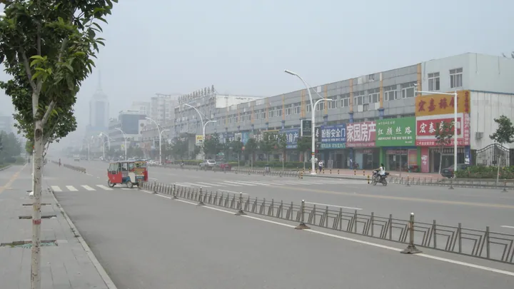
Photo adjustments
Full frame retained; proportionally resized and converted to WebP. No retouching or changes to the photographed subject. Card displays may crop the view.
- Administrative area
- County-level city · 县级市
- Part of
- Langfang
- Chinese name
- 三河市
- Local areas
- County-level city guide
Area & population
- Area in the source
- 643.00 km²
- Population · 2020
- 965,075
Source: cited geographic source, as of the dates shown.
Setting and landscape
Sanhe sits on the plain at the foot of the Yan Mountains (燕山), high in the north and sloping south. Most of it is plain built from the alluvial fans of the Chaobai and Jiyun (蓟运河) rivers, 6 to 32 metres above sea level, with waterlogged hollows in the southeast. The northeast rises into low hills: the Jiangfu Mountain (蒋福山) basin at about 200 metres, ringed by Longmen Mountain (龙门山) and Qinglong Mountain (青龙山) at up to 458 metres. Orchards on these hills grow apples, walnuts, persimmons and jujubes. The climate is warm-temperate continental, with a mean of 11.1°C.
History
Neolithic finds at Menggezhuang (孟各庄) and Liubaita (刘白塔村) villages show early settlement. Under the Western Han the area lay in Lu County (路县). The Tang briefly created Linju County (临泃县), named for its position on the Ju River, in 619, and in 716 formed Sanhe County from the eastern part of Lu County. In 936 Sanhe passed to the Khitan with the Sixteen Prefectures. The Kangxi Emperor of the Qing built a travelling palace at Yanjiao (燕郊). The county was merged into Ji County (蓟县) in 1958, restored in 1962 and became a county-level city under Langfang in 1993.
What to see
The city government groups its scenery into four areas: Lingshan (灵山), Jiangfu Mountain, the Ju River and the Chaobai River. Named sights include the Lingshan Liao Pagoda (灵山辽塔) and Lingshan Temple (灵山寺), Longtan Gorge (龙潭峡谷) and Yixiantian (一线天), 'a thread of sky'. The government also notes that 22 square kilometres of abandoned mine land have been turned into woodland and flower fields. In the Yanjiao high-tech zone, Mengdongfang Future World (梦东方未来世界) is a space-themed amusement park rated 4A.
Getting oriented
The city seat is Juyang (泃阳镇). The city government puts Sanhe 30 kilometres from Tiananmen and 25 kilometres from Beijing Capital International Airport. The Beijing–Tangshan intercity railway, opened in December 2022, has a station at Yanjiao, and the Jingping, Jingqin, Beijing–Harbin and Capital Region Ring expressways surround the city.
Highlights
- Lingshan Liao Pagoda 灵山辽塔: Named by the city government among the sights of the Lingshan scenic area.
- Jiangfu Mountain 蒋福山: Hill basin in the northeast, one of Sanhe's four scenic areas.
- Mengdongfang Future World 梦东方未来世界: Space-themed 4A amusement park in the Yanjiao high-tech zone.
Sources for this guide
地理三河 - 三河市人民政府 · Sanhe Municipal People's Government (Natural Resources and Planning Bureau)
历史沿革 - 三河市人民政府 · Sanhe Municipal People's Government
自然资源 - 三河市人民政府 · Sanhe Municipal People's Government (Natural Resources and Planning Bureau)
投资环境 - 三河市人民政府 · Sanhe Municipal People's Government (Investment Promotion Centre)
梦东方未来世界 - 廊坊市人民政府 · Langfang Municipal People's Government (Culture and Tourism Bureau)
Original English written from the listed sources and checked sentence by sentence against quoted extracts by a separate reviewer. Updated 2026-09-24.
Explore Sanhe
Core places to explore, with English and Chinese names.
Plan your visit
Getting there
Sanhe is about 65 km in a straight line from central Langfang. Search for 三河市 in a map app to find stations and your accommodation.
Where to stay →More in Langfang
Sources & geographic information
Administrative names and parent areas: Official geographic directory · Reference date 2026-09-06.
Map data © OpenStreetMap contributors. Pins mark approximate centres, not entrances or boundaries.