


Get to know Heshan District
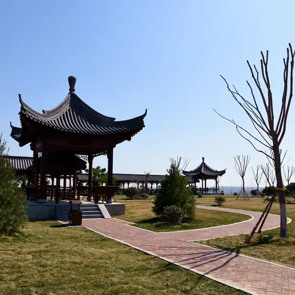
Photo adjustments
EXIF orientation normalized; resized without changing aspect ratio; converted to WebP. No subject edits.
- Administrative area
- District · 市辖区
- Part of
- Hebi
- Chinese name
- 鹤山区
- Local areas
- District guide
Area & population
- Area in the source
- 159.00 km²
- Population · 2019
- 129,800
Source: cited geographic source, as of the dates shown.
Setting and landscape
The district borders Linzhou (林州) and Anyang County (安阳县) to the west and north and Shancheng District (山城区) to the east and south. Its main rivers are the Tang (汤河), the You (羑河), the Jinxian (金线河), the Huan (洹河) and the Xinzhuang (新庄河); the last two only pass through. Coal is the main mineral. Huangmiaogou Forest Park (黄庙沟森林公园), in the western hills of Jijiashan Township (姬家山乡), holds medicinal plants such as polygala, bupleurum and Rabdosia (冬凌草).
History
When Hebi was founded in 1957 to work its coalfield, the city party committee and government sat first at Hebiji (鹤壁集) and then at Zhongshan (中山), both now in Heshan. The district itself was created on 18 December 1961 out of the Heshan Coal Mine People's Commune, and in May 1998 the rural townships of Hebiji and Jijiashan were added to it. Along the You River at Hebiji lies the Hebi kiln (鹤壁窑), a folk pottery centre of the Cizhou (磁州窑) tradition that fired from the late Tang to the Yuan, over 500 years; it has been a provincial protected site since 1963. The district government also points to a Song-dynasty coal-mining site at Gulouhe village (古楼河村).
What to see
Wuyan Mountain (五岩山), 574.4 metres high and 8 kilometres northwest of the old city, is where the Tang physician Sun Simiao (孙思邈) is said to have lived in his last years and written his two Qianjin (千金) medical books. His cave home, Yaowang Cave (药王洞), is a natural stalactite cave 500 metres long, and the Eastern Wei grottoes of Wuyan Temple (五岩寺) are provincially protected. Adou Zhai (阿斗寨) at Hebiji is named after Liu Shan (刘禅, nicknamed Adou), last ruler of Shu Han, who is said to have lived there. In Jijiashan, Wangjiachan village (王家辿村) was named one of the first Chinese traditional villages in December 2012, and the district government describes the plant-fossil beds at Dongqi (东齐) as the largest in China.
Getting oriented
Heshan lies 27 kilometres south of Anyang, 23 kilometres west of Tangyin (汤阴) county town and 30 kilometres north of the Qibin (淇滨) development area. Hebi North Station, in the district, is the city's only first-class freight station.
Highlights
- Wuyan Mountain 五岩山: 4A scenic area linked to Sun Simiao, with a 500-metre stalactite cave and Eastern Wei grottoes.
- Hebi kiln site 鹤壁窑遗址: Cizhou-tradition folk kilns on both banks of the You River, fired from the late Tang to the Yuan; provincially protected since 1963.
- Adou Zhai 阿斗寨: 4A scenic area at Hebiji named after the Shu Han ruler Liu Shan.
- Wangjiachan village 王家辿村: Listed in the first batch of Chinese traditional villages in 2012.
Sources for this guide
鹤山概况 · Heshan District People's Government, Hebi
国家4A级旅游景区五岩山 · Heshan District People's Government, Hebi
国家4A级旅游景区阿斗寨 · Heshan District People's Government, Hebi
鹤壁窑传习基地 · Heshan District People's Government, Hebi
姬家山乡 · Chinese Wikipedia · CC BY-SA 4.0
Original English written from the listed sources and checked sentence by sentence against quoted extracts by a separate reviewer. Updated 2026-09-24.
Explore Heshan District
Core places to explore, with English and Chinese names.
Heshan District 鹤山区
Plan your visit
Getting there
Heshan District is about 25 km in a straight line from central Hebi. Search for 鹤山区 in a map app to find stations and your accommodation.
Where to stay →More in Hebi
Sources & geographic information
Administrative names and parent areas: Official geographic directory · Reference date 2026-09-06.
Some facts checked against 姬家山乡 — Wikipedia contributors, CC BY-SA 4.0.
Map data © OpenStreetMap contributors. Pins mark approximate centres, not entrances or boundaries.