


Get to know Shancheng District
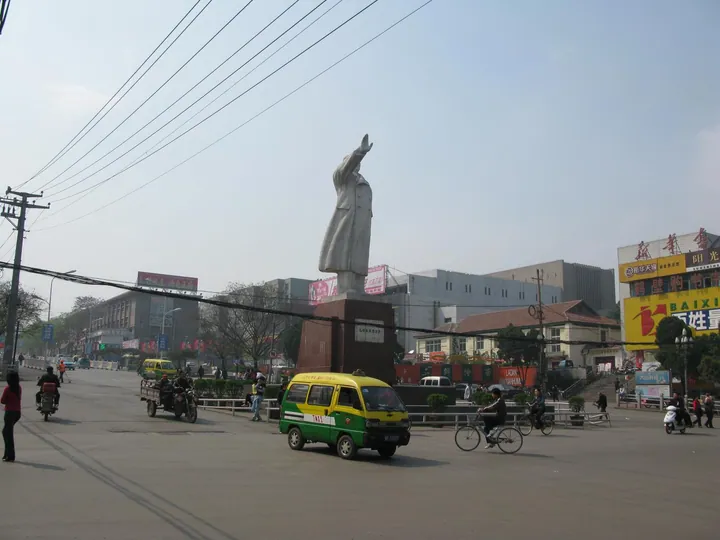
Photo adjustments
Full frame retained; proportionally resized and converted to WebP. No retouching or changes to the photographed subject. Card displays may crop the view.
- Administrative area
- District · 市辖区
- Part of
- Hebi
- Chinese name
- 山城区
- Local areas
- District guide
Area & population
- Area in the source
- 176.00 km²
- Population · 2019
- 242,800
Source: cited geographic source, as of the dates shown.
Setting and landscape
The district is low hill and ridge country, sloping from about 400 metres in the northwest to 150 metres in the southeast. It belongs to the Wei River (卫河) system of the Hai basin. Of its three rivers, the Tang (汤河), the Si (泗河) and the You (羑河), the Tang runs 18 kilometres through the district and through the town itself. Downstream, the former Tang River Reservoir, now Heming Lake (鹤鸣湖) in Shilin (石林), is a wetland of 568 hectares and a stopover on the central bird-migration route. Coal, cement limestone and dolomite are among some 30 minerals found here.
History
The district government places Zhongmou (中牟), capital of the Warring States kingdom of Zhao (赵) from 425 to 386 BC, around Guxian (故县) in Lulou (鹿楼). It also lists a Shang royal deer-park site, a Han iron-smelting site at Guxian, the Han tombs of Houying (后营) and a Song–Yuan kiln site at Siwan (寺湾). On 10 June 1947 Liu Bocheng (刘伯承) and Deng Xiaoping (邓小平), commander and political commissar of the Jin-Ji-Lu-Yu Field Army (晋冀鲁豫野战军), met their column commanders at Falong Temple (法隆寺) in Shilin and planned the army's thousand-li advance to the Dabie Mountains (大别山). The district was set up on 8 December 1961 from the Shancheng People's Commune. The city party and government offices moved here from Zhongshan (中山) in January 1959 and left for the new Qibin (淇滨) district in 1999.
What to see
The Shilin Conference Site (石林会议旧址), a 4A scenic area in Shilin, a provincial historic and cultural town, takes in Falong Temple, a memorial hall, a courtyard complex of the gentry Zhang Zhongren (张仲仁) begun in 1855, and an old cypress that Pingyuan Province named the first cypress of North China.
Shangshu Fu (尚书府) at Dahu village (大胡村) was begun in the Jiajing reign of the Ming and was the home of Li Sui (李燧), Minister of Works under the Hongzhi emperor, and of the Qing magistrate Li Shu (李塾). Water surrounds it on three sides, with the Tang River to the south. Five main courtyards stand side by side, with more than 1,500 rooms, carved brick screens and pottery roof beasts; locals call it the little Forbidden City, and it is a provincial protected site.
Highlights
- Shilin Conference Site 石林会议旧址: Falong Temple, where Liu Bocheng and Deng Xiaoping planned the 1947 advance to the Dabie Mountains.
- Shangshu Fu 尚书府: Ming–Qing Li family mansion at Dahu village with five parallel courtyards and over 1,500 rooms.
- Heming Lake 鹤鸣湖: Former Tang River Reservoir; a 568-hectare wetland on the central bird-migration route.
Sources for this guide
山城概况 · Shancheng District People's Government, Hebi
历史沿革 · Shancheng District People's Government, Hebi
自然环境 · Shancheng District People's Government, Hebi
石林会议旧址景区(AAAA级景区) · Shancheng District People's Government, Hebi
尚书府景区(AAA级景区) · Shancheng District People's Government, Hebi
鹤鸣湖景区(AAA级景区) · Shancheng District People's Government, Hebi
Original English written from the listed sources and checked sentence by sentence against quoted extracts by a separate reviewer. Updated 2026-09-24.
Explore Shancheng District
Core places to explore, with English and Chinese names.
Shancheng District 山城区
Plan your visit
Getting there
Shancheng District is about 15 km in a straight line from central Hebi. Search for 山城区 in a map app to find stations and your accommodation.
Where to stay →More in Hebi
Sources & geographic information
Administrative names and parent areas: Official geographic directory · Reference date 2026-09-06.
Map data © OpenStreetMap contributors. Pins mark approximate centres, not entrances or boundaries.