


Get to know Qi County
- Administrative area
- County · 县
- Part of
- Hebi
- Chinese name
- 淇县
- Local areas
- County guide
Area & population
- Area in the source
- 581.00 km²
- Population · 2019
- 279,000
Source: cited geographic source, as of the dates shown.
Setting and landscape
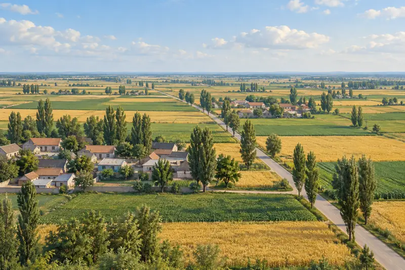
The county is named after the Qi River, which runs past the north and east of the county town and is shared with Xun County (浚县) on the east. Weihui (卫辉) lies to the south, Qibin District (淇滨区) to the north, and on the west the Taihang hills continue into Linzhou (林州).
History
Chinese Wikipedia names the Shang kings who ruled from Zhaoge as Wu Yi (武乙), Wen Ding (文丁), Di Yi (帝乙) and Di Xin (帝辛). After the Zhou conquest, Kangshu (康叔) received the fief of Wei (卫), whose capital stayed here for 403 years, and the Qi River appears again and again in the Book of Songs (诗经). The Hebi city government calls Qi County the birthplace of the Fengshen (封神, Investiture of the Gods) stories. Local tradition places two events at Zhaixintai (摘心台): the tearing out of Bi Gan's (比干) heart, and Di Xin's death by fire on the Deer Terrace. The county is a Henan provincial historic and cultural city, and the county town has a park on the site of the old Wei capital (卫国故城遗址公园).
What to see
Yunmeng Mountain (云梦山), 15 kilometres southwest of the county town on a spur at the eastern end of the Taihang, rises to 584 metres at Jianxiu Peak (剑秀峰). The Hebi city government calls it China's first ancient military academy, where the strategist Guiguzi (鬼谷子) taught Su Qin (苏秦), Zhang Yi (张仪), Sun Bin (孙膑), Pang Juan (庞涓) and Mao Sui (毛遂). His reputed retreat, Shuilian Cave (水帘洞), opens halfway up a cliff and is about 10 metres high, 50 metres wide and more than 80 metres deep, with a pool inside. The county gazetteer of 1545 already records the cave as where Guiguzi was traditionally said to have practised the Way, and an inscription of 1583 at the cave mouth names it his hermitage.
Food and local products
Seedless jujubes (无核枣) grow only around Lutai (鹿台) in the county's western hills. They are grafted onto wild sour jujube; cut open, the bright red fruit is hollow, with a soft stone that can be eaten. The Hebi city government says they were tribute under the Zhou and ranks them with Qi River crucian carp and chansi (缠丝蛋, "silk-wound") duck eggs as the three treasures of Qi County; in 1983 the Chinese Academy of Sciences named them soft-core honey jujubes.
Highlights
- Yunmeng Mountain 云梦山: Taihang spur 15 km southwest of town, linked with Guiguzi and his students; Shuilian Cave carries a 1583 inscription.
- Zhaixintai 摘心台: Traditional site of Bi Gan's death and the Deer Terrace of the last Shang king.
- Wei capital site park 卫国故城遗址公园: Park in the county town on the site of the old Wei capital.
- Seedless jujubes 无核枣: Hollow jujubes with an edible soft stone, grown only around Lutai.
Sources for this guide
淇县县委宣传部--河南频道--人民网 · People's Daily Online, Henan channel (Qi County party propaganda department column)
鹤壁概况 · Hebi Municipal People's Government
淇河三珍 · Hebi Municipal People's Government
鬼谷子与淇县云梦山(资料) · Qi River Culture Research Centre, Hebi Polytechnic
淇县 · Chinese Wikipedia · CC BY-SA 4.0
Original English written from the listed sources and checked sentence by sentence against quoted extracts by a separate reviewer. Updated 2026-09-24.
Explore Qi County
Core places to explore, with English and Chinese names.
Places to explore around Qi County
 Stone gate entrance to Yunmeng Mountain scenic area in Qi County, Hebi, with red lanterns and a chariot statue beyond · 鹤壁市淇县云梦山景区石砌大门,红灯笼与战车雕塑 Source-recorded photograph date: Taken on 22 January 2007.
Yunmeng Mountain云梦山
Yunmengshan is a scenic mountain area in Qi County, Hebi, on the Henan flank of the Taihang range, long associated in tradition with the Warring States strategist Guiguzi.
Read the place guide → AI illustration · AI 示意图(仅供参考,非该地点实拍)
Chaoyang Mountain朝阳山
Chaoyang Shan (朝阳山) is a hill about five kilometres west of the county town of Qi County, in Hebi, Henan, whose mid-slope carries Chaoyang Temple and a group of grottoes and cliff inscriptions protected as heritage.
Read the place guide →Plan your visit
Getting there
Qi County is about 20 km in a straight line from central Hebi. Search for 淇县 in a map app to find stations and your accommodation.
Where to stay →Build your route
Yunmeng Mountain and Chaoyang Mountain are both listed here. The linked place guides have entrance and visit details.
Continue with Hebi →More in Hebi
Sources & geographic information
Administrative names and parent areas: Official geographic directory · Reference date 2026-09-06.
Some facts checked against 淇县 — Wikipedia contributors, CC BY-SA 4.0.
Photo: Yunmeng Mountain · 山海风 · CC BY-SA 3.0. Full frame retained; proportionally resized and converted to WebP. No retouching or changes to the photographed subject. Card displays may crop the view.

Map data © OpenStreetMap contributors. Pins mark approximate centres, not entrances or boundaries.