


Get to know Fan County
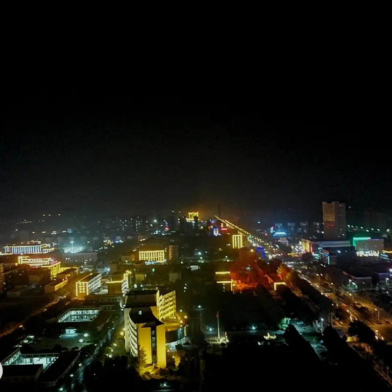
Photo adjustments
EXIF orientation normalized; resized without changing aspect ratio; converted to WebP. No subject edits.
- Administrative area
- County · 县
- Part of
- Puyang
- Chinese name
- 范县
- Local areas
- County guide
Area & population
- Population · 2019
- 447,900
Source: cited geographic source, as of the dates shown.
Setting and landscape
Both the Yellow River and the Jindi River (金堤河) cross the county, and its Yellow River frontage is 47 kilometres long. Chenzhuang town (陈庄镇) has a demonstration base of some 10,000 mu where lotus and loach are raised together.
History
The county was set up early in the Western Han, more than 2,200 years ago, and took its name from the Fan River (范水) running through its town. The county government places the battle of Chengpu (城濮之战) between Jin and Chu here, along with several stories of the Twenty-Four Filial Exemplars. Zheng Banqiao (郑板桥), one of the Eight Eccentrics of Yangzhou, served five years as magistrate.
During the war against Japan the county housed the party, government and army organs of the Hebei–Shandong–Henan Border Region (冀鲁豫边区) and was called a "little Yan'an" of north China. Fan belonged to Shandong from 1952 until April 1964, when the State Council moved it and its land south of the Jindi embankment to Henan to end a water dispute between the two provinces. The county town stayed 5 kilometres beyond the new border, surrounded by Shen County (莘县) in Shandong, an exclave. A new town was built south of the Jindi River from 1994, and the county offices moved there on 1 July 1997.
What to see
Two revolutionary sites are on the national list of protected monuments. The Border Region base site at Yancunpu village (颜村铺村), 6 kilometres east of the new town, was listed in 2006; its bank, field hospital and arsenal buildings were restored in 2013. At Baiyige village (白衣阁村), 3 kilometres south of the new town, the Shanxi–Hebei–Shandong–Henan Field Army held a meeting in October 1946 at which Deng Xiaoping spoke; that site was listed in 2019.
The Maolou Ecological Tourism Area (毛楼生态旅游区) at Maolou village is a national AAA scenic area and contains the Zheng Banqiao Memorial Hall (郑板桥纪念馆), built in Ming–Qing style, whose galleries cover his life and art. The Zhongyuan Lotus Garden (中原荷花园), also AAA, grows more than 100 kinds of ornamental lotus. Banqiao Ancient Town (板桥古镇) is a newly built quarter north of the Fan River with a county yamen and a Banqiao residence. The tomb site of Danzhu (丹朱), son of the legendary Emperor Yao, is a provincial protected site.
Food and local products
Fanxian rice (范县大米) is a protected geographical-indication product, and the county issued new rules for its protected mark in 2025. Chenzhuang's lotus base is described by the county as the largest green lotus-root production base north of the Yellow River.
Highlights
- Hebei–Shandong–Henan Border Region base site 冀鲁豫边区革命根据地(范县)旧址: Wartime seat of the Border Region party, government and army at Yancunpu village; national protected site since 2006.
- Baiyige Field Army headquarters site 晋冀鲁豫野战军指挥部(白衣阁)革命旧址: Site of an October 1946 military meeting addressed by Deng Xiaoping; national protected site since 2019.
- Maolou Ecological Tourism Area 毛楼生态旅游区: AAA Yellow River wetland area at Maolou village, with the Zheng Banqiao Memorial Hall inside.
- Zhongyuan Lotus Garden 中原荷花园: AAA scenic area in Chenzhuang town with more than 100 kinds of ornamental lotus.
- Fanxian rice 范县大米: Geographical-indication product protected under county rules revised in 2025.
Sources for this guide
范县简介-范县人民政府 · Fan County People's Government
历史沿革-范县人民政府 · Fan County People's Government
文化旅游资源-范县人民政府 · Fan County People's Government
政策解读--《范县大米地理标志产品保护管理办法》 · Fan County People's Government
Original English written from the listed sources and checked sentence by sentence against quoted extracts by a separate reviewer. Updated 2026-09-24.
Explore Fan County
Core places to explore, with English and Chinese names.
Fan County 范县
Plan your visit
Getting there
Fan County is about 45 km in a straight line from central Puyang. Search for 范县 in a map app to find stations and your accommodation.
Where to stay →More in Puyang
Sources & geographic information
Administrative names and parent areas: Official geographic directory · Reference date 2026-09-06.
Map data © OpenStreetMap contributors. Pins mark approximate centres, not entrances or boundaries.