


Get to know Puyang County
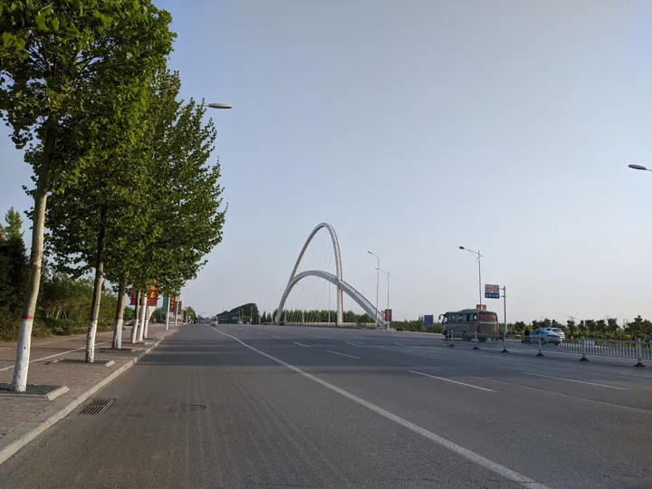
Photo adjustments
Full frame retained; proportionally resized and converted to WebP. No retouching or changes to the photographed subject. Card displays may crop the view.
- Administrative area
- County · 县
- Part of
- Puyang
- Chinese name
- 濮阳县
- Local areas
- County guide
Area & population
- Area in the source
- 1,455.00 km²
- Population · 2019
- 980,200
Source: cited geographic source, as of the dates shown.
Setting and landscape
The Yellow River runs for 61 kilometres through the county and the Jindi River (金堤河) for 37 kilometres. The river floodplain (滩区) covers 161 square kilometres across seven townships. Winters are cold and dry and summers hot, with most rain falling in the hot season.
History
The county government traces the area back to Zhuanxu (颛顼), one of the legendary Five Emperors, whose people flourished here with their capital at Diqiu (帝丘). In 629 BC Duke Cheng of Wei (卫成公) moved the capital of the state of Wei to Diqiu, and Wei ruled from there for 388 years, until Qin took it in 241 BC. The name Puyang, "north of the Pu", refers to Diqiu's position on the Pu River (濮水). Qin created Puyang County, which served as the seat of Dong Commandery (东郡).
Under the Five Dynasties and Song, because it held a strategic point on the Yellow River, Chanzhou (澶州) was raised in turn to higher ranks, including Kaide Prefecture (开德府); its seat was the walled town of Desheng (德胜城), and today's county town is Desheng's northern city. The Jin renamed Chanzhou as Kaizhou (开州), a name kept until the end of the Qing, and the name Puyang returned in 1914. When Puyang city was founded in September 1983 the county was dissolved; it was restored in June 1987.
What to see
Four national protected sites lie in the county. At Xishuipo (西水坡) in the county town, a dragon and a tiger laid out in shells, dating from the Yangshao period, were uncovered in 1987; the find is hailed as the "First Dragon of China". The Wei capital site (濮阳卫国故城), first called the Gaocheng site (高城遗址), lies south of Gaocheng village (高城村) in Wuxing township (五星乡) on the south bank of the Jindi River, an old Yellow River course. Excavation shows a walled town of about 9.16 million square metres in the Spring and Autumn and Warring States periods, and it was listed nationally in 2013. The other two are steles: the Tangwu Gong stele (唐兀公碑), which the county government says bears witness to the mingling of peoples, and the Huiluan stele (回銮碑), which records the Chanyuan Treaty (澶渊之盟) between the Song and the Liao.
Highlights
- Xishuipo 西水坡: Find-site of the Yangshao-period shell dragon and tiger uncovered in 1987, known as the First Dragon of China.
- Puyang Wei Capital Site 濮阳卫国故城: Walled town of about 9.16 million square metres at Gaocheng village, thought to be the Spring and Autumn capital of Wei; national protected site since 2013.
- Huiluan Stele 回銮碑: National protected stele recording the Chanyuan Treaty between Song and Liao.
- Tangwu Gong Stele 唐兀公碑: National protected stele described by the county as a witness to the mingling of peoples.
Sources for this guide
濮阳县情概况-濮阳县人民政府 · Puyang County People's Government
历史沿革-濮阳县人民政府 · Puyang County People's Government
自然地理-濮阳县人民政府 · Puyang County People's Government
濮阳卫国故城 · Wikipedia (Chinese) · CC BY-SA 4.0
Original English written from the listed sources and checked sentence by sentence against quoted extracts by a separate reviewer. Updated 2026-09-24.
Explore Puyang County
Core places to explore, with English and Chinese names.
Puyang County 濮阳县
Plan your visit
Getting there
Puyang County is about 6 km in a straight line from central Puyang. Search for 濮阳县 in a map app to find stations and your accommodation.
Where to stay →More in Puyang
Sources & geographic information
Administrative names and parent areas: Official geographic directory · Reference date 2026-09-06.
Some facts checked against 濮阳卫国故城 — Wikipedia contributors, CC BY-SA 4.0.
Map data © OpenStreetMap contributors. Pins mark approximate centres, not entrances or boundaries.