


Get to know Eastern District
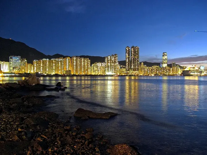
Photo adjustments
Full frame retained; proportionally resized and converted to WebP. No retouching or changes to the photographed subject. Card displays may crop the view.
- Administrative area
- District · 地區
- Part of
- Hong Kong
- Chinese name
- 東區
- Local areas
- District guide
Area & population
- Area in the source
- 18.90 km²
- Population · 2011
- 588,094
Source: cited geographic source, as of the dates shown.
History
People lived in the area by the Song dynasty at the latest, when ships sailing between Zhejiang, Fujian and Guangzhou sometimes put in at Chai Wan for water. Minnan (Hokkien) was the main early language, and many North Point and Quarry Bay families trace their roots to Fujian. Chai Wan, exposed to pirates, stayed undeveloped until after the Second World War, when the government built an industrial area and public housing there; the Island Eastern Corridor, opened between 1984 and 1991, then drove rapid growth.
What to see
At the island's northeast corner, overlooking the eastern entrance to Victoria Harbour, the old Lei Yue Mun Barracks (鯉魚門軍營) was one of the earliest British Army fortifications in Hong Kong. Built from 1890, it fell to Japanese forces on 19 December 1941 and was a training ground until 1987. Its central area and western ridge became Lei Yue Mun Park and Holiday Village in 1988, and the headland forts reopened in 2000 as the Museum of Coastal Defence. Block 7, officers' quarters of 1890 to 1895 with verandahs on three sides, was declared a monument in 2016.
In Chai Wan, Law Uk (羅屋), a Hakka village house more than 200 years old with a central hall behind a light well, was restored as a folk museum, completed in 1989. The district's other museums are the Hong Kong Film Archive (香港電影資料館) and the Fireboat Alexander Grantham Exhibition Gallery (葛量洪號滅火輪展覽館). The district also has the Oi! (油街實現) arts space, and the Hong Kong Tramways, built in 1904, run along King's Road and Shau Kei Wan Road to their Shau Kei Wan terminus.
Food and local products
Tai On Building (太安樓) is known for street snacks such as egg waffles, fish balls, cart noodles and siu mai, and Shau Kei Wan Main Street East (筲箕灣東大街) is listed among the island's well-known food streets.
Highlights
- Lei Yue Mun Barracks and Museum of Coastal Defence 鯉魚門軍營: British barracks built from 1890; the headland forts became the museum in 2000.
- Law Uk Folk Museum 羅屋: Hakka village house over 200 years old in Chai Wan, restored by 1989.
- Hong Kong Film Archive 香港電影資料館: One of four museums in the district.
- Shau Kei Wan Main Street East 筲箕灣東大街: One of Hong Kong Island's well-known food streets.
Sources for this guide
Block 7 of the old Lei Yue Mun Barracks, Chai Wan - Declared Monuments · Antiquities and Monuments Office, HKSAR Government
Law Uk, Chai Wan - Declared Monuments · Antiquities and Monuments Office, HKSAR Government
東區 (香港) - 維基百科 · Chinese Wikipedia · CC BY-SA 4.0
Original English written from the listed sources and checked sentence by sentence against quoted extracts by a separate reviewer. Updated 2026-09-25.
Explore Eastern District
Core places to explore, with English and Chinese names.
Places to explore around Eastern District
 Exterior of the Hong Kong Museum of Coastal Defence site · 香港海防博物馆馆址外观 Capture date not established by the retained file page.
Hong Kong Museum of Coastal Defence香港抗战及海防博物馆
The Hong Kong Museum of the War of Resistance and Coastal Defence occupies the former Lyemun Fort above the eastern harbour entrance. Galleries inside the redoubt connect coastal military structures with the wartime experience…
Read the place guide →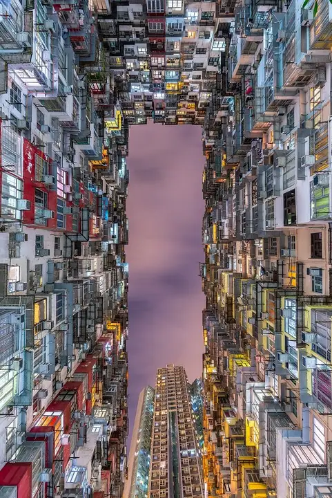 Upward view within Yick Cheong Building, Monster Building complex · 怪兽大厦益昌大厦仰视景观 Photograph date recorded by the source: 13 June 2019, 22:09.
Monster Building怪兽大厦
The group nicknamed the Monster Building comprises five interconnected residential buildings in Quarry Bay, including Yick Cheong and Yick Fat. Repeated windows and projecting residential units create the dense facade pattern…
Read the place guide →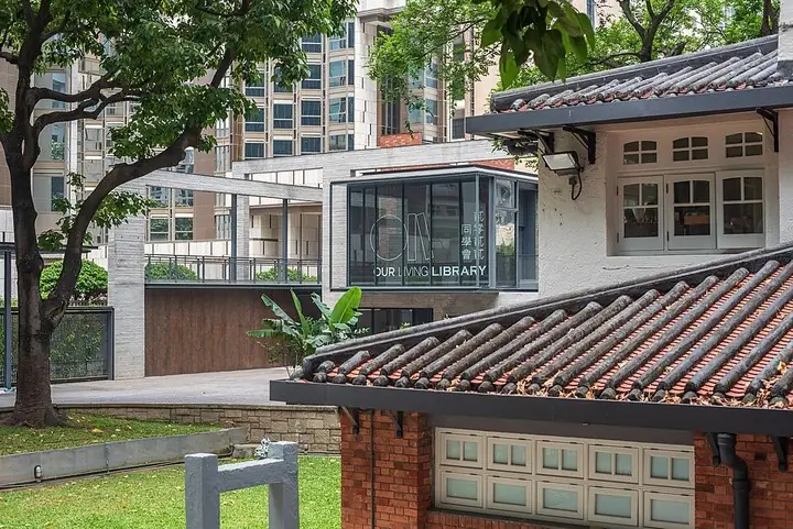 Historic Oi Art Space buildings and Oi Glassie extension · 油街实现历史建筑与油街玻璃屋 Photograph date recorded by the source: 21 April 2022, 12:36:11.
Oi! Art Space油街实现
Oi! combines a former yacht-club setting with newer spaces for contemporary art in North Point. The remodelled dockyard building, Oi! Warehouse, hosts exhibitions, while Oi! Glassie adds a contrasting glass, concrete and…
Read the place guide →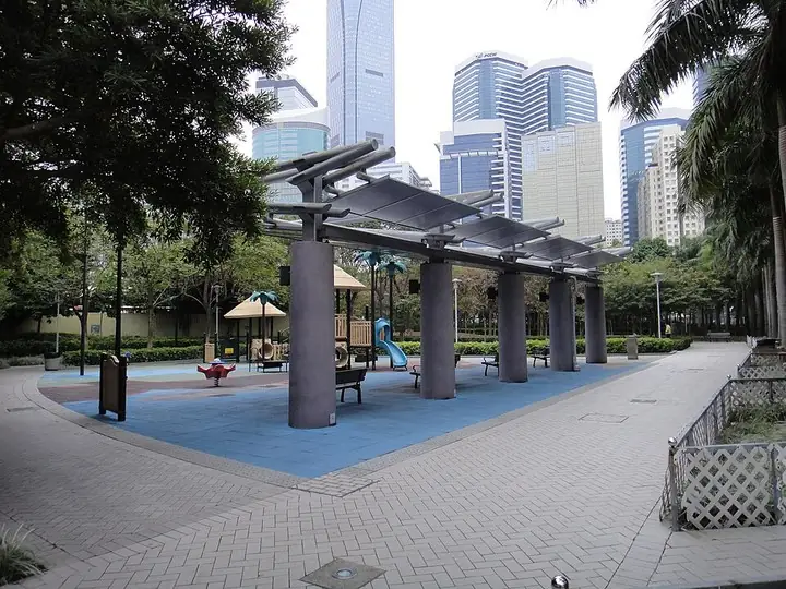 Playground and pergola in Quarry Bay Park · 鲗鱼涌公园游乐区与廊架 Capture date not established by the retained file page.
Quarry Bay Park鲗鱼涌公园
Quarry Bay Park stretches between the eastern harbourfront and the residential streets of Taikoo Shing. Its waterfront gives a different perspective from Central’s familiar skyline, while the retired fireboat Alexander Grantham…
Read the place guide →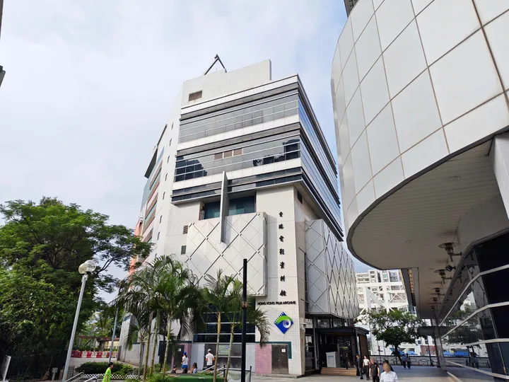 The Hong Kong Film Archive building in Sai Wan Ho, Eastern District · 东区西湾河香港电影资料馆大楼 Source-recorded photograph date: 2026-05-10 16:57:15.
Hong Kong Film Archive香港电影资料馆
The Hong Kong Film Archive in Sai Wan Ho preserves the city’s cinema history through films and related material.
Read the place guide → Quarry Bay and Taikoo Industrial Heritage · 鰂鱼涌历史街区与太古船坞遗产
Quarry Bay and Taikoo Industrial Heritage鰂鱼涌历史街区与太古船坞遗产
Quarry Bay on eastern Hong Kong Island grew around industry as well as housing.
Read the place guide →Plan your visit
Getting there
Eastern District is about 7 km in a straight line from central Hong Kong. Search for 東區 in a map app to find stations and your accommodation.
Where to stay →Build your route
Hong Kong Museum of Coastal Defence and Monster Building are about 2 km apart in a straight line. The linked place guides have entrance and visit details.
Continue with Hong Kong →More in Hong Kong
Sources & geographic information
Administrative names and parent areas: Official geographic directory · Reference date 2026-09-06.
Some facts checked against 東區 (香港) — Wikipedia contributors, CC BY-SA 4.0.
Photo: Hong Kong Museum of Coastal Defence · Gp03dhk at English Wikipedia · Gp03dhk at English Wikipedia — Hong_Kong_Museum_of_Coastal_Defence.JPG — Public domain · Public domain. The exact downloaded source bytes are separately retained and hashed. Prepared JPEG is proportionally reduced to a maximum 720-pixel long edge; full frame retained, no subject alteration. Final website rendition: full frame retained, proportionally resized to at most 720 pixels and converted to WebP. No additional retouching or subject alteration. Card displays may crop the view.


Photo: Monster Building · Benh LIEU SONG (Flickr) · Benh LIEU SONG (Flickr) — Looking_upward_at_the_Yick_Cheong_Building,_13_June_2019.jpg — CC BY-SA 4.0 · CC BY-SA 4.0. The exact downloaded source bytes are separately retained and hashed. Prepared JPEG is proportionally reduced to a maximum 720-pixel long edge; full frame retained, no subject alteration. Final website rendition: full frame retained, proportionally resized to at most 720 pixels and converted to WebP. No additional retouching or subject alteration. Card displays may crop the view.

Photo: Oi! Art Space · Oil Street Art Space · Oil Street Art Space — Grade_II_historic_building_Oi!_with_its_new_extension.jpg — CC BY-SA 4.0 · CC BY-SA 4.0. The exact downloaded source bytes are separately retained and hashed. Prepared JPEG is proportionally reduced to a maximum 720-pixel long edge; full frame retained, no subject alteration. Final website rendition: full frame retained, proportionally resized to at most 720 pixels and converted to WebP. No additional retouching or subject alteration. Card displays may crop the view.

Photo: Quarry Bay Park · HK Arun · HK Arun — Quarry_Bay_Park_1.JPG — CC BY-SA 3.0 · CC BY-SA 3.0. The exact downloaded source bytes are separately retained and hashed. Prepared JPEG is proportionally reduced to a maximum 720-pixel long edge; full frame retained, no subject alteration. Final website rendition: full frame retained, proportionally resized to at most 720 pixels and converted to WebP. No additional retouching or subject alteration. Card displays may crop the view.

Photo: Hong Kong Film Archive · Tombus20032000 · CC BY-SA 4.0. Full frame retained; proportionally resized and converted to WebP. No retouching or changes to the photographed subject. Card displays may crop the view.

Photo: Quarry Bay and Taikoo Industrial Heritage · Source photographer · License not provided. EXIF orientation normalized; resized without changing aspect ratio; converted to WebP. No subject edits.
Map data © OpenStreetMap contributors. Pins mark approximate centres, not entrances or boundaries.