


Get to know Baokang County
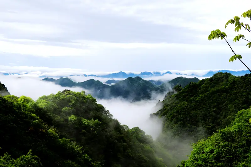
Photo adjustments
EXIF orientation normalized; resized without changing aspect ratio; converted to WebP. No subject edits.
- Administrative area
- County · 县
- Part of
- Xiangyang
- Chinese name
- 保康县
- Local areas
- County guide
Area & population
- Area in the source
- 3,225.00 km²
- Population · 2020
- 223,622
Source: cited geographic source, as of the dates shown.
Setting and landscape
Local shorthand calls the county eight parts mountain, one part water and one part field. The Jingshan divide crosses the middle of the county from west to east: south of it the mountains are gentler and the valleys wider, while to the north they are higher and the valleys narrower. The average elevation is 910 metres, ranging from 194 metres at Fengqiao (枫桥) in Guoduwan (过渡湾) to 2,000 metres at Oudianguan Mountain (欧店关山). The main rivers include the Nan River (南河), the Ju River (沮河) and the Man River (蛮河), and a local saying holds that the climate changes with every zhang (about three metres) of height and between sunny and shady slopes.
History
The county government presents Baokang as the source of the Chu state and its culture, stating that 350 of Chu's 800 years were spent in the Jing Mountains around Baokang. Chaoyuan Mountain (朝元山) in Liangyu township (两峪乡), a Taoist site with a 1,469.4-metre main peak, was first built up in 477 under the Northern Wei, flourished in the Qing Tongzhi reign and is known as the 'Middle Wudang'. The former residence of Wu Defeng (吴德峰故居) at Baizhu village (白竹村) in Xiema (歇马镇), a late-Qing manor house with two halls and four courtyards, is a Hubei provincial key protected site; Wu, born there, later became the first mayor of Wuhan.
What to see
Baokang has five national AAAA scenic areas. Wudao Gorge (五道峡), a national nature reserve in Houping (后坪镇), takes its name from five natural passes, and legend says Bian He (卞和) of Chu found a fine jade here. Jiuluzhai (九路寨) in Xiema is a karst landscape at an average 1,200 metres with Chuwang Peak (楚王峰) and Huanglong Cave (黄龙洞). Yaozhihe (尧治河), at the junction of Baokang, Shennongjia and Fang County, lies at 1,300–1,500 metres and has a phosphate-mining museum. Hengchong (横冲), on the main peak of the Jing Mountains, averages 1,700 metres with a 1,949-metre summit and over 92 percent forest cover, and has a ski slope. Liuzhuya (六柱垭) at Huanglongguan village (黄龙观村) in Maqiao (马桥镇) rises to 1,525 metres.
In the county town, the Chinese Crape Myrtle Grove (中华紫薇林) holds more than 5,000 crape myrtle trees over a century old, the oldest put at 1,500 years; the trees flower from June to September.
Highlights
- Wudao Gorge 五道峡: AAAA scenic area and national nature reserve named for five natural passes; linked in legend to Bian He's jade.
- Jiuluzhai 九路寨: AAAA karst scenic area in Xiema at an average 1,200 metres.
- Hengchong 横冲: AAAA area on the main peak of the Jing Mountains, summit 1,949 metres, with a ski slope.
- Chaoyuan Mountain 朝元山: Taoist mountain first built up in 477, known as the 'Middle Wudang'.
- Chinese Crape Myrtle Grove 中华紫薇林: Over 5,000 century-old crape myrtles, the oldest put at 1,500 years.
Explore Baokang County
Core places to explore, with English and Chinese names.
Places to explore around Baokang County
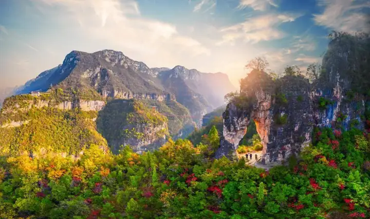 Jiuluzhai Scenic Area · 九路寨
Jiuluzhai Scenic Area九路寨
Jiuluzhai (九路寨) is an ecological tourism area in the southwest of Baokang County, Xiangyang, Hubei, set on cliff-walled high ground in the Jingshan range at an average elevation of more than 1,200 metres.
Read the place guide →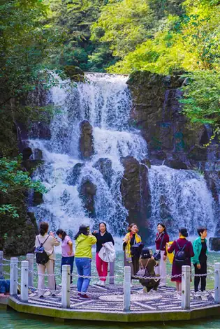 Wudao Gorge · 五道峡
Wudao Gorge五道峡
Wudaoxia (五道峡) is a gorge in Houping township, Baokang County, Xiangyang, Hubei, and the visitor focus of the Hubei Wudaoxia National Nature Reserve that takes its name from it.
Read the place guide →Plan your visit
Getting there
Baokang County is about 95 km in a straight line from central Xiangyang. Search for 保康县 in a map app to find stations and your accommodation.
Where to stay →Build your route
Jiuluzhai Scenic Area and Wudao Gorge are both listed here. The linked place guides have entrance and visit details.
Continue with Xiangyang →More in Xiangyang
Sources & geographic information
Administrative names and parent areas: Official geographic directory · Reference date 2026-09-06.
Photo: Jiuluzhai Scenic Area · Source photographer · License not provided. EXIF orientation normalized; resized without changing aspect ratio; converted to WebP. No subject edits.
Photo: Wudao Gorge · Source photographer · License not provided. EXIF orientation normalized; resized without changing aspect ratio; converted to WebP. No subject edits.
Map data © OpenStreetMap contributors. Pins mark approximate centres, not entrances or boundaries.