


Get to know Gucheng County
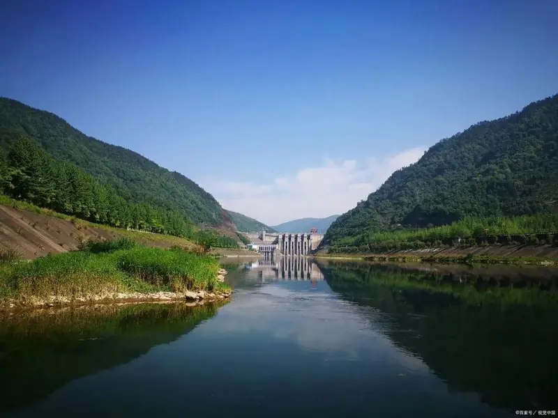
Photo adjustments
EXIF orientation normalized; resized without changing aspect ratio; converted to WebP. No subject edits.
- Administrative area
- County · 县
- Part of
- Xiangyang
- Chinese name
- 谷城县
- Local areas
- County guide
Area & population
- Area in the source
- 2,553.00 km²
- Population · 2020
- 483,293
Source: cited geographic source, as of the dates shown.
Setting and landscape
The county government describes a C-shaped terrain opening to the north-east, falling in three steps from the south-west. The top is Qinglong Mountain (青龙山), 1,584 metres, in Zhaowan township (赵湾乡); the lowest point, 71 metres, is at Jiudaowan (九道湾) in Cihe town (茨河镇). The south-west is steep karst mountain country cut by V-shaped valleys; the middle band of rounded mountains reaches 1,099 metres at Nü'er Peak (女儿峰) in the Xieshan (薤山) forest; the north-east is low ridged hills and small plains along the Han and the lower South and North rivers (南河、北河).
History
The county was the seat of the ancient state of Gu (谷国). A Qianlong-era gazetteer quoted by Chinese Wikipedia places Gu Mountain (谷山), with the tomb of the Earl of Gu on top and the old Gu city below, ten li north-west of the county town. In June 1930 the Communist county committee moved into the summer villas on Mount Xieshan, and the Gucheng County soviet was founded there on 5 October 1931. In April 1939 the Party's north-west Hubei committee moved to the lower street of Cihe; it was active in Gucheng for nearly two years and set up the North Hubei Hand-Spinning Training Institute (鄂北手纺织训练所) there.
What to see
Chengen Temple (承恩寺), a national key protected site, stands below Lion Peak (狮子峰) on the north side of Wuduo Mountain (五朵山) in Cihe town, 35 kilometres from the county town. The county government dates it to the Sui dynasty; of more than 200 halls and rooms, over 70 survive, and a bronze bell of ten thousand jin inscribed with Sanskrit is described as the largest surviving in Hubei.
Shenya Catholic Church (沈垭天主教堂) in Zijin town (紫金镇) was founded in 1723 and by 1731 was the mother church for north-west Hubei. In 1879 the Italian priest Nanxi (南熙) built a Western-style church, seminary and orphanage at Mupan Mountain (木盘山).
The Nanhe Little Three Gorges (南河小三峡), a national 3A scenic area in Nanhe town (南河镇) 23 kilometres south-west of the county town, follows the South River (南河) for more than 30 kilometres through karst gorges. The river rises in Shennongjia (神农架) and is also called Fenshui (粉水), "powder water", after a legend of the face powder of Xiao He's (萧何) wife. The name "Little Three Gorges" for the Mafei, Shennü and Wulong gorges was in use by 1792, and the Nanhe dam has turned the gorge into a lake.
Highlights
- Chengen Temple 承恩寺: National key protected site below Lion Peak in Cihe town, with a Sanskrit-inscribed bronze bell of ten thousand jin.
- Shenya Catholic Church 沈垭天主教堂: Founded in 1723; mother church of north-west Hubei by 1731; Western-style church built in 1879.
- Nanhe Little Three Gorges 南河小三峡: National 3A scenic area on the South River, 23 km south-west of the county town, called the "Little Three Gorges" by 1792.
- Xieshan revolutionary sites 薤山革命旧址群落: Former county committee, soviet government and Red Army guerrilla headquarters in the Xieshan summer villas, 26 km south-west of the county town.
Sources for this guide
地形地貌 - 谷城县人民政府门户网站 · Gucheng County People's Government
文化遗产 - 谷城县人民政府门户网站 · Gucheng County People's Government
南河小三峡 - 谷城县公共资源交易网 · Gucheng County Public Resources Trading Centre (county government site)
开启创4A征程!谷城首个国家3A级旅游景区有望升级 - 湖北日报新闻客户端 · Hubei Daily
谷城县 - 维基百科,自由的百科全书 · Wikipedia (Chinese) · CC BY-SA 4.0
Original English written from the listed sources and checked sentence by sentence against quoted extracts by a separate reviewer. Updated 2026-09-24.
Explore Gucheng County
Core places to explore, with English and Chinese names.
Places to explore around Gucheng County
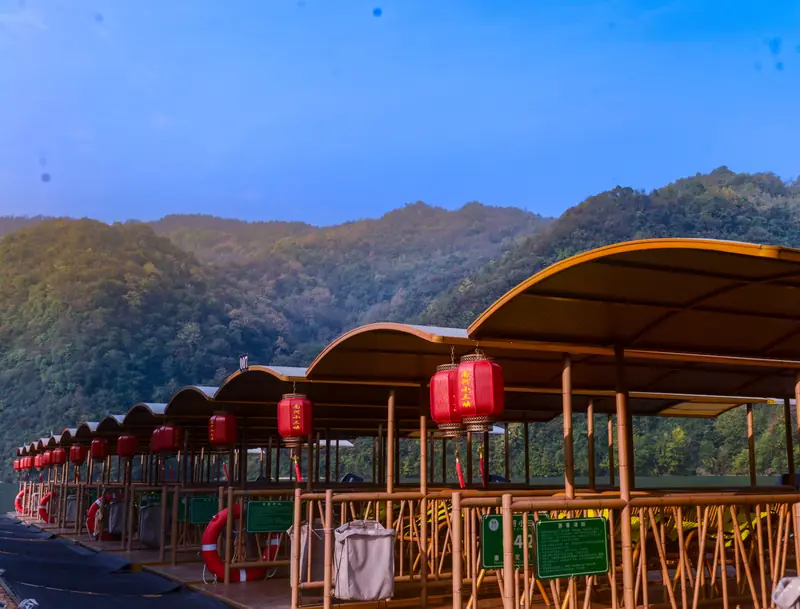 Nanhe Little Three Gorges ·
 Plan your visit
Getting there
Gucheng County is about 50 km in a straight line from central Xiangyang. Search for 谷城县 in a map app to find stations and your accommodation.
Where to stay →Build your route
Start with Nanhe Little Three Gorges. The linked place guides have entrance and visit details.
Continue with Xiangyang →More in Xiangyang
Sources & geographic information
Administrative names and parent areas: Official geographic directory · Reference date 2026-09-06.
Some facts checked against 谷城县 — Wikipedia contributors, CC BY-SA 4.0.
Photo: Nanhe Little Three Gorges · Source photographer · License not provided. EXIF orientation normalized; resized without changing aspect ratio; converted to WebP. No subject edits.
Map data © OpenStreetMap contributors. Pins mark approximate centres, not entrances or boundaries.