


Get to know Laohekou
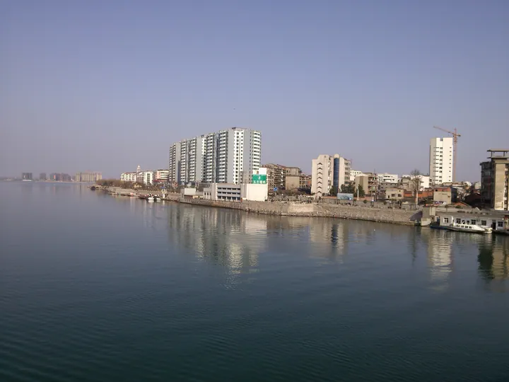
Photo adjustments
Full frame retained; proportionally resized and converted to WebP. No retouching or changes to the photographed subject. Card displays may crop the view.
- Administrative area
- County-level city · 县级市
- Part of
- Xiangyang
- Chinese name
- 老河口市
- Local areas
- County-level city guide
Area & population
- Area in the source
- 1,032.00 km²
- Population · 2020
- 420,495
Source: cited geographic source, as of the dates shown.
Setting and landscape
The city sits at the southern tail of the Funiu Mountains (伏牛山), a spur of the Qinling, on the edge of the Nanyang Basin (南阳盆地). Ground falls from north-west to south-east in a set of "chicken-claw" ridges, and ridged upland and hills cover most of it; plain makes up under a fifth. The Zhulian Mountains (朱连山) along the Henan border reach 462 metres. A 57-kilometre main ridge splits the drainage: streams to its west run straight into the Han, those to its east reach it by way of the Xiaoqing River (小清河).
History
The city government traces the area to the ancient state of Yin (阴国), named for lying north of Jing Mountain (荆山). Under the Qin it held the counties of Cuo (酂) and Yin; in 202 BC Xiao He (萧何) was made Marquis of Cuo, and the old Cuo city was lost to the Han River in the early fourth century. Renamed Guanghua County (光化县) in 1072, the area took its modern name from Laohekou town, set up in 1937; Guanghua County merged into the city of Laohekou in 1983. From autumn 1939 Li Zongren (李宗仁) ran the Fifth War Zone of the Nationalist government from here, and writers including Yao Xueyin (姚雪垠) and Zang Kejia (臧克家) gathered in the town.
What to see
The Former Headquarters of Li Zongren (李宗仁长官司令部旧址), on Beijing Road, is now the Laohekou Museum. It was a Du family house requisitioned in 1939: two front courtyards are northern-style brick-and-timber, and the rear one holds a European-style conference building added by the headquarters. The conference room, war room and Li's study and bedroom have been restored. Rated scenic areas include the Yindan Canal (引丹渠) area in Zhulinqiao town (竹林桥镇) and Dengyun Lake (登云湖) at Xianrendu (仙人渡). Wangfuzhou (王府洲), a Han River island once overgrown with silvergrass (芭茅), turned to rural tourism after a fishing ban.
Music and crafts
Laohekou sixian (老河口丝弦), on the national intangible-heritage list since 2008, is string music derived from the Bianliang (汴梁) ditties of Kaifeng and played on sanxian, zither, pipa and yueqin. Laohekou woodblock New Year prints (老河口木版年画), listed in 2011, are cut on hard pear wood and coloured with plant and mineral pigments; kitchen-god prints and door prints are common types.
Highlights
- Former Headquarters of Li Zongren 李宗仁长官司令部旧址: Fifth War Zone headquarters from 1939, now the city museum; provincial protected site since 2002.
- Wangfuzhou 王府洲: Han River island once overgrown with silvergrass, turned to rural tourism after a fishing ban.
- Laohekou sixian 老河口丝弦: String music from the Kaifeng tradition, on the national intangible-heritage list since 2008.
- Laohekou woodblock New Year prints 老河口木版年画: Pear-wood block prints coloured with plant and mineral pigments; national list 2011.
Sources for this guide
老河口市 - 维基百科,自由的百科全书 · Wikipedia (Chinese) · CC BY-SA 4.0
本地历史沿革 - 老河口市政府门户网站 · Laohekou Municipal People's Government
老河口市博物馆(李宗仁长官司令部旧址)简介 - 老河口市政府门户网站 · Laohekou Municipal Bureau of Culture and Tourism
2024年A级旅游景区基本情况 - 老河口市政府门户网站 · Laohekou Municipal Bureau of Culture and Tourism
王府洲:从芭茅洲到“汉江绿岛” - 老河口市政府门户网站 · Laohekou Municipal People's Government
老河口丝弦 - 中国非物质文化遗产网·中国非物质文化遗产数字博物馆 - 中国非物质文化遗产网非遗 · China Intangible Cultural Heritage Network (ihchina.cn)
木版年画(老河口木版年画) - 中国非物质文化遗产网·中国非物质文化遗产数字博物馆 - 中国非物质文化遗产网非遗 · China Intangible Cultural Heritage Network (ihchina.cn)
Original English written from the listed sources and checked sentence by sentence against quoted extracts by a separate reviewer. Updated 2026-09-24.
Explore Laohekou
Core places to explore, with English and Chinese names.
Laohekou 老河口市
Plan your visit
Getting there
Laohekou is about 55 km in a straight line from central Xiangyang. Search for 老河口市 in a map app to find stations and your accommodation.
Where to stay →More in Xiangyang
Sources & geographic information
Administrative names and parent areas: Official geographic directory · Reference date 2026-09-06.
Some facts checked against 老河口市 — Wikipedia contributors, CC BY-SA 4.0.
Map data © OpenStreetMap contributors. Pins mark approximate centres, not entrances or boundaries.