


Get to know Anlu
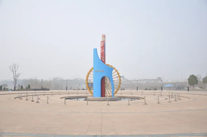
Photo adjustments
Full frame retained; proportionally resized and converted to WebP. No retouching or changes to the photographed subject. Card displays may crop the view.
- Administrative area
- County-level city · 县级市
- Part of
- Xiaogan
- Chinese name
- 安陆市
- Local areas
- County-level city guide
Area & population
- Population · 2020
- 498,356
Source: cited geographic source, as of the dates shown.
Setting and landscape
The land steps down from north to south: low mountains and high hills in the north-west and north-east, shallow hills over most of the city, and the alluvial plain of the Fu River (府河) in the south. The highest peak, Taipingzhai (太平寨), reaches 517 metres in the north-west. The Fu River, a major tributary of the Yangtze, runs for 49.7 kilometres through the city. Neighbours are Xiaochang County (孝昌县) to the east, Yunmeng (云梦县) and Yingcheng (应城市) to the south, Jingshan (京山市) to the west, and Suizhou's Zengdu District (曾都区) and Guangshui (广水市) to the north.
History
Under the Zhou the area was the state of Yun (郧国), and in the Warring States period it became a county of Chu. From 201 BC Anlu was the seat of Jiangxia Commandery (江夏郡). The Tang renamed Anlu Commandery (安陆郡) as Anzhou (安州) in 621, and in 1119 the Song raised it to De'an Prefecture (德安府), which governed five counties from Anlu. Li Bai's ten years in Anlu left 106 poems. During the war against Japan, Li Xiannian (李先念), Chen Shaomin (陈少敏) and others founded two anti-Japanese base areas in Anlu, at Zhaojiapeng (赵家棚) and Baizhao Mountain, as well as the New Fourth Army's 5th Division. The county became a city in September 1987 and has belonged to Xiaogan since 1993.
What to see
The Baizhao Mountain Li Bai Cultural Tourism Area (白兆山李白文化旅游区), a 4A scenic area, lies 15 kilometres west of the city in Yandian (烟店镇). The mountain, also called Bishan (碧山), appears in records from AD 573. Li Bai made it the centre of his Anlu years: he married and raised children here, studied and wrote, and many sites connected with him survive.
At Wangyizhen (王义贞镇), the Qianchong ancient ginkgo area (钱冲古银杏) protects one of the two ginkgo communities in China still growing in a natural state. The Xiaogan city government counts 59 trees over 1,000 years old and 1,486 over 500 years. Li Xiannian's forces fought here for three years and founded the first anti-Japanese base in central Hubei, and many revolutionary relics are kept.
Food and local products
Anlu ginkgo, the vegetable baihuacai (白花菜) and Nanxiang radish (南乡萝卜) are protected national geographical-indication products. The city also promotes Anlu rice noodles (安陆米粉) and Shendan egg products (神丹蛋品).
Getting oriented
Central Wuhan is 100 kilometres away. Anlu West station is on the Wuhan–Xi'an high-speed railway (武西高铁), and Anlu station is on the Hankou–Danjiangkou railway (汉丹铁路).
Highlights
- Baizhao Mountain Li Bai Cultural Tourism Area 白兆山李白文化旅游区: 4A scenic area 15 km west of the city; centre of Li Bai's ten years in Anlu.
- Qianchong ancient ginkgo area 钱冲古银杏: One of China's two natural ancient ginkgo communities, with 59 trees over 1,000 years old.
- Taipingzhai 太平寨: Highest peak in Anlu at 517 metres.
- Nanxiang radish 南乡萝卜: National geographical-indication product.
Sources for this guide
安陆概况 - 安陆概况 - 安陆市人民政府 · Anlu Municipal People's Government
历史沿革 - 安陆概况 - 安陆市人民政府 · Anlu Municipal People's Government
地理环境 - 安陆概况 - 安陆市人民政府 · Anlu Municipal People's Government
白兆山李白文化旅游区(4A)-孝感市人民政府 · Xiaogan Municipal People's Government
钱冲古银杏国家森林公园-孝感市人民政府 · Xiaogan Municipal People's Government
Original English written from the listed sources and checked sentence by sentence against quoted extracts by a separate reviewer. Updated 2026-09-24.
Explore Anlu
Core places to explore, with English and Chinese names.
Places to explore around Anlu
 Baizhao Mountain ·
 Plan your visit
Getting there
Anlu is about 50 km in a straight line from central Xiaogan. Search for 安陆市 in a map app to find stations and your accommodation.
Where to stay →Build your route
Start with Baizhao Mountain. The linked place guides have entrance and visit details.
Continue with Xiaogan →More in Xiaogan
Sources & geographic information
Administrative names and parent areas: Official geographic directory · Reference date 2026-09-06.
Photo: Baizhao Mountain · Source photographer · License not provided. EXIF orientation normalized; resized without changing aspect ratio; converted to WebP. No subject edits.
Map data © OpenStreetMap contributors. Pins mark approximate centres, not entrances or boundaries.