


Get to know Yingcheng
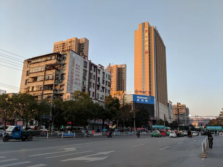
Photo adjustments
Full frame retained; proportionally resized and converted to WebP. No retouching or changes to the photographed subject. Card displays may crop the view.
- Administrative area
- County-level city · 县级市
- Part of
- Xiaogan
- Chinese name
- 应城市
- Local areas
- County-level city guide
Area & population
- Area in the source
- 1,103.00 km²
- Population · 2020 census
- 476,596
- Administrative seat
- Chengzhong
Source: cited geographic source, as of the dates shown.
Setting and landscape
Most of the city is low ridges, outliers of the Dahong Mountains (大洪山), tilting from north-west to south-east. The highest point, Baisha Mountain (白沙山), reaches only 111.6 metres. Plains follow the Dafu River (大富水) through the centre and the Zhang (漳河) and Yun (涢水) rivers in the east, while the south is lakeside marsh with lakes such as Dongxicha (东西汊湖), Longsai (龙赛湖) and Laoguan (老观湖). The landscape is summed up as "seven parts hills, one part lake, two parts plain". The climate is subtropical monsoon.
History
The area is identified with ancient Pusao (蒲骚). Yingcheng County was carved out of southern Anlu (安陆) in 454 under Emperor Xiaowu of the Liu Song, and the name is explained as a strategic point where a walled town ought to be built. In 550 the Western Wei made it the seat of Chengyang Commandery (城阳郡), which also governed Yunmeng (云梦). The county became a county-level city on 27 May 1986.
Gypsum was first found here in the Jiajing reign of the Ming (1522–1566), when a cliff collapsed at the foot of Tuanshanmiao hill (团山庙) in the north-west, and rock salt lies under some 140 square kilometres of the city. The Neolithic Menbanwan site (门板湾遗址) is in Chengbei subdistrict.
What to see
Tangchi Hot Spring (汤池温泉) is the city's main scenic area, in Tangchi town (汤池镇), which is named after the spring and lies in the west where Yingcheng meets Jingshan (京山) and Tianmen (天门), 33 kilometres by road from the city. People's Daily describes it as one of China's five high-quality high-temperature hot springs. The Tang poet Li Bai (李白) travelled here and wrote about it, and in 1937 Tao Zhu (陶铸) and Li Fanyi (李范一) ran a training course for anti-Japanese cadres in the town.
A tourism route promoted by the city links the National Mine Park, the National Gypsum Museum (国家石膏博物馆) and Tangchi. Another follows the Dafu River past the Xihe old ferry (西河古渡) and Wenfeng Pagoda (文峰塔) to Laoguan Lake National Wetland Park (老观湖国家湿地公园), with reed beds and large flocks of birds. Yingcheng gypsum carving (应城膏雕) is a local folk craft.
Getting oriented
The city centre is 49 kilometres west of Xiaogan's urban area. Yingcheng station is on the Changjiangbu–Jingmen railway (长荆铁路), and National Highway 347 and the Shanghai–Chengdu and Xiaogan–Honghu expressways cross the city.
Highlights
- Tangchi Hot Spring 汤池温泉: The city's main scenic area, described by People's Daily as one of China's five high-quality high-temperature hot springs; Li Bai wrote about the place.
- National Gypsum Museum 国家石膏博物馆: On a tourist route promoted by the city; gypsum was first found in Yingcheng in the 16th century.
- Laoguan Lake National Wetland Park 老观湖国家湿地公园: Reed beds and large flocks of birds at the end of the Dafu River route.
- Yingcheng gypsum carving 应城膏雕: Folk craft listed among Xiaogan's local arts.
Sources for this guide
应城市 - 维基百科,自由的百科全书 · Wikipedia (Chinese) · CC BY-SA 4.0
应城市 - 荆楚网 · cnhubei.com (Hubei Daily Media Group)
湖北应城: “温泉+”推动农文旅养融合发展【9】--湖北频道--人民网 · People's Daily Online, Hubei channel
汤池镇 (应城市) - 维基百科,自由的百科全书 · Wikipedia (Chinese) · CC BY-SA 4.0
孝感市 - 维基百科,自由的百科全书 · Wikipedia (Chinese) · CC BY-SA 4.0
Original English written from the listed sources and checked sentence by sentence against quoted extracts by a separate reviewer. Updated 2026-09-24.
Explore Yingcheng
Core places to explore, with English and Chinese names.
Places to explore around Yingcheng
 Tangchi Hot Spring ·
 Plan your visit
Getting there
Yingcheng is about 35 km in a straight line from central Xiaogan. Search for 应城市 in a map app to find stations and your accommodation.
Where to stay →Build your route
Start with Tangchi Hot Spring. The linked place guides have entrance and visit details.
Continue with Xiaogan →More in Xiaogan
Sources & geographic information
Administrative names and parent areas: Official geographic directory · Reference date 2026-09-06.
Some facts checked against 应城市 — Wikipedia contributors, CC BY-SA 4.0.
Some facts checked against 汤池镇 (应城市) — Wikipedia contributors, CC BY-SA 4.0.
Some facts checked against 孝感市 — Wikipedia contributors, CC BY-SA 4.0.
Photo: Tangchi Hot Spring · Source photographer · License not provided. EXIF orientation normalized; resized without changing aspect ratio; converted to WebP. No subject edits.
Map data © OpenStreetMap contributors. Pins mark approximate centres, not entrances or boundaries.