


Get to know Dawu County
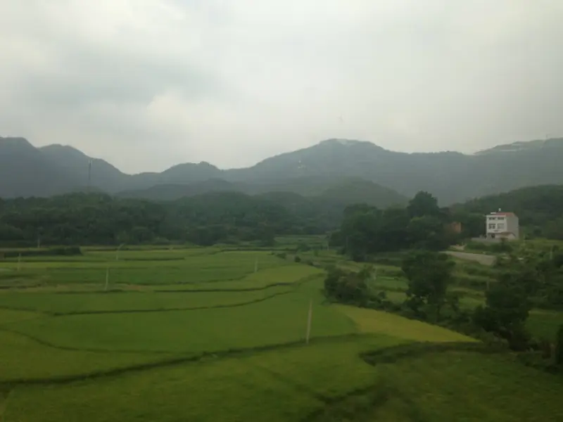
Photo adjustments
Full frame retained; EXIF orientation normalized, proportionally resized to at most 800 pixels and converted to WebP. No generated pixels or subject changes. Cards may crop the display.
- Administrative area
- County · 县
- Part of
- Xiaogan
- Chinese name
- 大悟县
- Local areas
- County guide
Area & population
- Area in the source
- 1,980.00 km²
- Population · 2020
- 486,153
Source: cited geographic source, as of the dates shown.
History
Until 1932 the area was split between Luoshan (罗山) in Henan and Xiaogan, Huangpi (黄陂) and Huang'an (黄安) in Hubei. On 1 January 1933 the Nationalist authorities cut the border lands of these four counties into a new Lishan County (礼山县). The county government records that in 1930 local Red Guards captured a Nationalist trainer aircraft, which became the Red Army's first plane, the "Lenin". From 1942 to 1945 the headquarters of the New Fourth Army's 5th Division sat in the Dawu Mountain area, and in January 1946 the Central Plains Military Region moved to Xuanhuadian (宣化店), from where its troops broke out of encirclement on 26 June. In 1952 Lishan was renamed Dawu to honour the people of the Dawu mountain area. The county counts 37 founding generals among its natives, including Xu Haidong (徐海东) and Liu Huaqing (刘华清).
What to see
At Xuanhuadian, Zhou Enlai (周恩来) met American and Nationalist representatives on 8 May 1946 in part of the old Hubei Guild Hall (湖北会馆), 20 metres from the west bank of the Zhugan River (竹竿河). Its lattice doors carry carvings of scenes from Journey to the West, the Eight Immortals and Romance of the Three Kingdoms. With the former military region headquarters and leaders' residence, the building became a memorial hall in 1974 and is a provincial protected site.
The Hubei–Henan Border Region Revolutionary Martyrs' Cemetery (鄂豫边区革命烈士陵园), on the east bank of the Huan River (澴河) at the county seat, was completed in 1984. Its 21.8-metre monument copies the Monument to the People's Heroes in Tiananmen Square, and a second monument of 1998, shaped like a military map, marks the Central Plains breakout. The State Council listed the cemetery in 1986 among the first nationally protected martyrs' memorials.
Dawu Mountain (大悟山) rises to 813 metres; the county dates the old temple on its summit to the Tang. In autumn, Chinese tallow trees colour the Dabie Mountains (Dawu) Red Leaf Scenic Area (大别山(大悟)红叶景区) at Beishan village, Sigu (四姑镇), a 4A scenic area since 2023.
Food and local products
Dawu peanuts, Dawu tea and Dawu loach are national geographical-indication products. The county's pumpkin and loach soup (南瓜泥鳅汤) fries the loach until lightly golden, simmers it with ginger, then cooks sliced pumpkin in the broth until soft.
Highlights
- Xuanhuadian negotiation site 宣化店谈判旧址: Where Zhou Enlai met American and Nationalist representatives on 8 May 1946; a memorial hall since 1974.
- Hubei–Henan Border Region Revolutionary Martyrs' Cemetery 鄂豫边区革命烈士陵园: Completed 1984 on the Huan River; national protected martyrs' memorial since 1986.
- Dawu Mountain 大悟山: 813-metre mountain with an old summit temple dated by the county to the Tang.
- Dabie Mountains (Dawu) Red Leaf Scenic Area 大别山(大悟)红叶景区: Chinese tallow trees in autumn colour; 4A scenic area since 2023.
Sources for this guide
大别山(大悟)红叶景区(4A)-孝感市人民政府 · Xiaogan Municipal People's Government
大悟县人民政府门户网站 - 县情简介 · Dawu County People's Government
大悟县人民政府门户网站 - 历史沿革 · Dawu County People's Government
大悟县人民政府门户网站 - 游在大悟 · Dawu County People's Government
大悟县人民政府门户网站 - 游在大悟 · Dawu County People's Government
大悟县人民政府门户网站 - 食在大悟 · Dawu County People's Government
大悟县人民政府门户网站 - 游在大悟 · Dawu County People's Government
Original English written from the listed sources and checked sentence by sentence against quoted extracts by a separate reviewer. Updated 2026-09-24.
Explore Dawu County
Core places to explore, with English and Chinese names.
Places to explore around Dawu County
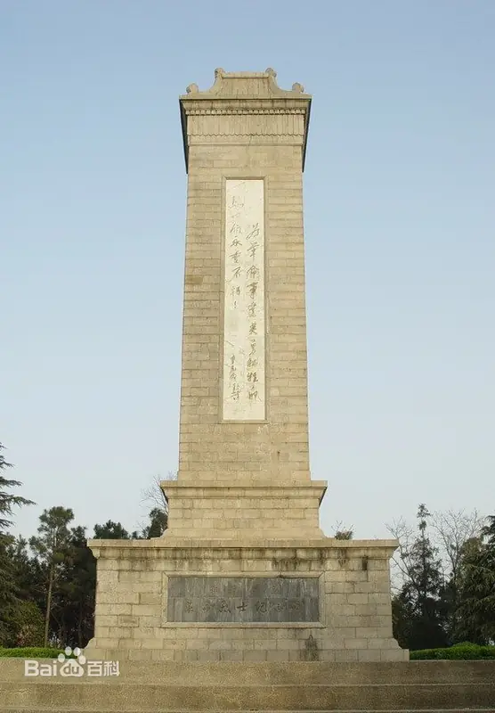 Hubei-Henan Border Region Revolutionary Martyrs Cemetery ·
 Plan your visit
Getting there
Dawu County is about 85 km in a straight line from central Xiaogan. Search for 大悟县 in a map app to find stations and your accommodation.
Where to stay →Build your route
Start with Hubei-Henan Border Region Revolutionary Martyrs Cemetery. The linked place guides have entrance and visit details.
Continue with Xiaogan →More in Xiaogan
Sources & geographic information
Administrative names and parent areas: Official geographic directory · Reference date 2026-09-06.
Photo: Hubei-Henan Border Region Revolutionary Martyrs Cemetery · Source photographer · License not provided. EXIF orientation normalized; resized without changing aspect ratio; converted to WebP. No subject edits.
Map data © OpenStreetMap contributors. Pins mark approximate centres, not entrances or boundaries.