


Get to know Qidong County
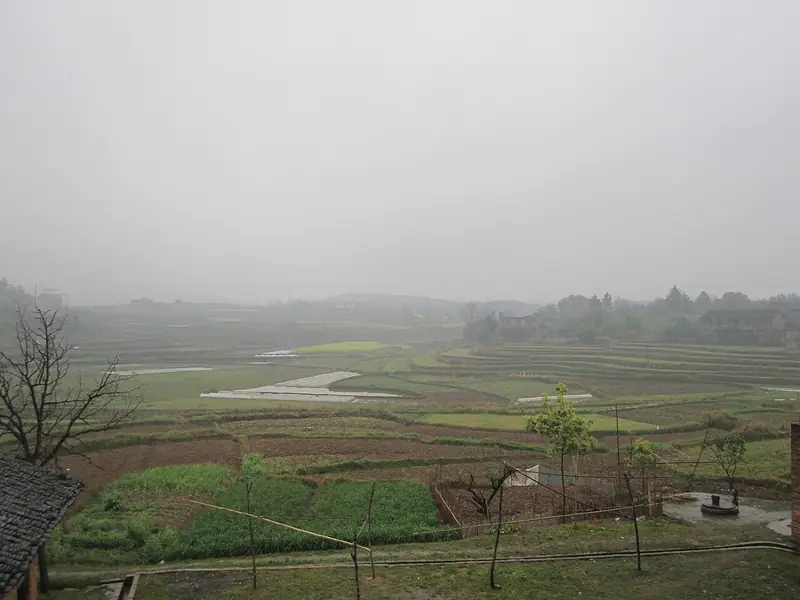
Photo adjustments
Full frame retained; EXIF orientation normalized, proportionally resized to at most 800 pixels and converted to WebP. No generated pixels or subject changes. Cards may crop the display.
- Administrative area
- County · 县
- Part of
- Hengyang
- Chinese name
- 祁东县
- Local areas
- County guide
Setting and landscape
Qidong touches Qiyang to the south, Shaodong (邵东) and Hengyang County (衡阳县) to the north, Hengnan (衡南) to the east, and Dong'an (东安) and Shaoyang (邵阳) to the west. On the county's edge rises Siming Mountain (四明山), whose name comes from its closeness to four counties: Shuangpai (双牌), Qiyang, Dong'an and Shaoyang. The mountain became a national forest park in 2014; on it stand the Siming Temple (四明寺), founded in the early Tang, and the Tengyun Zushi Hall (腾云祖始殿) from the late Ming.
History
On 25 April 1952 the northeastern districts of Qiyang County were split off to form Qidong, named for lying mostly to Qiyang's east, with its seat at Hongqiao (洪桥). Much older remains exist: in September 1981 a late Spring and Autumn period tomb was found on Xiaomishan hill (小米山春秋墓) in Shitingzi (石亭子镇). Its decoration marks it as a burial of the ancient Yue people, and its 14 bronze weapons and tools, including arrowheads, axes and knives, are now in the Hengyang Museum.
What to see
Other sights in the county include Dingshan Park (鼎山公园), the stone swallows of Yanjiang (烟江石燕), Yanzi Rock (燕子岩), where clear spring water drips, and the steep Xiongpi Ridge (熊罴岭). Historic sites include the Daying Temple (大营寺), where the army of Yue Fei (岳飞) is said to have camped, the site of the old Yongchang County (古永昌县址), the Baisui Gate (百岁门) and the Zhuangyuan Bridge (状元桥).
Food and local products
Qidong daylily (祁东黄花菜) is a national geographical indication product with a long history of cultivation in the county. The daylilies are harvested in midsummer, and the Hunan provincial government notes that the county's traditional method of steaming, boiling and sun-drying them is long established. Huangtupu (黄土铺镇) is one of the places where they are grown and picked. The county also carries the title "home of Chinese quyi" (中国曲艺之乡), the storytelling and ballad-singing arts.
Highlights
- Siming Mountain National Forest Park 四明山: Mountain on the county edge named for its four neighbouring counties; national forest park since 2014, with an early-Tang temple.
- Xiaomishan Spring and Autumn Tomb 小米山春秋墓: Late Spring and Autumn Yue burial found in 1981; its bronzes are in the Hengyang Museum.
- Qidong Daylily 祁东黄花菜: National geographical indication product, harvested in midsummer and traditionally steamed, boiled and sun-dried.
Sources for this guide
祁东县 - 维基百科,自由的百科全书 · Chinese Wikipedia · CC BY-SA 4.0
【衡阳市】祁东黄花菜进入采摘期-湖南省人民政府门户网站 · Hunan Provincial People's Government
湖南衡阳:黄花菜飘香采收忙-新华网 · Xinhua
四明山 (湖南) - 维基百科,自由的百科全书 · Chinese Wikipedia · CC BY-SA 4.0
小米山春秋墓 - 维基百科,自由的百科全书 · Chinese Wikipedia · CC BY-SA 4.0
Original English written from the listed sources and checked sentence by sentence against quoted extracts by a separate reviewer. Updated 2026-09-24.
Explore Qidong County
Core places to explore, with English and Chinese names.
Qidong County 祁东县
Plan your visit
Getting there
Qidong County is about 50 km in a straight line from central Hengyang. Search for 祁东县 in a map app to find stations and your accommodation.
Where to stay →More in Hengyang
Sources & geographic information
Administrative names and parent areas: Official geographic directory · Reference date 2026-09-06.
Some facts checked against 祁东县 — Wikipedia contributors, CC BY-SA 4.0.
Some facts checked against 四明山 (湖南) — Wikipedia contributors, CC BY-SA 4.0.
Some facts checked against 小米山春秋墓 — Wikipedia contributors, CC BY-SA 4.0.
Map data © OpenStreetMap contributors. Pins mark approximate centres, not entrances or boundaries.