


Get to know Yueyanglou District
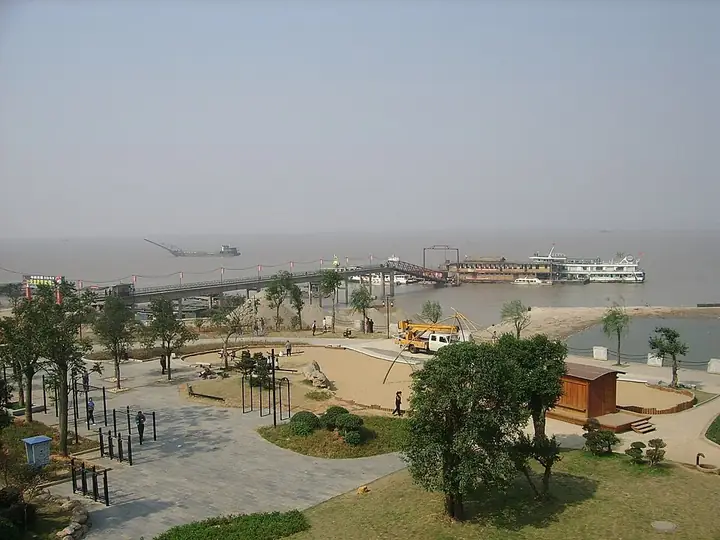
Photo adjustments
Full frame retained; resized proportionally to a maximum dimension of 960 pixels and converted to WebP quality 88. No crop, retouch, generated elements, or subject alteration. Final website rendition: full frame retained, proportionally resized to at most 720 pixels and converted to WebP. No additional retouching or subject alteration. Card displays may crop the view.
- Administrative area
- District · 市辖区
- Part of
- Yueyang
- Chinese name
- 岳阳楼区
- Local areas
- District guide
Area & population
- Area in the source
- 464.55 km²
- Population · 2015
- 514,100
- Administrative seat
- Wulipai
Source: cited geographic source, as of the dates shown.
Setting and layout
The southwest of the district is the site of the walled town that served for centuries as the seat of successive counties, prefectures and commanderies; the city has expanded steadily since 1949, and its main streets include Dongting Road (洞庭路) and Baling Road (巴陵路). In the northeast, Chenglingji (城陵矶) stands where Dongting Lake meets the Yangtze and, with Chenglingji Port, is the water gateway of northern Hunan. The district in its present form was created on 16 March 1996.
What to see
Yueyang Tower sits on the west gate of the old city, looking over Dongting Lake toward Junshan (君山). Tradition traces it to a tower from which the Eastern Wu general Lu Su (鲁肃) reviewed his lake fleet around 215. It took its present name in the Tang, when poets including Li Bai and Du Fu wrote about it, and became famous after Teng Zijing (滕子京) rebuilt it in 1045–46 and Fan Zhongyan (范仲淹) wrote his essay On Yueyang Tower (岳阳楼记). The present three-storey timber building, 19.42 metres tall, has a helmet-shaped roof and is held together without iron nails. It has been a national key cultural relic since 1988. The park around it also holds the reburied tomb of Xiao Qiao (小乔墓), moved here in 1992–93.
Cishi Pagoda (慈氏塔) on Taqian Street (塔前街) is a solid, seven-storey octagonal brick pagoda 39 metres high on a granite base. Inscriptions dated 1066 were found on its top during repairs in 2015, and it was listed as a national key cultural relic in 2013. Other named relics include the tomb of Lu Su (鲁肃墓) and the Yuezhou Confucian Temple (岳州文庙).
Streets and parks
The Dongting South Road historic quarter (洞庭南路历史文化街区) was named a national tourism and leisure street in the Ministry of Culture and Tourism's third list, and the district's culture bureau also promotes Bianhe Street (汴河街), the Confucian temple, Jin'e Park (金鹗公园) and Mabu Mountain Forest Park (麻布山森林公园). Yueyang Tower and its surroundings are a national night-time culture and tourism area. Yueyang North Station on the Beijing–Guangzhou railway is in the east of the district at Lengshuipu (冷水铺).
Highlights
- Yueyang Tower 岳阳楼: Timber gate tower over Dongting Lake made famous by Fan Zhongyan's essay; national key cultural relic since 1988.
- Cishi Pagoda 慈氏塔: Seven-storey octagonal brick pagoda with inscriptions dated 1066; national key cultural relic since 2013.
- Dongting South Road historic quarter 洞庭南路历史文化街区: Old street quarter listed as a national tourism and leisure street.
- Bianhe Street 汴河街: Street promoted by the district culture and tourism bureau alongside the Confucian temple and Jin'e Park.
Sources for this guide
岳阳楼区 - 维基百科,自由的百科全书 · Wikipedia (Chinese) · CC BY-SA 4.0
岳阳楼 - 维基百科,自由的百科全书 · Wikipedia (Chinese) · CC BY-SA 4.0
岳阳楼区文化旅游广电体育局2023年工作总结及2024年工作思路-岳阳市岳阳楼区政府门户网站 · Yueyanglou District Bureau of Culture, Tourism, Radio, Television and Sports
慈氏塔 - 维基百科,自由的百科全书 · Wikipedia (Chinese) · CC BY-SA 4.0
Original English written from the listed sources and checked sentence by sentence against quoted extracts by a separate reviewer. Updated 2026-09-25.
Explore Yueyanglou District
Core places to explore, with English and Chinese names.
Places to explore around Yueyanglou District
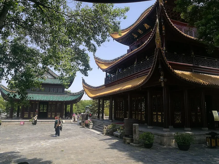 Yueyang Tower, Hunan, seen from the side.
Yueyang Tower岳阳楼
Yueyang Tower looks across Dongting Lake from the old city’s western defensive edge. Its timber structure and helmet-shaped roof reward close attention, while Fan Zhongyan’s celebrated essay explains why the building has such a…
Read the place guide → A waterside pavilion with lanterns and a fountain on Bianhe Street, Yueyanglou District, Yueyang · 岳阳市岳阳楼区汴河街,水边亭台与喷泉 Source-recorded photograph date: Taken on 21 June 2011.
Bianhe Street汴河街
Bianhe Street (汴河街), officially the Traditional Streetscape Street, is a mock-antique shopping street beside Yueyang Tower in Yueyanglou District, Yueyang, Hunan, running between the tower and the shore of Dongting Lake.
Read the place guide →Plan your visit
Getting there
Yueyanglou District is about 8 km in a straight line from central Yueyang. Search for 岳阳楼区 in a map app to find stations and your accommodation.
Where to stay →Build your route
Yueyang Tower and Bianhe Street are both listed here. The linked place guides have entrance and visit details.
Continue with Yueyang →More in Yueyang
Sources & geographic information
Administrative names and parent areas: Official geographic directory (dmfw.mca.gov.cn) · Reference date 2026-09-06.
Some facts checked against 岳阳楼区 — Wikipedia contributors, CC BY-SA 4.0.
Some facts checked against 岳阳楼 — Wikipedia contributors, CC BY-SA 4.0.
Some facts checked against 慈氏塔 — Wikipedia contributors, CC BY-SA 4.0.
Photo: Yueyang Tower · Huangdan2060 · CC0. Proportionally resized and converted to WebP without cropping, retouching or changing the photographed subject.

Photo: Bianhe Street · Yin沩 · CC BY-SA 3.0. Full frame retained; proportionally resized and converted to WebP. No retouching or changes to the photographed subject. Card displays may crop the view.

Map data © OpenStreetMap contributors. Pins mark approximate centres, not entrances or boundaries.