


Get to know Dengkou County
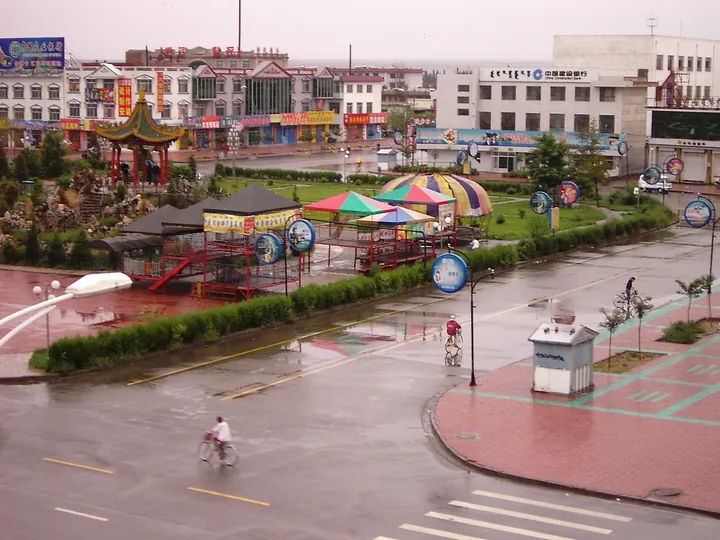
Photo adjustments
Full frame retained; proportionally resized and converted to WebP. No retouching or changes to the photographed subject. Card displays may crop the view.
- Administrative area
- County · 县
- Part of
- Bayannur
- Chinese name
- 磴口县
- Local areas
- County guide
Area & population
- Population · 2020
- 90,196
- Administrative seat
- Bayangol
Source: cited geographic source, as of the dates shown.
Setting and landscape
The county government lists the Ulan Buh Desert as one of China's eight great deserts, with 2,846 square kilometres inside Dengkou and more than 200 lakes. Licorice, cistanche, sea buckthorn and saxaul grow there. Nalin Lake (纳林湖) is a national 4A scenic area, national wetland park and national geopark. The main farm crops are tomatoes and oil sunflowers.
History
In the Qianlong reign of the Qing, Dengkou was chosen as the river wharf for shipping salt from Jilantai Salt Lake (吉兰泰盐湖) in Alxa (阿拉善). The county itself was created in January 1929 under Ningxia province, and in 1958 Bayan Gol became the seat of Bayannur League. The local Chinese dialect belongs to the Wutai group of Jin and is known locally as Houtao speech (后套话).
In early 1969 a regiment of the Inner Mongolia Production and Construction Corps (内蒙古生产建设兵团) was set up at today's Ulan Buh Farm (乌兰布和农场), drawing educated youth from Beijing, Shanghai, Tianjin and elsewhere. The regiment's original buildings at the farm headquarters now form a Corps culture area that includes the three-storey Inner Mongolia Corps Museum (内蒙古兵团博物馆); the area is protected at autonomous-region level.
What to see
The Sanshenggong barrage was built between 1959 and 1961. The county government describes it as the only large irrigation-led plain barrage with a single intake on the Yellow River; it secures water for nearly 9 million mu of Hetao (河套) farmland. The Ministry of Water Resources named it a national water-conservancy scenic area in 2005. Its scenic area holds the 27-metre "Concentric Lock" sculpture, made from retired sluice gates.
In the Ge'eraobao (格尔敖包沟) and Molihetu (默里赫图沟) gullies of the Yin Mountains, nearly ten thousand Yinshan petroglyphs (阴山岩画), a national protected site, are carved into boulders and cliffs. The Northern Wei geographer Li Daoyuan (郦道元) recorded them in the early sixth century. They run from the Bronze Age to the Qing and show more than 20 kinds of animals, hunters, dancers, carts, riders and felt tents.
Agui Temple (阿贵庙), begun in 1798, belongs to the Nyingma or "Red" school of Tibetan Buddhism. Its name comes from the word for cave: five natural caves open in the cliffs around the main hall. The county government calls it the largest Red-school temple in north-west China; temple fairs fall on the 10th day of the seventh lunar month and the 25th day of the ninth.
Highlights
- Sanshenggong barrage 三盛公水利枢纽: Yellow River barrage built 1959–1961; national water-conservancy scenic area since 2005.
- Ulan Buh Desert 乌兰布和沙漠: 2,846 square kilometres of the desert lie in the county, with more than 200 lakes.
- Yinshan petroglyphs 阴山岩画: Nearly ten thousand rock carvings from the Bronze Age to the Qing; national protected site.
- Agui Temple 阿贵庙: Nyingma temple begun in 1798 with five natural cliff caves.
- Inner Mongolia Corps Museum 内蒙古兵团博物馆: Museum of the 1969 Production and Construction Corps at Ulan Buh Farm.
- Nalin Lake 纳林湖: National 4A scenic area, wetland park and geopark.
Sources for this guide
磴口县 - 维基百科,自由的百科全书 · Wikipedia (Chinese) · CC BY-SA 4.0
国家级文物保护单位——阴山岩画 · Dengkou County People's Government
纳林湖景区 · Dengkou County People's Government
国家级水利风景区——黄河三盛公水利枢纽工程 · Dengkou County People's Government
乌兰布和沙漠生态旅游 · Dengkou County People's Government
“红教古刹”阿贵庙 · Dengkou County People's Government
内蒙古兵团博物馆 · Dengkou County People's Government
Original English written from the listed sources and checked sentence by sentence against quoted extracts by a separate reviewer. Updated 2026-09-25.
Explore Dengkou County
Core places to explore, with English and Chinese names.
Dengkou County 磴口县
Plan your visit
Getting there
Dengkou County is about 55 km in a straight line from central Bayannur. Search for 磴口县 in a map app to find stations and your accommodation.
Where to stay →More in Bayannur
Sources & geographic information
Administrative names and parent areas: Official geographic directory · Reference date 2026-09-06.
Some facts checked against 磴口县 — Wikipedia contributors, CC BY-SA 4.0.
Map data © OpenStreetMap contributors. Pins mark approximate centres, not entrances or boundaries.