


Get to know Wuyuan County
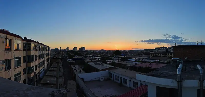
Photo adjustments
EXIF orientation normalized; resized without changing aspect ratio; converted to WebP. No subject edits.
- Administrative area
- County · 县
- Part of
- Bayannur
- Chinese name
- 五原县
- Local areas
- County guide
Area & population
- Area in the source
- 2,472.00 km²
- Population · 2020
- 224,809
- Administrative seat
- Longxingchang
Source: cited geographic source, as of the dates shown.
History
The Qing court set up Wuyuan sub-prefecture (五原厅) here in 1903, after Wang Tongchun (王同春) and others had opened up the Hetao region for farming, and it became a county after the 1911 revolution. From the late Ming to the early Republic the area drew poor migrants from Shanxi, Shaanxi, Hebei, Shandong and other provinces in the movement known as "going beyond the western pass" (走西口).
Two events of the Republican era are marked in the county town. On 17 September 1926 the general Feng Yuxiang (冯玉祥) held the "Wuyuan Oath" (五原誓师), declaring his forces the Nationalist Allied Army and joining the Northern Expedition. Between December 1939 and March 1940 Fu Zuoyi (傅作义) led the western Suiyuan campaign that retook Wuyuan, remembered as the Wuyuan victory (五原大捷); 679 soldiers died in the battle.
What to see
Oath Square (五原誓师广场), at the north end of the town where Qianjin Road meets the Yihe Canal (义和渠), is built around an old town wall, an oath platform and statues of three soldiers, including Feng Yuxiang. The Wuyuan War of Resistance Memorial Park (五原抗战纪念园), north of the town, has a war memorial hall and the cemetery Fu Zuoyi built for the dead of 1940; a wall lists the names of all 679, and the site was restored in 2005.
The Hetao Farming Culture Expo Park (河套农耕文化博览园) at Baliqiao (八里桥) is a national AAAA-rated scenic area. Its Hetao Farming Culture Museum opened in May 2016 with more than 6,000 exhibits on the farm tools, grain processing, village houses, textiles, dress and customs of the Hetao region. More than a hundred poems about Wuyuan survive, by poets including Li Bai (李白) and Du Fu (杜甫); in the west of the town a poetry garden sets many verses on carved stones among flowers, trees and lakes.
Food and local products
Wuyuan is a major farming county of Bayannur, growing sunflowers, Hami melons, maize and seed melons (籽瓜). Sunflowers cover about 52 percent of its farmland, and in 2025 the China National Intellectual Property Administration approved a "Wuyuan Sunflower" (五原向日葵) geographical-indication protection demonstration zone.
Highlights
- Wuyuan Oath Square 五原誓师广场: Marks Feng Yuxiang's oath of 17 September 1926, with an oath platform and statues.
- Wuyuan War of Resistance Memorial Park 五原抗战纪念园: Museum and cemetery of the 679 soldiers killed in the 1940 Wuyuan battle.
- Hetao Farming Culture Expo Park 河套农耕文化博览园: National AAAA scenic area with a farming museum of over 6,000 exhibits, opened in 2016.
- Wuyuan Sunflower 五原向日葵: Grown on about 52 percent of the county's farmland; a national geographical-indication demonstration zone from 2025.
Sources for this guide
五原县 · Wikipedia (Chinese) · CC BY-SA 4.0
“五原向日葵”国家地理标志保护示范区获批成立 · Wuyuan County People's Government
内蒙古五原:璀璨明珠耀古今 · People's Daily Online, Inner Mongolia channel
Original English written from the listed sources and checked sentence by sentence against quoted extracts by a separate reviewer. Updated 2026-09-26.
Explore Wuyuan County
Core places to explore, with English and Chinese names.
Wuyuan County 五原县
Plan your visit
Getting there
Wuyuan County is about 85 km in a straight line from central Bayannur. Search for 五原县 in a map app to find stations and your accommodation.
Where to stay →More in Bayannur
Sources & geographic information
Administrative names and parent areas: Official geographic directory · Reference date 2026-09-06.
Some facts checked against 五原县 — Wikipedia contributors, CC BY-SA 4.0.
Map data © OpenStreetMap contributors. Pins mark approximate centres, not entrances or boundaries.