


Get to know Urad Rear Banner
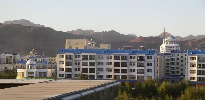
Photo adjustments
Full frame retained; proportionally resized and converted to WebP. No retouching or changes to the photographed subject. Card displays may crop the view.
- Administrative area
- Banner · 旗
- Part of
- Bayannur
- Chinese name
- 乌拉特后旗
- Local areas
- Banner guide
Area & population
- Area in the source
- 24,530.00 km²
- Population · 2020
- 53,946
- Administrative seat
- Bayan Bulag
Source: cited geographic source, as of the dates shown.
Setting and landscape
The banner government sums up its landscape as "grain in the south, herding in the north, mines in the middle". South of the Yin Mountains, Yellow River water irrigates wheat, maize and sunflowers; north of them lie hills and upland plateau with some 36.5 million mu of natural pasture where cattle, horses, sheep and camels graze. The main ranges are the Erlang (二郎山) and Zhagela (扎格拉山) mountains. The climate is a dry, sunny upland continental one, with cold, windy winters. The main mineral resources are lead, zinc, copper, iron and sulphur.
History
In 1648 the Qing court divided the Urad (乌喇特) people, who had come over to it from Hulunbuir (呼伦贝尔), into front, middle and rear banners, and in 1649 moved the three banners west from the Xar Moron River (西拉木伦河) to graze around Mount Muna (穆纳山), today's Wula Mountains (乌拉山). The present banner descends from Chaoge Banner (潮格旗), created in October 1970 from eight communes and two pastures in the west of Urad Middle Banner and renamed Urad Rear Banner in 1981. The seat moved to Bayan Bulag (巴音宝力格镇), whose Mongolian name the banner government glosses as "rich spring", after a 2002 decision.
At Bayan Mandahu (巴音满都呼), in Bayan Qiandamen Sum (巴音前达门苏木), Chinese and Canadian scientists found dinosaur fossils about 70 million years old in 1987. The banner government calls it the most important and largest Late Cretaceous dinosaur fossil site in China and Central Asia.
What to see
The Chuanji (川吉) rock at Baoyintu (宝音图) in Bayan Qiandamen Sum is a wind-eroded outcrop shaped like a camel with its head raised. The banner calls itself the home of the gobi red camel: herders drive camel herds between pastures in winter and spring, and each year in autumn and winter an international camel culture festival stages camel races and camel polo.
East of Chaogewendur town (潮格温都尔镇), the Chaogewendur obo (敖包) stands on the mountain of the same name. Built from the records of the old Urad Middle Duke Banner, it was named the banner obo in March 2015, when 12 subsidiary obo were built in a bow-shaped row with a bronze statue of the legendary Chaogewendur mountain spirit set among them.
Highlights
- Bayan Mandahu dinosaur fossil beds 巴音满都呼恐龙化石: Late Cretaceous fossils about 70 million years old, found by a Sino-Canadian team in 1987.
- Chuanji camel rock 川吉(神驼)风蚀景观: Wind-eroded rock shaped like a camel at Baoyintu.
- Chaogewendur obo 潮格温都尔敖包: Banner obo named in 2015, with 12 subsidiary cairns and a mountain-spirit statue.
Sources for this guide
乌拉特后旗 - 维基百科,自由的百科全书 · Wikipedia (Chinese) · CC BY-SA 4.0
后旗概况 · Urad Rear Banner People's Government
一城看北疆丨大漠天工的自然图腾 · Urad Rear Banner People's Government
潮格温都尔敖包文化体验区 · Urad Rear Banner People's Government
Original English written from the listed sources and checked sentence by sentence against quoted extracts by a separate reviewer. Updated 2026-09-25.
Explore Urad Rear Banner
Core places to explore, with English and Chinese names.
Urad Rear Banner 乌拉特后旗
Plan your visit
Getting there
Urad Rear Banner is about 45 km in a straight line from central Bayannur. Search for 乌拉特后旗 in a map app to find stations and your accommodation.
Where to stay →More in Bayannur
Sources & geographic information
Administrative names and parent areas: Official geographic directory · Reference date 2026-09-06.
Some facts checked against 乌拉特后旗 — Wikipedia contributors, CC BY-SA 4.0.
Map data © OpenStreetMap contributors. Pins mark approximate centres, not entrances or boundaries.