


Get to know Zhuozi County
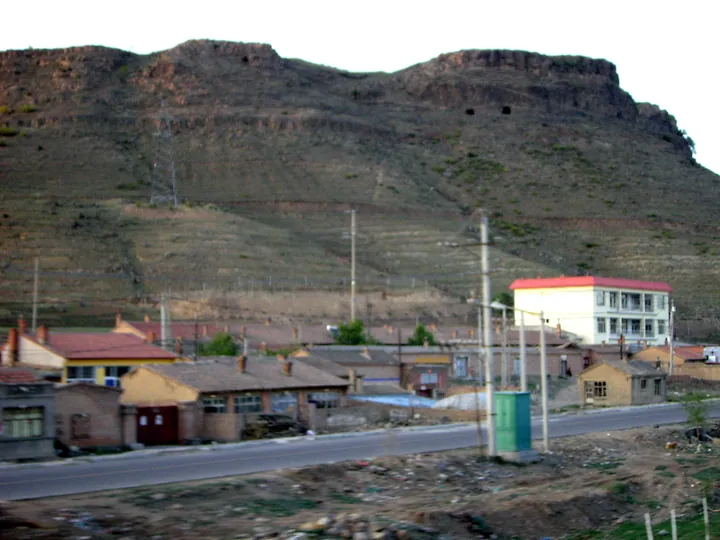
Photo adjustments
Full frame retained; proportionally resized and converted to WebP. No retouching or changes to the photographed subject. Card displays may crop the view.
- Administrative area
- County · 县
- Part of
- Ulanqab
- Chinese name
- 卓资县
- Local areas
- County guide
Area & population
- Area in the source
- 3,122.00 km²
- Population · 2020
- 85,648
- Administrative seat
- Zhuozishan
Source: cited geographic source, as of the dates shown.
Setting and landscape
Only about 12 percent of the county is flat valley land; the ground is higher in the northwest and lower in the southeast. The highest point is Liubeiqu (柳背渠) in Qixiaying (旗下营镇), and the lowest is the bank of the Daheihe River (大黑河) at the Hohhot boundary, at 1,235 m. The Daheihe, a first-order tributary of the Yellow River, rises on the southern hills of Shibatai (十八台镇) and runs 87 km through the county, flowing southwest to join the Yellow River at Togtoh (托克托县). The county government also names the Naoerliang (淖尔梁) alpine meadow grassland among its landscapes.
History
People lived here from the late Palaeolithic, and remains of the northern wall of the state of Zhao survive in the county. In the early Qing the land was pasture of the Chahar Plain Red and Bordered Red banners. The present county was cut from parts of Liangcheng (凉城), Fengzhen (丰镇), Taolin (陶林) and Jining (集宁) on 28 December 1945 and named Longsheng (龙胜县) because He Long (贺龙) had commanded the capture of Zhuozishan (卓资山镇), now the county seat; it was renamed Zhuozi on 1 May 1952. The name comes from Zhuozi Mountain (卓资山), most often explained as a "table mountain" for its flat top.
What to see
Hongzhao Jiulongwan (红召九龙湾生态旅游区), a 4A scenic area in Hongzhao township (红召乡) in the northwest of the county, runs 15 km through a branch of the Daqing Mountains (大青山) inside the Daqingshan national nature reserve, with natural birch woods; it is called the "Little Guilin beyond the Great Wall". Linhu Gusai (林胡古塞), rated 4A in 2016, is themed on the culture of the Linhu tribe and on revolutionary history, and four giant pandas moved there in September 2019.
Food and local products
Zhuozi smoked chicken was created in the 1920s by Li Zhen (李珍), a smoked-meat maker from Hebei, who combined the smoking methods of his home with the local way of braising chicken. It became a national geographical-indication product in late 2016, and its making is on the Inner Mongolia intangible heritage list. A smoked-chicken industrial park in Zhuozishan town includes a museum.
Getting oriented
The Beijing–Baotou railway (京包铁路) crosses the county with ten stations, the Hohhot–Zhangjiakou high-speed line (呼张客运专线) stops at Zhuozi East (卓资东站), and the county government puts Baita (白塔) airport 70 km to the west and Jining airport 50 km to the east.
Highlights
- Zhuozi smoked chicken 卓资熏鸡: Created in the 1920s by Li Zhen; national geographical-indication product since 2016.
- Hongzhao Jiulongwan 红召九龙湾生态旅游区: 4A scenic area 15 km long in the Daqingshan national nature reserve.
- Linhu Gusai 林胡古塞: 4A scenic area themed on Linhu tribal culture; home to four giant pandas since 2019.
- Daheihe River 大黑河: Yellow River tributary that rises in Shibatai and flows 87 km through the county.
Sources for this guide
卓资县 - 维基百科,自由的百科全书 · Chinese Wikipedia · CC BY-SA 4.0
卓资概况 - 卓资县人民政府 · Zhuozi County People's Government
旅游卓资 - 旅游卓资 - 卓资县人民政府 · Zhuozi County People's Government
卓资县熏鸡 - 卓资名片 - 卓资县人民政府 · Zhuozi County People's Government
红召九龙湾生态旅游区 - 卓资名片 - 卓资县人民政府 · Zhuozi County People's Government
林胡古塞 - 卓资名片 - 卓资县人民政府 · Zhuozi County People's Government
Original English written from the listed sources and checked sentence by sentence against quoted extracts by a separate reviewer. Updated 2026-09-26.
Explore Zhuozi County
Core places to explore, with English and Chinese names.
Zhuozi County 卓资县
Plan your visit
Getting there
Zhuozi County is about 50 km in a straight line from central Ulanqab. Search for 卓资县 in a map app to find stations and your accommodation.
Where to stay →More in Ulanqab
Sources & geographic information
Administrative names and parent areas: Official geographic directory · Reference date 2026-09-06.
Some facts checked against 卓资县 — Wikipedia contributors, CC BY-SA 4.0.
Map data © OpenStreetMap contributors. Pins mark approximate centres, not entrances or boundaries.