


Get to know Qahar Right Front Banner
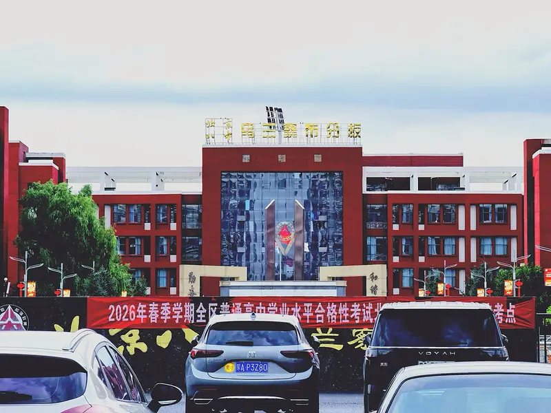
Photo adjustments
Full frame retained; EXIF orientation normalized, proportionally resized to at most 800 pixels and converted to WebP. No generated pixels or subject changes. Cards may crop the display.
- Administrative area
- Banner · 旗
- Part of
- Ulanqab
- Chinese name
- 察哈尔右翼前旗
- Local areas
- Banner guide
Area & population
- Area in the source
- 2,734.00 km²
- Population · 2020
- 125,172
- Administrative seat
- Tugin Ul
Source: cited geographic source, as of the dates shown.
Setting and landscape
The banner government describes a basin averaging 1,600 metres above sea level, higher in the west and north, with the open alluvial plain of the Huangqi Hai basin in the middle and hilly upland in the south. The climate is semi-arid and continental: an annual mean of 6.3 °C, about 120 frost-free days and 360.8 millimetres of rain. Most of its drainage is inland, to the Huangqi Hai and Chagan Nur (察汗淖尔) systems; the Bawang River (霸王河) is one of the rivers that feed Huangqi Hai.
Chinese Wikipedia describes Huangqi Hai as a roughly triangular lake about 20 kilometres long, with its surface at 1,266 metres, lying in a fault basin formed in the Tertiary; its water is alkaline. Crucian carp from the lake were once shipped by rail from Guancun station, now Tuguiwula (土贵乌拉), to Beijing and Tianjin, until freshwater fish disappeared in 1973 as the water shrank and grew saltier. The Huangqi Hai Nature Reserve (黄旗海自然保护区) is a wetland reserve at autonomous-region level.
History
Under the Yuan, a county called Pingdi (平地县) was set up here in 1288. Chahar is Mongolian for "edge", the name of a Mongol tribe living beyond the frontier. In 1954 the Plain Yellow Banner (正黄旗) became Qahar Right Front Banner, with its government moved from Yinshang (印上) to Guancun, today's Tuguiwula town.
What to see
The banner government names three archaeological attractions. The Miaozigou site (庙子沟遗址) is a late Yangshao settlement of about 5,500 years ago; Chinese Wikipedia records it as a national key cultural relic protection site listed in 2001. The Khitan woman's mummy (契丹女尸) is known as the "thousand-year sleeping beauty". The ruins of the Yuan-dynasty city of Jining Road (集宁路古城遗址) were among the ten major archaeological discoveries of 2003. Other sights the banner lists are Huangqi Hai, the Guli Naobao stone forest (谷力脑包石林) and the Night of Ulanqab (乌兰察布之夜).
Food and local products
The banner government calls Ulanqab naked oats (莜麦) one of Inner Mongolia's "three treasures", grown mainly in Ulanqab and sold to Beijing, Shanxi and Hebei.
Getting oriented
Ulanqab high-speed railway station stands within the banner. The banner government puts Beijing 320 kilometres to the east, Hohhot 138 kilometres to the west and Datong 90 kilometres to the south.
Highlights
- Huangqi Hai 黄旗海: Alkaline lake in a Tertiary fault basin at the heart of the banner; a regional wetland reserve.
- Miaozigou site 庙子沟遗址: Late Yangshao settlement of about 5,500 years ago; national key cultural relic protection site listed in 2001.
- Jining Road ancient city site 集宁路古城遗址: Yuan-dynasty city ruins, one of the ten major archaeological discoveries of 2003.
- Ulanqab naked oats 莜麦: Called one of Inner Mongolia's three treasures; grown mainly in Ulanqab.
Sources for this guide
前旗概况 - 察哈尔右翼前旗人民政府 · Qahar Right Front Banner People's Government
乌盟莜麦 - 名优特产 - 察哈尔右翼前旗人民政府 · Qahar Right Front Banner People's Government
黄旗海 - 维基百科 · Wikipedia (Chinese) · CC BY-SA 4.0
庙子沟遗址 - 维基百科 · Wikipedia (Chinese) · CC BY-SA 4.0
Original English written from the listed sources and checked sentence by sentence against quoted extracts by a separate reviewer. Updated 2026-09-26.
Explore Qahar Right Front Banner
Core places to explore, with English and Chinese names.
Qahar Right Front Banner 察哈尔右翼前旗
Plan your visit
Getting there
Qahar Right Front Banner is about 25 km in a straight line from central Ulanqab. Search for 察哈尔右翼前旗 in a map app to find stations and your accommodation.
Where to stay →More in Ulanqab
Sources & geographic information
Administrative names and parent areas: Official geographic directory · Reference date 2026-09-06.
Some facts checked against 黄旗海 — Wikipedia contributors, CC BY-SA 4.0.
Some facts checked against 庙子沟遗址 — Wikipedia contributors, CC BY-SA 4.0.
Map data © OpenStreetMap contributors. Pins mark approximate centres, not entrances or boundaries.