


Get to know Arxan
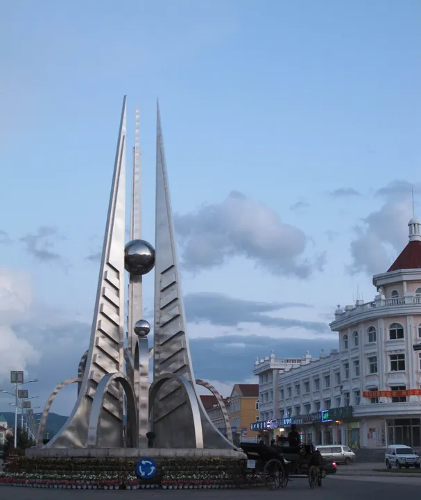
Photo adjustments
Full frame retained; proportionally resized and converted to WebP. No retouching or changes to the photographed subject. Card displays may crop the view.
- Administrative area
- County-level city · 县级市
- Part of
- Hinggan League
- Chinese name
- 阿尔山市
- Local areas
- County-level city guide
Area & population
- Area in the source
- 7,408.70 km²
- Population · 2020
- 32,301
- Administrative seat
- Wenquan Subdistrict
Source: cited geographic source, as of the dates shown.
Setting and landscape
The city government places Arxan where the Hulunbuir (呼伦贝尔), Horqin (科尔沁), Xilingol (锡林郭勒) and Mongolian grasslands meet, in a transition zone between forest and grassland, with forest over more than 80 percent of the land. There are 42 hot and cold springs, whose water ranges from 1°C to 45°C and differs in chemistry from spring to spring. Winters are long and cold, with a January mean of −25.1°C, and summers short and cool.
History
The springs were formally developed from 1853, in the Qing Xianfeng reign. In 1933 the Japanese army built a sanatorium here, the Yamato Hotel (大和旅社), piping spring water indoors, and in 1948 the People's Liberation Army set up its own sanatorium. The area was a town of Horqin Right Front Banner (科尔沁右翼前旗) until it became a development zone in 1992, and it was made a county-level city in 1996.
What to see
Arxan National Forest Park (阿尔山国家森林公园) is a landscape of volcanic lava, with a high crater lake, lakes dammed by lava, and mineral springs. Its developed sights include Tuofengling Tianchi (驼峰岭天池), a lake filling a volcanic crater, Azalea Lake (杜鹃湖), the Santan Gorge (三潭峡), a river that does not freeze (不冻河), and Shitanglin (石塘林), a lava field that a report on the Ministry of Culture and Tourism website likens to a natural museum of volcanic lava geology.
Arxan Station (阿尔山站) on the Baicheng–Arxan railway was begun in 1935 and opened in 1937, built by the Japanese army to carry off local minerals, and first named Wenquan ("hot spring") Station. As part of the remains of the Japanese Arxan fortress it became a national key heritage site in 2013.
Getting oriented
Arxan borders Zalantun (扎兰屯) to the east, Xilingol League and Mongolia to the west, New Barag Left and Ewenki banners of Hulunbuir to the north, and Horqin Right Front Banner to the south, with 98.01 kilometres of frontier. The Arxan border crossing (阿尔山口岸), 45 kilometres west of the city on the Numrug River (努木尔根河), faces Mongolia's Sumber crossing. Railways run to Baicheng (白城) and to Yimin (伊敏).
Highlights
- Arxan National Forest Park 阿尔山国家森林公园: Volcanic lava landscape with a crater lake, lava-dammed lakes and the Shitanglin lava field.
- Tuofengling Tianchi 驼峰岭天池: Mountain lake formed where water filled a volcanic crater.
- Arxan Station 阿尔山站: Station opened in 1937; national key heritage site from 2013.
- Arxan hot springs 阿尔山温泉: 42 springs from 1°C to 45°C, developed from 1853.
Sources for this guide
阿尔山市 - 维基百科,自由的百科全书 · Chinese Wikipedia · CC BY-SA 4.0
阿尔山概况_阿尔山市人民政府 · Arxan Municipal People's Government
历史沿革_阿尔山市人民政府 · Arxan Municipal People's Government
阿尔山站 - 维基百科,自由的百科全书 · Chinese Wikipedia · CC BY-SA 4.0
生态阿尔山 美好新生活 · Ministry of Culture and Tourism of the People's Republic of China
Original English written from the listed sources and checked sentence by sentence against quoted extracts by a separate reviewer. Updated 2026-09-26.
Explore Arxan
Core places to explore, with English and Chinese names.
Places to explore around Arxan
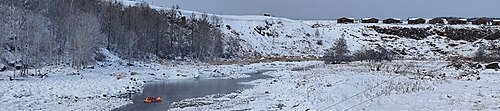 Arxan National Forest Park · 阿尔山国家森林公园
Arxan National Forest Park阿尔山国家森林公园
Arxan Forest Park combines volcanic landforms with the forests of the Greater Khingan Range. At Shitanglin, dark solidified lava breaks into an irregular stone landscape, with plants returning between the rocks. Nearby Dujuan…
Read the place guide → Arxan Railway Station building in winter, its name in gold characters on the gable · 冬季的阿尔山火车站站房,山墙上以金色大字标注站名 Source-recorded photograph date: 2025-02-04.
Arxan Railway Station阿尔山火车站
Arxan Railway Station is a small 1937 building whose two-storey form, low eaves and pointed roofs make it a distinctive landmark in the town.
Read the place guide →Plan your visit
Getting there
Arxan is about 205 km in a straight line from central Hinggan League. Search for 阿尔山市 in a map app to find stations and your accommodation.
Where to stay →Build your route
Arxan National Forest Park and Arxan Railway Station are both listed here. The linked place guides have entrance and visit details.
Continue with Hinggan League →More in Hinggan League
Sources & geographic information
Administrative names and parent areas: Official geographic directory · Reference date 2026-09-06.
Some facts checked against 阿尔山市 — Wikipedia contributors, CC BY-SA 4.0.
Some facts checked against 阿尔山站 — Wikipedia contributors, CC BY-SA 4.0.
Photo: Arxan National Forest Park · HCCB3947 · CC BY-SA 4.0. Wikimedia thumbnail; fitted to the ranking-card frame.

Photo: Arxan Railway Station · HCCB3947 · CC BY-SA 4.0. Full frame retained; proportionally resized and converted to WebP. No retouching or changes to the photographed subject. Card displays may crop the view.

Map data © OpenStreetMap contributors. Pins mark approximate centres, not entrances or boundaries.