


Get to know Horqin Right Middle Banner
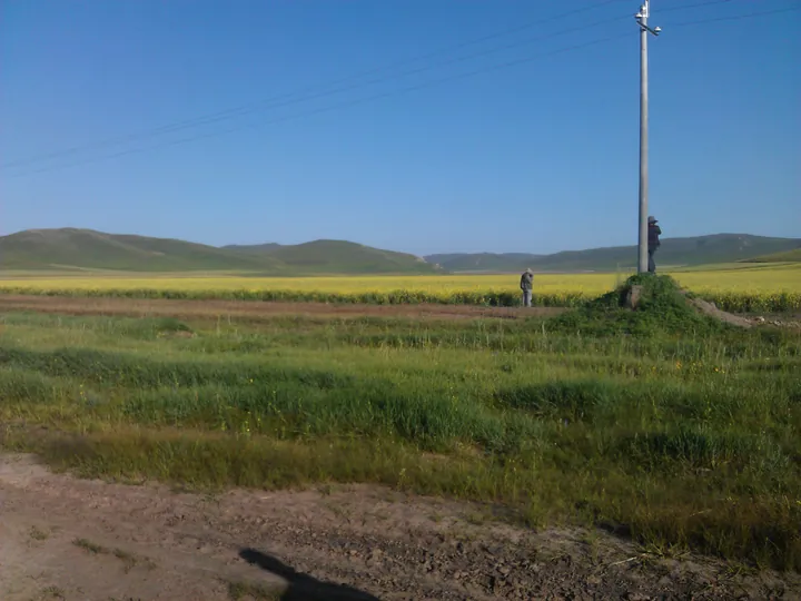
Photo adjustments
Full frame retained; proportionally resized and converted to WebP. No retouching or changes to the photographed subject. Card displays may crop the view.
- Administrative area
- Banner · 旗
- Part of
- Hinggan League
- Chinese name
- 科尔沁右翼中旗
- Local areas
- Banner guide
Area & population
- Area in the source
- 15,613.00 km²
- Population · 2020
- 207,380
- Administrative seat
- Bayan Huxu
Source: cited geographic source, as of the dates shown.
Setting and landscape
The banner is a long, thin strip about 310 kilometres from north to south and only 55 kilometres across. The land rises to the northwest and falls to the southeast, and hills and mountains make up about two-thirds of it, with plains, dunes and marsh in the rest. The banner government places it on the transition from the Songliao Plain (松辽平原) and the Greater Khingan Range to the Horqin Sandy Land (科尔沁沙地). Its largest river is the Huolin River (霍林河), part of the Nen River (嫩江) system, which flows for 285 kilometres inside the banner.
History and culture
The name Horqin comes from a Mongolian word meaning people who carry bows and arrows. The banner was created in 1636, early in the Qing dynasty, and was commonly called the Tushiye Tu Banner (图什业图旗) after its ruling jasagh prince; it attended the assemblies of Jirim League (哲里木盟). Manchukuo renamed it in 1932, it was placed under Jilin from 1969 to 1979, and it has belonged to Hinggan League since 1980.
Older traces include Jin-dynasty border walls (金界壕): Xinhua reports 33 surveyed sections running 121 kilometres through the banner. The banner lists five national intangible-heritage items: Urgeer (乌力格尔) storytelling, the making of Mongolian bowed string instruments, Horqin Mongolian medicinal baths, Mongolian four-string fiddle (四胡) music and Mongolian embroidery. Tushiye Tu leather painting (图什业图皮画) was added to the region's eighth intangible-heritage list.
What to see
The Tushiye Tu Prince's Mansion (图什业图亲王府), 20 kilometres north of Bayan Huxu (巴彦呼舒镇), was built between 1871 and 1890 under the thirteenth jasagh prince. Its 150 timber-framed rooms of grey brick and tile sit inside walls, gates, watchtowers and a moat, with a rear garden. Just south of it, the China Film production base (中影制作基地) recreates a northern town of the 1960s and 1970s with its supply-and-marketing co-op, bus station and canteen.
The banner government describes the five-lobed maple (五角枫) woodland as Asia's largest open woodland grassland, and visitors can ride horses through it. It forms one national 4A scenic area with Hangali Lake (翰嘎利湖), a lake in the grassland with a white sand beach and lakeside campsites. The banner's own route also takes in the Horqin National Nature Reserve (科尔沁国家级自然保护区), Menggehan Mountain (蒙格罕山), Xiafu Temple (遐福寺) and the Tuliemaodu (吐列毛杜) ancient city site.
Highlights
- Tushiye Tu Prince's Mansion 图什业图亲王府: Timber-framed prince's residence of 150 rooms built 1871–1890, with walls, moat and garden.
- Five-lobed maple woodland 五角枫: Maple-dotted grassland that the banner government calls Asia's largest; part of a national 4A scenic area.
- Hangali Lake 翰嘎利湖: Grassland lake with a white sand beach and lakeside campsites.
- China Film production base 中影制作基地: Film set recreating a northern town of the 1960s and 1970s, south of the prince's mansion.
- Urgeer 乌力格尔: Mongolian storytelling art, one of the banner's five national intangible-heritage items.
Sources for this guide
中旗概况_科尔沁右翼中旗人民政府 · Horqin Right Middle Banner People's Government
历史文化_科尔沁右翼中旗人民政府 · Horqin Right Middle Banner People's Government
科尔沁右翼中旗 - 维基百科,自由的百科全书 · Wikipedia · CC BY-SA 4.0
科右中旗旅游景区及线路_科尔沁右翼中旗人民政府 · Horqin Right Middle Banner People's Government
内蒙古科右中旗:文耕沃野焕“枫”景- 新华网内蒙古频道 · Xinhua
Original English written from the listed sources and checked sentence by sentence against quoted extracts by a separate reviewer. Updated 2026-09-26.
Explore Horqin Right Middle Banner
Core places to explore, with English and Chinese names.
Horqin Right Middle Banner 科尔沁右翼中旗
Plan your visit
Getting there
Horqin Right Middle Banner is about 120 km in a straight line from central Hinggan League. Search for 科尔沁右翼中旗 in a map app to find stations and your accommodation.
Where to stay →More in Hinggan League
Sources & geographic information
Administrative names and parent areas: Official geographic directory · Reference date 2026-09-06.
Some facts checked against 科尔沁右翼中旗 — Wikipedia contributors, CC BY-SA 4.0.
Map data © OpenStreetMap contributors. Pins mark approximate centres, not entrances or boundaries.